
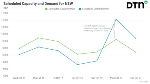
Two bursts of heat will impact Sydney and NSW in the coming week, driving high energy demand and a forecast Lack of Reserve Level 2 (LOR2) issued by AEMO. Bursts of springtime heat moving east The DTN forecast for Sydney below, generated by our professional team of weather risk analysts, shows two spikes in heat […]
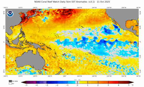
A La Niña advisory has been issued by the US Climate Prediction Center (CPC), indicating that La Niña conditions have emerged in the tropical Pacific Ocean and are expected to continue for the coming months. What is La Niña? La Niña is one of three phases of the El Niño-Southern Oscillation (ENSO), a coupled ocean-atmosphere […]
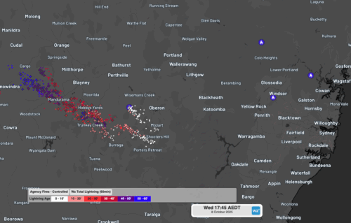
Fires were triggered in central NSW by dry lightning on Wednesday as high-based severe thunderstorms tracked over the region which also produced damaging winds. The satellite loop below shows a cloudband moving over NSW on Wednesday afternoon and evening. Clear skies through the earlier part of the day allowed ample surface heating, helping fuel and […]
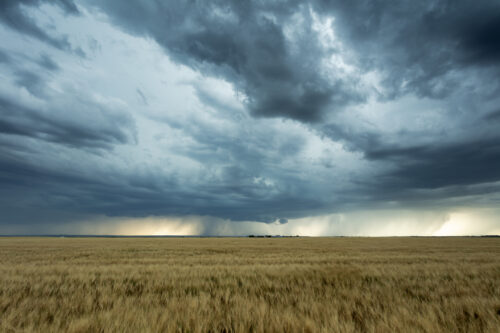
Australian agricultural, forestry and fire emergency agencies and industries that were hoping for a wetter than average spring have been left disappointed by a lacklustre start to the season, despite the emergence of a strong negative Indian Ocean Dipole in recent weeks. Official rainfall outlooks at the end of August were pointing to a good […]
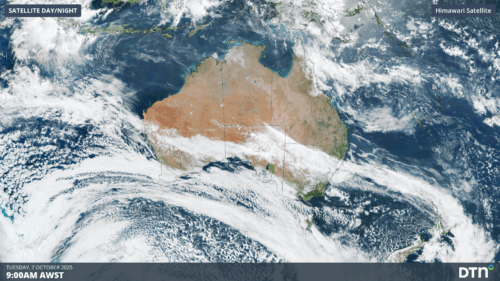
A huge northwest cloudband stretching from Indonesia to waters east of New Zealand has delivered the heaviest October rainfall on record to the WA gold mining city of Kalgoorlie. Extending at least 8000km, the cloudband has brought rain over the past couple of days not just to WA, but all the way east to large […]
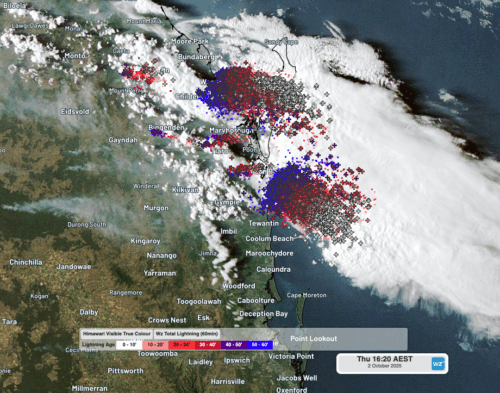
Severe thunderstorms brought large hail and heavy rain to southeast Queensland’s Wide Bay and Burnett on Thursday, October 2, 2025 – impacting businesses and insurance claims. Clear skies at midday It’s 12pm on an early October Thursday and it’s warm and sunny with barely a cloud in the sky and a light seabreeze coming from […]
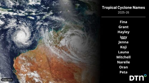
Australia’s 2025-26 tropical cyclone season is almost here and the names that will be used for cyclones throughout the season have been locked in. The Australian tropical cyclone season runs from the beginning of November to the end of April. During this six-month period, we usually see around 9-11 tropical cyclones in the Australian region, […]

Despite a brief cool spell early in the month which included Sydney’s wettest September day in 146 years, the harbour city has recorded its second-warmest September since records were first kept in 1858. In September 2025: Sydney’s average maximum was 23.5°C, which was around 3.3°C above the long-term average of 20.2°C. Sydney’s average minimum was […]

A developing negative Southern Annular Mode (SAM) will influence weather patterns across the Australian region this week, favouring relatively cool and wet weather in the country’s south bringing increased wind energy generation, and much warmer conditions in the east and north driving higher energy demand. Negative SAM emerging Recent warming in the stratosphere high above […]

Australia’s tropical cyclone season is officially underway, but we may not see much activity for few months yet. The season runs from November to April, and for mining operators and businesses across northern Australia, 2026-27 is shaping up to be a season where the headline numbers and the real risk may not line up. On […]

A positive Indian Ocean Dipole is underway, but this one is unlikely to deliver the textbook dry spring and summer that businesses have come to expect from the pattern. The Bureau of Meteorology officially declared a positive IOD on Tuesday, October 27, which typically like El Niño can cause drier and warmer conditions over parts of […]

Waters off Indonesia have cooled in recent weeks, an indication that a positive Indian Ocean Dipole (IOD) event could be developing. It’s an important climate driver for Australia, and it could shape rainfall and temperatures heading into summer, with flow-on effects for farmers, energy and other industries. What is the Indian Ocean Dipole? The IOD […]

Leonora, WA, had its wettest September day on record earlier this month. Three weeks later, more than 1.3 million lightning pulses were detected within 800 km of the town in 48 hours. Why is a stalled trough delivering storms to mining country, and what it could mean for operations? The DTN Total Lightning Network detected […]
