
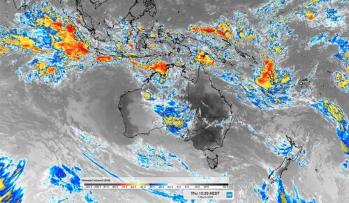
An active pulse of the Madden-Julian Oscillation will increase the risk of tropical cyclones and thunderstorms in the Australian region over the coming week. The Madden-Julian Oscillation (MJO) refers to a pulse of increased tropical cloud, rainfall and thunderstorm activity that moves through our planet’s atmosphere, from west to east, near the equator. The MJO […]
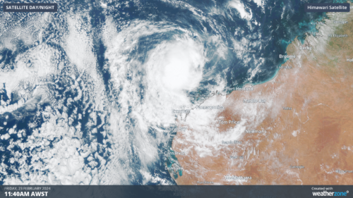
Ex- Tropical Cyclone Lincoln should re-develop into cyclone off the Kimberley coast in WA on Friday night, before setting its sights on the Pilbara and northern Gascoyne in the next 48 hours. Lincoln will be the first Tropical Cyclone to impact WA this season, but it is the second Tropical Cyclone to move into the Western […]
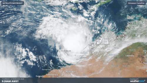
Ex-Tropical cyclone Lincoln is likely to re-develop into a cyclone by Friday morning, before it sets its path towards the Pilbara or Gascoyne coasts on the weekend. The image below shows clouds rotating around ex- tropical cyclone Lincoln on Thursday morning when the system was around 270 km northwest of Broome. Image: Himawari-9 satellite imagery […]
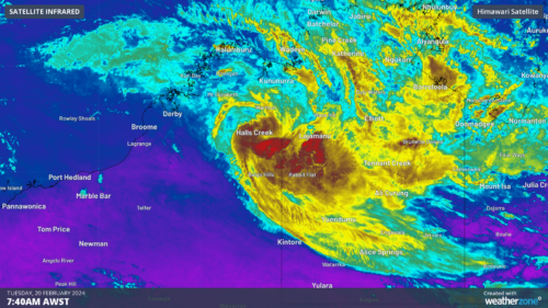
There are growing concerns that ex-Tropical Cyclone Lincoln could redevelop and move towards the Pilbara coast later this week Tropical Cyclone Lincoln crossed the NT coast near Borroloola last Friday, February 16 and weakened as it moved inland through the central NT and the Kimberley region in WA. The ex-tropical cyclone (07U) has dumped […]
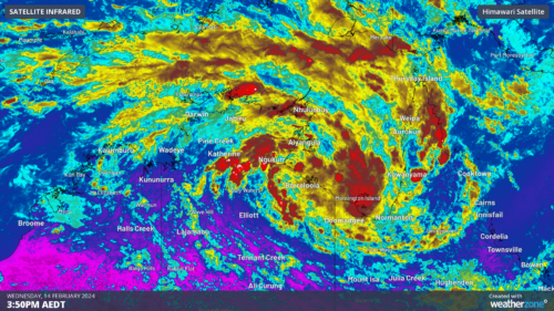
A tropical low (07U) has now formed over the Gulf of Carpentaria, with a moderate chance of becoming a tropical cyclone on Thursday or Friday. The satellite image below shows a broad-scale circulation rotating clockwise around the tropical low on Wednesday morning. Image: Himawari-9 visible (top) shows the system rotating and the water […]
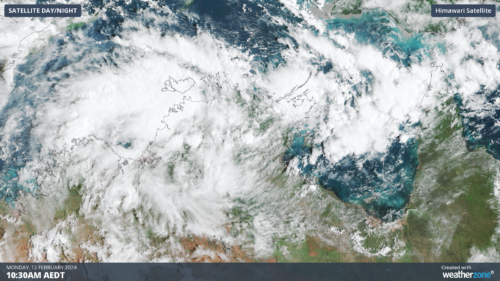
Darwin has had its wettest day in 7 years as a tropical low builds strength in the Top End and could become a tropical cyclone later this week. Over the last 36 hours, a tropical low has been building over the western Top End. Last night, the low strengthened enough to incorporate cross-equatorial winds from […]
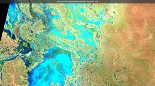
Satellites have captured images of floodwaters filling rivers and lakes in southwest Qld and northwest NSW, following heavy rain from ex-Tropical Cyclone Kirrily. Clouds, rain and thunderstorms have been a persistent feature over Australia’s eastern inland during the last fortnight. This late-summer soaking was caused by the overland journey of ex-Tropical Cyclone Kirrily, which made […]
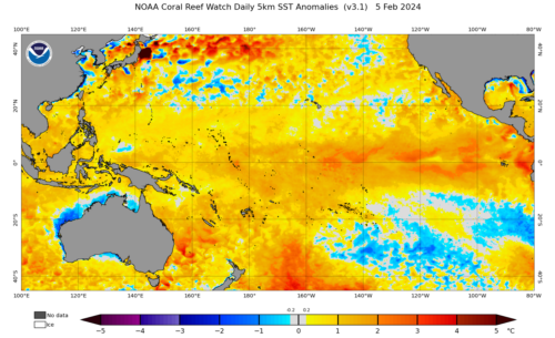
The oceans off the NSW and Qld coast are extremely warm and theoretically could provide enough energy to bring a tropical cyclone into NSW waters. The map below shows that the temperatures off the Coffs Coast and north are currently above 26.5 °C, which is 2-3°C above average for this time of year. […]

Heavy and intense rainfall is forecast across southeast Qld in the next 72 hours, bringing hundreds of millimetres to the region. The satellite image below shows thick cloud over Qld and northeast NSW on Monday afternoon. Image: Himawarri-9 satellite image at 1pm AEST on Monday, January 29. A coastal trough is expected to […]

Australia’s tropical cyclone season is officially underway, but we may not see much activity for few months yet. The season runs from November to April, and for mining operators and businesses across northern Australia, 2026-27 is shaping up to be a season where the headline numbers and the real risk may not line up. On […]

A positive Indian Ocean Dipole is underway, but this one is unlikely to deliver the textbook dry spring and summer that businesses have come to expect from the pattern. The Bureau of Meteorology officially declared a positive IOD on Tuesday, October 27, which typically like El Niño can cause drier and warmer conditions over parts of […]

Waters off Indonesia have cooled in recent weeks, an indication that a positive Indian Ocean Dipole (IOD) event could be developing. It’s an important climate driver for Australia, and it could shape rainfall and temperatures heading into summer, with flow-on effects for farmers, energy and other industries. What is the Indian Ocean Dipole? The IOD […]

Leonora, WA, had its wettest September day on record earlier this month. Three weeks later, more than 1.3 million lightning pulses were detected within 800 km of the town in 48 hours. Why is a stalled trough delivering storms to mining country, and what it could mean for operations? The DTN Total Lightning Network detected […]
