
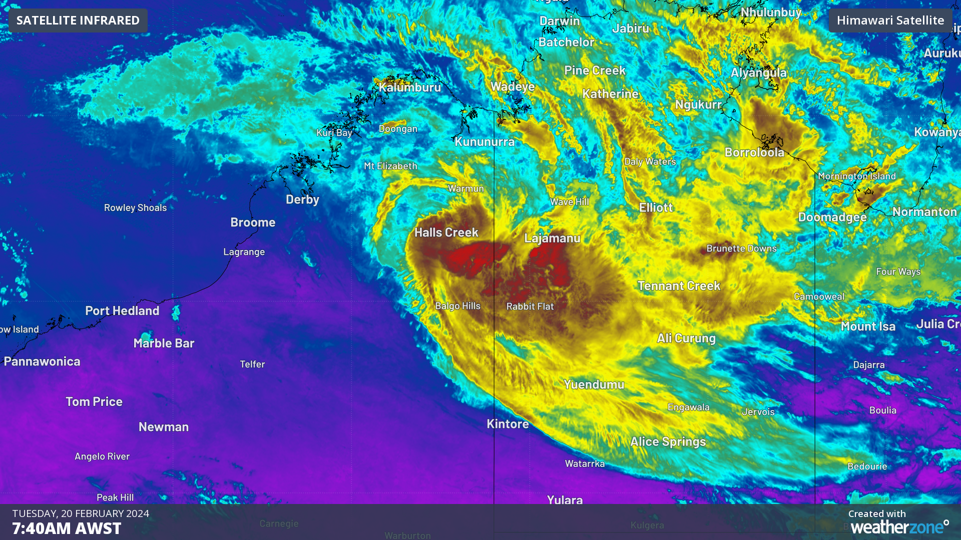
There are growing concerns that ex-Tropical Cyclone Lincoln could redevelop and move towards the Pilbara coast later this week
Tropical Cyclone Lincoln crossed the NT coast near Borroloola last Friday, February 16 and weakened as it moved inland through the central NT and the Kimberley region in WA.
The ex-tropical cyclone (07U) has dumped hundreds of millimetres of rainfall in its track and continues to bring the risk of heavy rain and flooding to parts of the Gregory and Tanami districts in the NT and the Kimberley in WA on Tuesday.
There is a severe weather warning for heavy rainfall in these districts, where six hourly rainfall total could be between 60 to 100mm and 24 hour totals up to 200mm are possible. Please check out the latest warnings here if you live or work in these regions.
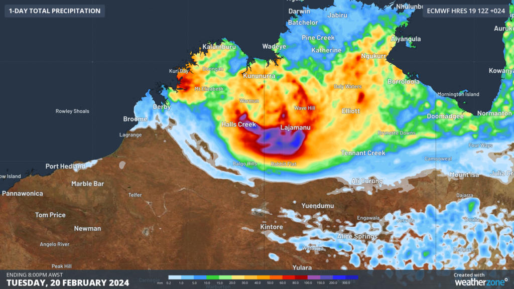
Image: Accumulated rainfall in the 24 hours leading up to 8pm AWST on Tuesday, February 20, according to the ECWF model.
The map below shows a mass of cloud rotating around the ex-tropical cyclone as the sun rises, with its centre located near the Kimberley on Tuesday morning, February 20.
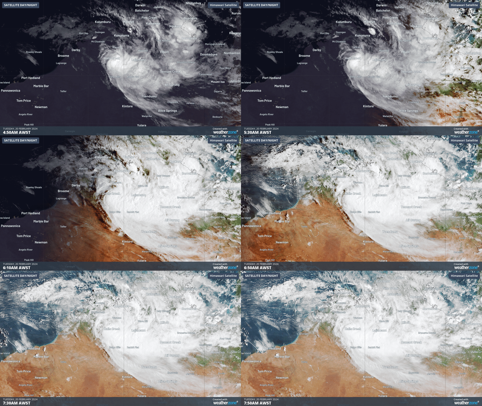
Image: Himawari satellite image for the three hours leading up to 7:40am AWST.
The low (07U) is expected to move into the waters off the Kimberley coast from Wednesday, using the humid environment to develop into a tropical cyclone on Thursday.
When it redevelops into a cyclone, it will retain its name: Tropical Cyclone Lincoln. This will be the first tropical cyclone this season to threaten the WA coastline.
The cyclone has a chance of strengthening into a severe tropical cyclone as it moves over the warm waters off the WA coastline. ECMWF also gives a roughly 90% chance of this system will pass within 300km of the Pilbara coast on Saturday, February 24.
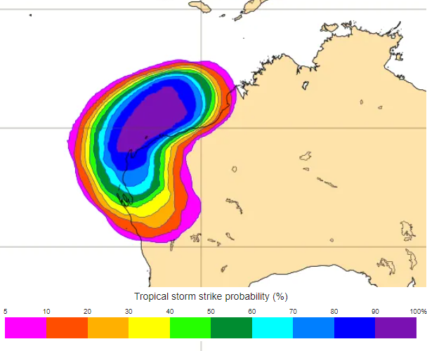
Image: Tropical cyclone strike probability from the ECMWF-ENS model for Saturday, February 20, 2024. The strike probability is the probability that a tropical cyclone will pass within a 300 km radius from a given location and within a time window of 48 hours. Source: ECMWF
The image above shows there is a high risk of the Pilbara coast being impacted by this cyclone. As the system moves over land it will weaken again into Ex-tropical cyclone Lincoln from Sunday, however the risk of heavy rainfall, flooding and strong winds will remain.
The image below shows the predicted track from three different computer models. All these models agree that it will move offshore, but there is still some uncertainty whether it will remain offshore or cross the coast.
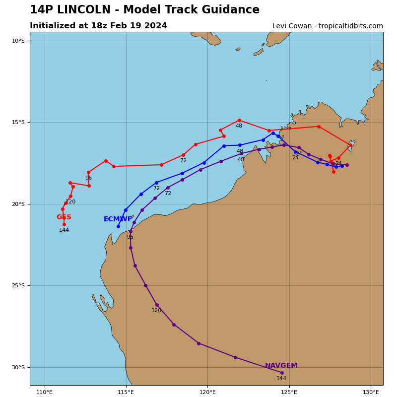
Image: Model track guidance for ex-Tropical Cyclone Lincoln with GFS (red), ECMWF (blue), purple (NAVGEM, similar track to Access-G), each dot shows the forecast location each 6 hours. Source: TropicalTidbits.com
As you can see there is still some uncertainty regarding the potential cyclone’s track, however several models are predicting Tropical Cyclone Lincoln to cross the Pilbara coast on Saturday. As this system unfolds, please keep an eye out for our updates and warnings.
DTN APAC gives you a comprehensive tropical cyclone service that helps your enterprise prepare for the worst in the best possible way.
As the climate delivers increasingly severe weather events, their potential to impact your business operations grows.
DTN APAC, specialises in industry-leading forecast, alerting and threat analysis of tropical cyclones, offering you expert, customised solutions when the weather turns wild.
Providing rapid-update forecast information, we alert you to any low-pressure system gaining power within your region and, unlike other providers, can track its development out to 7 days. This gives you the time to prepare and safeguard your staff, sites and assets.
You will have the most precise weather intelligence charting rainfall, wind speeds and potential storm surges to help you make critical decisions quickly. Whether it’s adjusting key work schedules, protecting your staff or securing your site, we have the alerting capability to keep you steps ahead of the storm.
We will support you, 24/7, keeping you informed and making your critical decisions easier. For more information, please contact us at apac.sales@dtn.com.




