
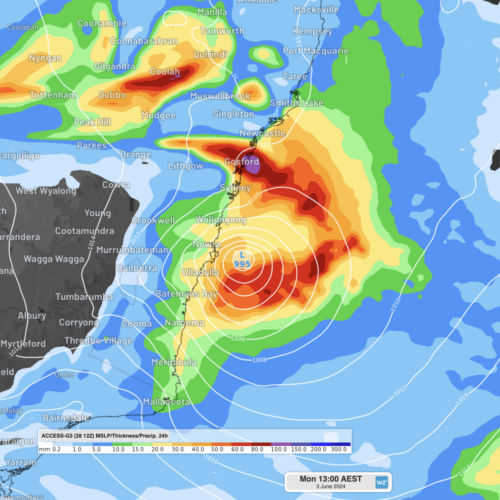
An East Coast Low is expected to form off the NSW coast this weekend, with heavy rainfall, powerful winds, erosive surf and cold temperatures forecast. An East Coast Low (ECL) is a type of low pressure system that forms close to the east coast of Australia and stays close to shore for at least 24 […]
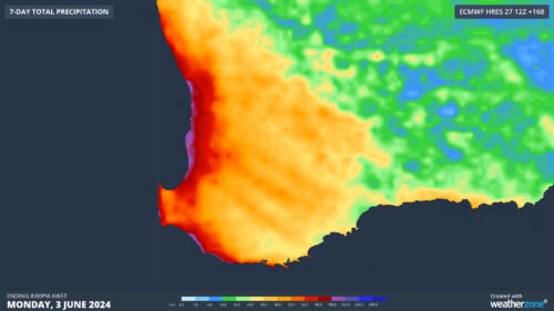
A series of cold fronts will deliver much-needed rain to southwestern Australia this week, easing a drought that has broken records over the past seven months. The animation below shows cloud streaming over WA on Tuesday morning ahead of an approaching cold front. This is the first in a series of cold fronts and low […]
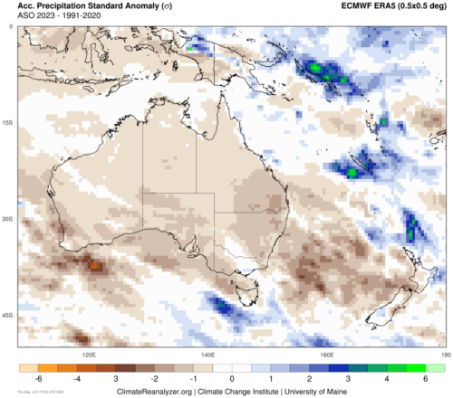
Signs are pointing to the second consecutive positive Indian Ocean Dipole (IOD) developing in the next few months. However, May is shaping up to be a time to make-or-break this event. What is a positive IOD? The IOD is a coupled ocean-atmosphere climate driver that changes the circulation patterns over the Indian Ocean. A positive […]
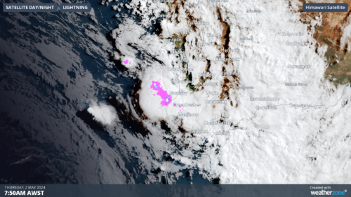
A line of severe thunderstorms is moving onshore towards the southwest of WA, which could produce heavy rainfall and large hail on Thursday morning. These thunderstorms are forming on a trough offshore ahead of an approaching cold front and sweeping across the region. The image below shows a shelf cloud over Bunbury on Thursday morning. […]

Welcome rain is coming to the parched southwest WA this week, possibly including Perth and Bunbury which are both having their driest 7 months on record. Many locations in the southwest will see the driest April on record, with much of this rainfall likely to contribute to May’s totals, as a cold front approaches the […]
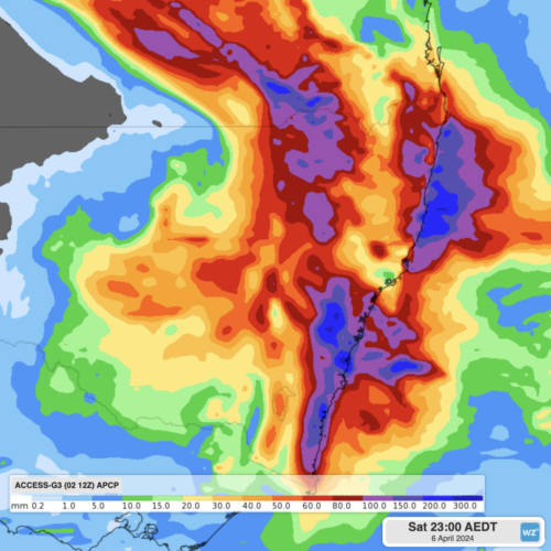
Heavy rainfall of up to 300mm is expected this Friday and Saturday for southeast Queensland and eastern NSW, as a powerful cut-off low and a moisture-rich coastal trough combine. A pool of cold air currently crossing the Great Australian Bight is expected to produce an upper-level low pressure system over southeastern Australia by Thursday. This […]
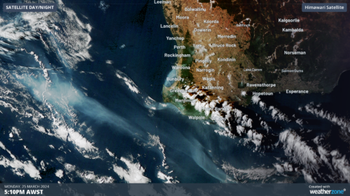
Several fires are burning across southwest WA this week, with smoke plumes seen from 36,000km above the surface. A previously out-of-control bushfire in Perth’s southwest is now under control, after burning 3000 hectares of land and damaging property. As of 10am WST On Tuesday, March 26, four other fires are burning in the […]
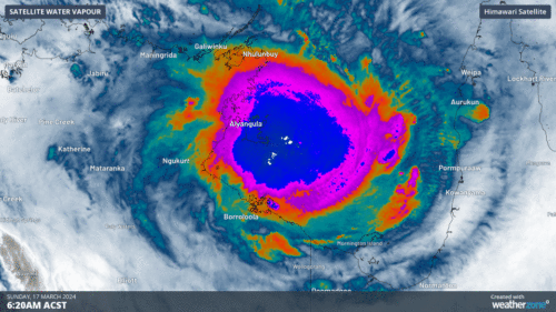
After dumping half a year’s worth of rainfall over Groote Eylandt in the past 48 hours, Tropical Cyclone Megan is building strength in the Gulf of Carpentaria and will make landfall over the NT coast on Monday night. Tropical Cyclone Megan formed on Saturday afternoon in the Gulf of Carpentaria, making it the fifth tropical […]
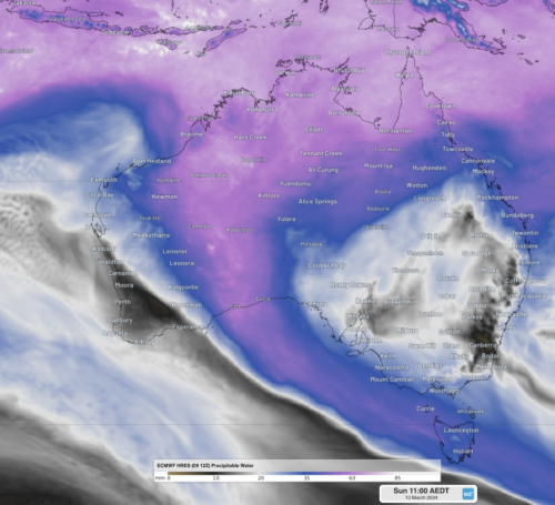
Over 4 months of rainfall has fallen in a single day in southeastern parts of WA, with the chance of over a years’ worth of rainfall falling by the end of the week. Eyre, along WA’s southern coast, experienced unprecedented heavy rainfall, with 141mm of rainfall was recorded in the gauge to 9am WST Sunday. […]

Australia’s tropical cyclone season is officially underway, but we may not see much activity for few months yet. The season runs from November to April, and for mining operators and businesses across northern Australia, 2026-27 is shaping up to be a season where the headline numbers and the real risk may not line up. On […]

A positive Indian Ocean Dipole is underway, but this one is unlikely to deliver the textbook dry spring and summer that businesses have come to expect from the pattern. The Bureau of Meteorology officially declared a positive IOD on Tuesday, October 27, which typically like El Niño can cause drier and warmer conditions over parts of […]

Waters off Indonesia have cooled in recent weeks, an indication that a positive Indian Ocean Dipole (IOD) event could be developing. It’s an important climate driver for Australia, and it could shape rainfall and temperatures heading into summer, with flow-on effects for farmers, energy and other industries. What is the Indian Ocean Dipole? The IOD […]

Leonora, WA, had its wettest September day on record earlier this month. Three weeks later, more than 1.3 million lightning pulses were detected within 800 km of the town in 48 hours. Why is a stalled trough delivering storms to mining country, and what it could mean for operations? The DTN Total Lightning Network detected […]
