
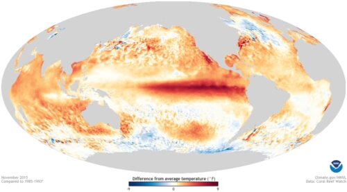
There are signs that a very strong, or ‘super’ El Niño could develop in the tropical Pacific Ocean later this year. So, what does this mean for Australia’s weather during the second half of 2026? El Niño on the horizon The tropical Pacific Ocean is currently in a neutral state, meaning neither El Niño nor […]
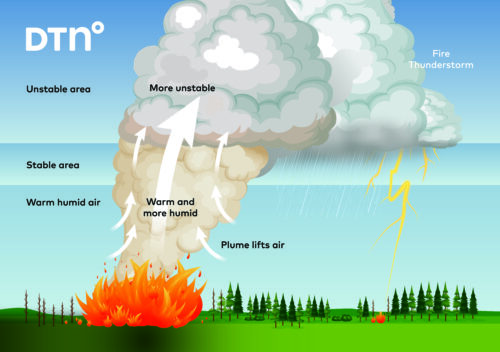
Intense heat from bushfires during elevated fire danger days can trigger fire-induced pyrocumulonimbus thunderstorms that ignite additional fires. In early January 2026, an extreme heatwave sweeping over southeastern Australia brought catastrophic fire danger to Victoria. Intensely hot bush and grass fires spread erratically and quickly in hot, dry and gusty winds, with pyrocumulonimbus generating lightning, […]

Seas to the north and east of Australia are experiencing periods of increased activity this week, leading to disruptions to port, maritime and offshore operations. Intense and hazardous Tasman Sea Ocean conditions across NSW’s South Coast rapidly deteriorated last Friday as a deep feed of easterly winds whipped up large and dangerous seas. The Batemans […]
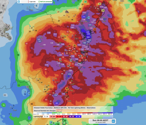
Transport, emergency, energy and port industries in eastern NSW and Sydney were impacted by significant flash flooding with intense and heavy rainfall this weekend. Rainfall rates between 80 and 140mm in one to three hours were registered across parts of Sydney’s Northern Beaches and Central Coast on Saturday afternoon and evening. In some areas, these […]
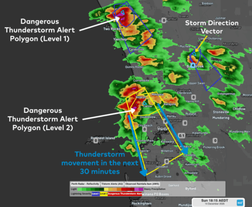
Severe thunderstorms impacted southwest WA and the Perth region on Sunday, December 14, 2025, triggering Dangerous Thunderstorm Alerts (DTA) by DTN for industries and businesses in the region. DTN operates Dangerous Thunderstorm Alerts (DTA) which alert businesses and industries to thunderstorms based on intensity and movement. These alerts provide advanced notice of thunderstorms moving into […]
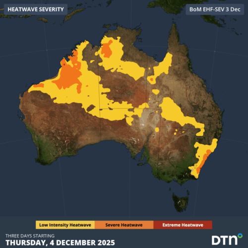
Hot, dry and windy weather causing elevated fire danger and severe heatwave conditions are sweeping across southeastern Australia over the next three days, driving high energy demand and disruption to operations. Clear skies associated a large and slow-moving high pressure system have allowed hot air to build up over parts of northern, western and central […]
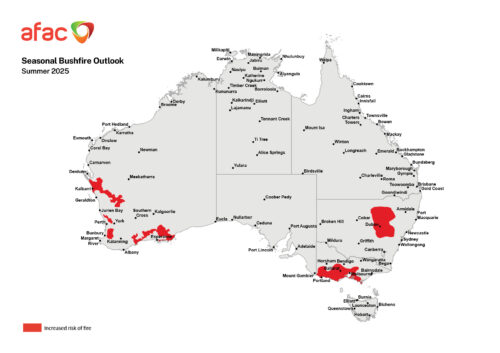
The Australian and New Zealand Council for fire and emergency services (AFAC) identified western and southern WA, Victoria and inland NSW as key regions that are at risk of heightened bushfire risk this summer. Parts of Australia have experienced severe soil moisture and rainfall deficiencies over the past months and years, while high fuel loads […]

The Bureau of Meteorology has declared that La Niña is underway in the Pacific Ocean. So, what does this mean for Australia’s weather this summer? What is La Niña? La Niña is one phase of a Pacific Ocean phenomenon called the El Niño–Southern Oscillation (ENSO). The other phases of ENSO are El Niño and neutral. […]

Over 75,000 customers across southeast Queensland remain without power on Tuesday, after a peak of around 161,000 following the relatively brief, but intense severe thunderstorms complex that crossed the region on Monday afternoon. Damage to power utility networks and rescue efforts for residents was worse than those inflicted by Cyclone Alfred in March for some […]

Australia’s tropical cyclone season is officially underway, but we may not see much activity for few months yet. The season runs from November to April, and for mining operators and businesses across northern Australia, 2026-27 is shaping up to be a season where the headline numbers and the real risk may not line up. On […]

A positive Indian Ocean Dipole is underway, but this one is unlikely to deliver the textbook dry spring and summer that businesses have come to expect from the pattern. The Bureau of Meteorology officially declared a positive IOD on Tuesday, October 27, which typically like El Niño can cause drier and warmer conditions over parts of […]

Waters off Indonesia have cooled in recent weeks, an indication that a positive Indian Ocean Dipole (IOD) event could be developing. It’s an important climate driver for Australia, and it could shape rainfall and temperatures heading into summer, with flow-on effects for farmers, energy and other industries. What is the Indian Ocean Dipole? The IOD […]

Leonora, WA, had its wettest September day on record earlier this month. Three weeks later, more than 1.3 million lightning pulses were detected within 800 km of the town in 48 hours. Why is a stalled trough delivering storms to mining country, and what it could mean for operations? The DTN Total Lightning Network detected […]
