

Despite a brief cool spell early in the month which included Sydney’s wettest September day in 146 years, the harbour city has recorded its second-warmest September since records were first kept in 1858. In September 2025: Sydney’s average maximum was 23.5°C, which was around 3.3°C above the long-term average of 20.2°C. Sydney’s average minimum was […]

A series of swells generated from powerful storms south of Australia are impacting coastal NSW ports on Thursday and Friday. Large waves peak on Thursday morning A large southerly swell moved into coastal NSW overnight into Thursday morning. Significant wave heights off Sydney’s coast can be seen rapidly increasing late on Wednesday and early on […]

Japan’s Himawari-9 satellite has captured striking images of Super Typhoon Ragasa – known locally as Nando in the Philippines – bearing down on the Babuyan Islands on Monday and causing massive disruptions to industries across the region. Typhoon Ragasa underwent rapid intensification late last week and became the first super typhoon so far this season […]
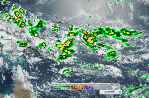
Aviation, mining and shipping industries in the Solomon Islands and other South Pacific nations are often unable to use traditional radar to warn of incoming storms that disrupt operations and put workers in harm’s way. DTN APAC offers a suite of remote sensing weather solutions that give businesses and industries in remote areas around the […]
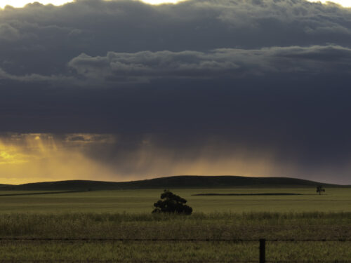
A negative Indian Ocean Dipole (IOD) event is now underway, increasing the likelihood of above average rain over large parts of Australia in the coming months. What is the Indian Ocean Dipole (IOD)? The IOD is an index used to monitor sea surface temperatures across the tropical Indian Ocean. It’s an important index for the […]
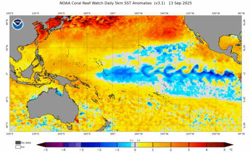
The likelihood of La Niña occurring in 2025 has increased due to a change in the way the Bureau of Meteorology calculates sea surface temperature anomalies in the tropical Pacific Ocean. What is La Niña? La Niña refers to a distinct pattern of sea surface temperatures across the tropical Pacific Ocean. When La Niña is […]
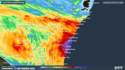
Intense and disruptive thunderstorms, rain, strong winds and large surf will develop along eastern NSW later today, bringing localised areas of flooding and hazardous driving conditions. A cut-off low currently tracking over western NSW, is bringing heavy rain and thunderstorms to the region. This burst of early spring storms already marks the wettest September day […]

Typhoon Kajiki is starting to bring flooding rainfall, destructive winds and large waves to parts of Southeast Asia. Kajiki is the 23rd tropical depression in the Pacific region in 2025, and the 14th to develop into at least a tropical storm this season. As of 10am local time on Sunday, August 24, 2025, Kajiki was […]
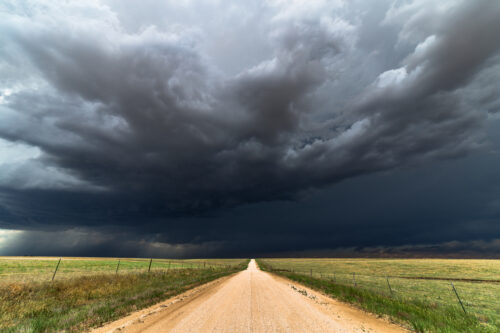
Abnormally warm oceans surrounding Australia and a developing negative Indian Ocean Dipole will increase the likelihood of abnormally wet weather across large parts of the country this spring, along with an increased risk of flooding and severe thunderstorms disrupting businesses and industries. Spring in Australia runs for three months from the start of September to […]

Australia’s tropical cyclone season is officially underway, but we may not see much activity for few months yet. The season runs from November to April, and for mining operators and businesses across northern Australia, 2026-27 is shaping up to be a season where the headline numbers and the real risk may not line up. On […]

A positive Indian Ocean Dipole is underway, but this one is unlikely to deliver the textbook dry spring and summer that businesses have come to expect from the pattern. The Bureau of Meteorology officially declared a positive IOD on Tuesday, October 27, which typically like El Niño can cause drier and warmer conditions over parts of […]

Waters off Indonesia have cooled in recent weeks, an indication that a positive Indian Ocean Dipole (IOD) event could be developing. It’s an important climate driver for Australia, and it could shape rainfall and temperatures heading into summer, with flow-on effects for farmers, energy and other industries. What is the Indian Ocean Dipole? The IOD […]

Leonora, WA, had its wettest September day on record earlier this month. Three weeks later, more than 1.3 million lightning pulses were detected within 800 km of the town in 48 hours. Why is a stalled trough delivering storms to mining country, and what it could mean for operations? The DTN Total Lightning Network detected […]
