
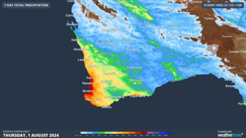
Another showery night in Perth has delivered enough rain to make this Perth’s first wetter-than-average month in more than one year. The animation below shows showers streaming over Perth and other areas of southwestern Australia late on Thursday. This wet weather was caused by persistent onshore winds along the west coast of WA, and the […]

A frigid airmass originating from Antarctica is on its way to Australia on Friday, with the southeastern states expected to shiver through a prolonged cold spell. This airmass will arrive behind a cold front over the weekend and will linger over southeastern Aus well into next week. The satellite image below shows the cold front […]
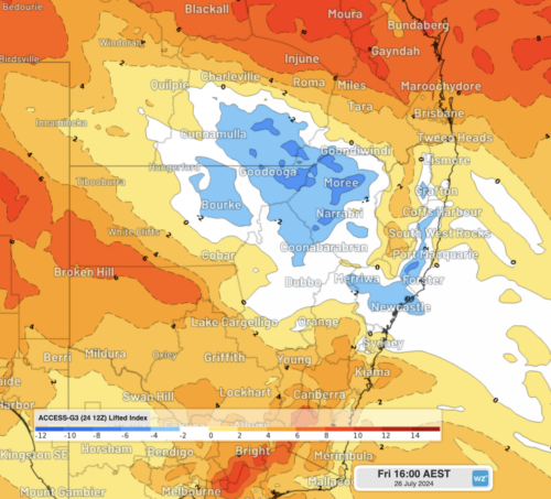
The weather is feeling quite spring-like over northern NSW and southern Queensland, with warm days, smoke from hazard reduction burns and even a chance of thunderstorms on Thursday and Friday. Northerly winds ahead of a trough and cold front are creating a very mild winter’s day, with temperatures 4-7 degrees above the July average across […]

Temperatures will reach 5 to 7°C above average in some capital cities this week as a warm airmass moves across Australia’s southeastern states. This burst of warmth is being caused by warm west to northwesterly winds ahead of a cold front that will sweep across the southeast from Wednesday. The satellite images below show […]

There has been a major shift in the wind pattern over southern Australia, with another great wind power week on the cards. During autumn and the beginning of winter, the National Electricity Market (NEM) saw a wind drought in response to abnormally high pressure, forcing cold fronts and the associated wind south of Australia. […]

Rain and thunderstorms will spread over southwestern Australia in the next few days, giving Perth a chance of registering its first wetter-than-average month in more than a year. The satellite image below shows a large band of cloud highlighting the location of a cold front to the southwest of Australia on Monday morning. The speckled […]

Blizzards are in the forecast for the high country of New South Wales and Victoria for the coming weekend, and in case you’re wondering, “blizzard” is actually a technical weather term in the Australian context. On the BoM’s severe weather definition page, blizzard conditions are defined as “strong winds in conjunction with blowing or falling […]
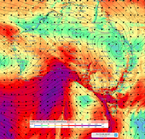
Fierce winds are moving across parts of WA, SA, Vic, NSW and the ACT on Friday as two intense cold fronts sweep across southern Australia. The satellite image below shows the first cold front moving over SA and the other following closely behind in the Bight. Image: Himawari-9 satellite images at around 6:40am on Friday, […]
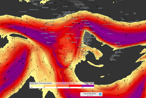
The coming weeks’ weather will be a mixed bag of severe weather and mild wintry weather, in response to a shift in the jetstream. Our planet’s jetstreams are bands of fast-moving air that sit about 10km above the surface. They typically flow from west to east and lie between regions of contrasting temperature. You […]

Australia’s tropical cyclone season is officially underway, but we may not see much activity for few months yet. The season runs from November to April, and for mining operators and businesses across northern Australia, 2026-27 is shaping up to be a season where the headline numbers and the real risk may not line up. On […]

A positive Indian Ocean Dipole is underway, but this one is unlikely to deliver the textbook dry spring and summer that businesses have come to expect from the pattern. The Bureau of Meteorology officially declared a positive IOD on Tuesday, October 27, which typically like El Niño can cause drier and warmer conditions over parts of […]

Waters off Indonesia have cooled in recent weeks, an indication that a positive Indian Ocean Dipole (IOD) event could be developing. It’s an important climate driver for Australia, and it could shape rainfall and temperatures heading into summer, with flow-on effects for farmers, energy and other industries. What is the Indian Ocean Dipole? The IOD […]

Leonora, WA, had its wettest September day on record earlier this month. Three weeks later, more than 1.3 million lightning pulses were detected within 800 km of the town in 48 hours. Why is a stalled trough delivering storms to mining country, and what it could mean for operations? The DTN Total Lightning Network detected […]
