The weather is feeling quite spring-like over northern NSW and southern Queensland, with warm days, smoke from hazard reduction burns and even a chance of thunderstorms on Thursday and Friday.
Northerly winds ahead of a trough and cold front are creating a very mild winter’s day, with temperatures 4-7 degrees above the July average across NSW and Qld. As of 1pm, Sydney had reached 22.5°C, six degrees above the July average, and its warmest day in 2 months.
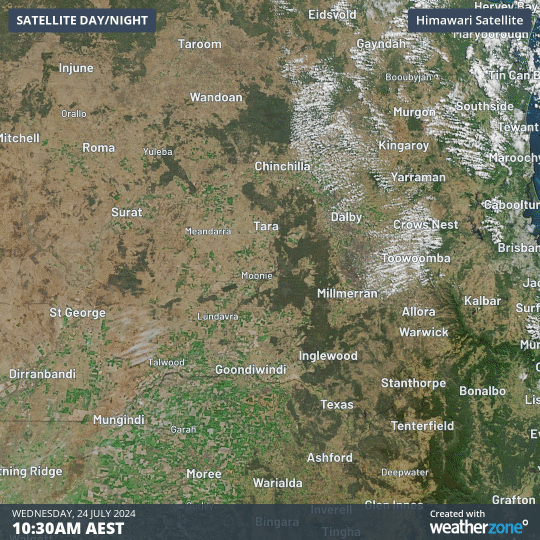
Fire agencies in both NSW and Qld have been making use of the mild weather and modest winds, with dozens of hazard reduction burns being carried out across the two states.
Smoke from three hazard reduction burns, burning in the Jarrah, Barakula and Whetstone State Forests, could be clearly seen on the satellite on Wednesday afternoon.
As the cold front and trough sweep through, isolated thunderstorms have been popping up over NSW and northeast Vic on Thursday afternoon. As of 2pm, 308 lightning strikes had been recorded over the eastern states, with the most active cell near Wagga Wagga.
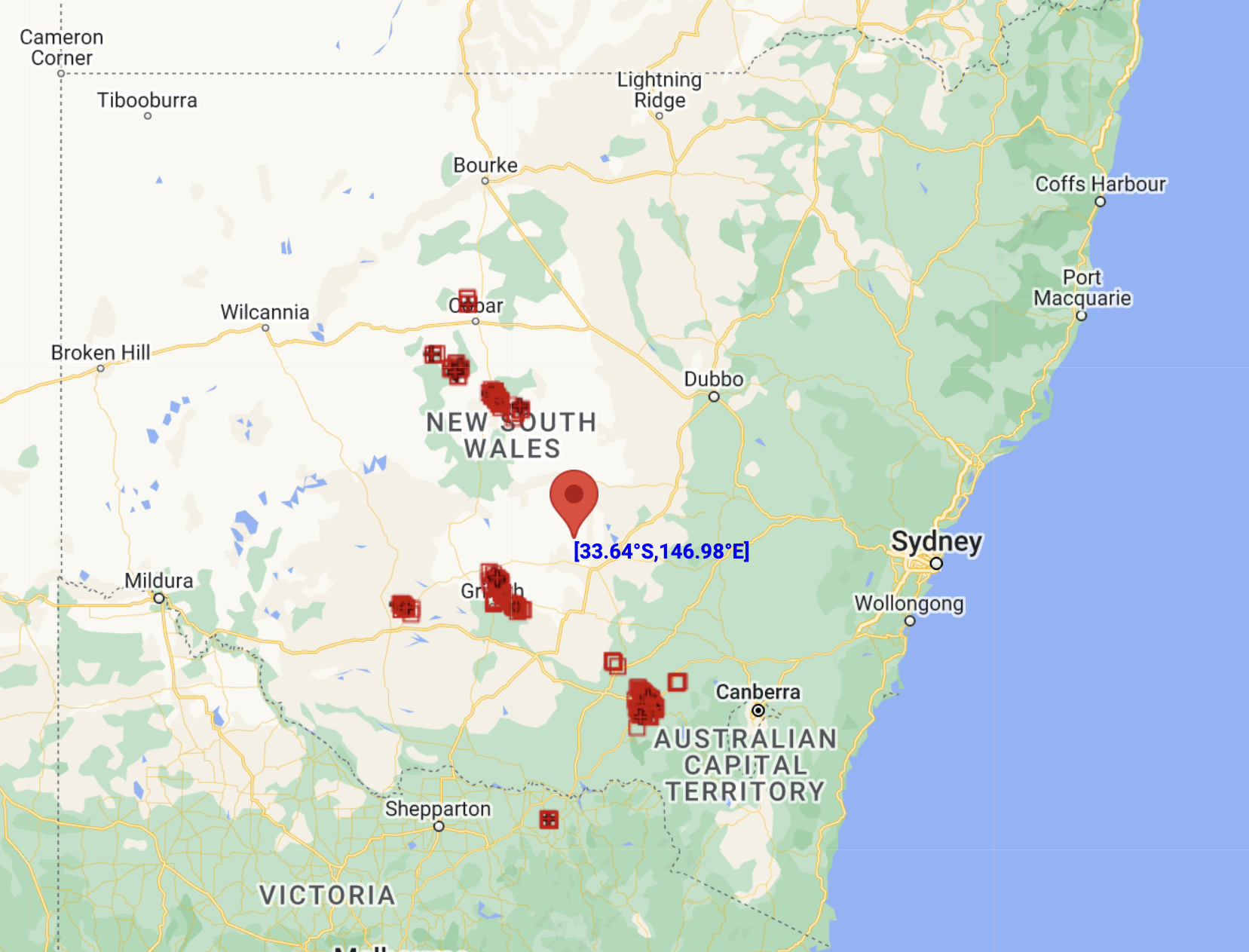
Image: Lightning Strikes recorded by the Total Lightning Network on Thursday up to 2pm.
On Friday afternoon, the trough will cause more instability through northern NSW and far southern Qld, as the warm temperatures meet up with modest humidity coming in from the Coral Sea. Some models even suggest that conditions will be unstable enough for scattered thunderstorms, with a risk of large hail and damaging wind gusts.
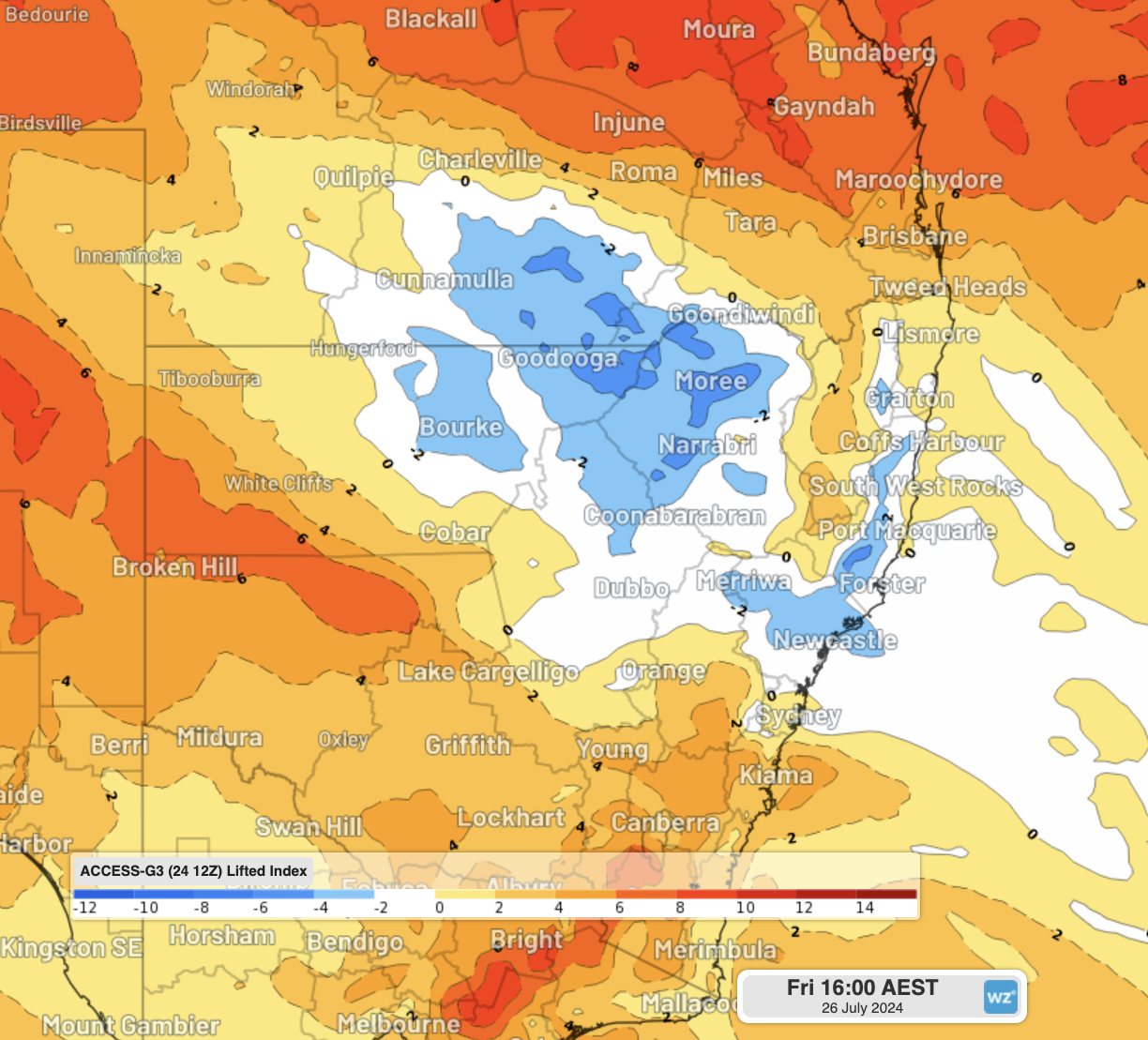
Image: Lifted Index from Access-G for Friday afternoon. Areas in white and blue are potentially unstable, with lower values (darker blues) indicating a higher chance of lightning and severe thunderstorms.
These conditions are more commonly seen in early spring rather than the middle of winter, but certainly occur every few years. Early indications suggest that the thunderstorm season this year could be more active than normal in the east. Warmth and humidity from the warm oceans near Australia could combine with cold upper air and strong fronts from the distorted polar vortex over Antartica (courtesy of the Sudden Stratospheric Warming event).
Conditions will stay mild over most of NSW and Qld until a more substantial cold front crosses on Sunday, reminding us all that it is still wintertime.
Miningzone, by DTN APAC, is the only weather tracking and alerting solution purpose-built for the resources sector. To find out more, please visit our website or email us at apac.sales@dtn.com.


