
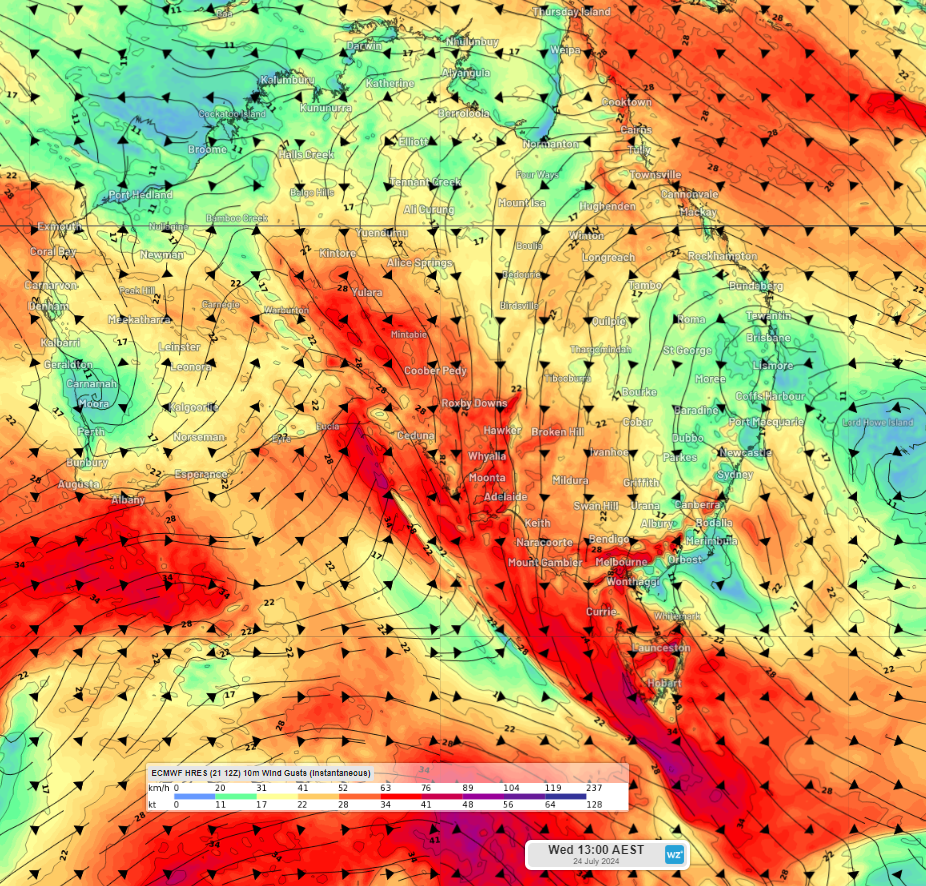
There has been a major shift in the wind pattern over southern Australia, with another great wind power week on the cards.
During autumn and the beginning of winter, the National Electricity Market (NEM) saw a wind drought in response to abnormally high pressure, forcing cold fronts and the associated wind south of Australia.
There has been a shift in this pattern in recent weeks, with plentiful cold fronts and low-pressure systems drifting across southern Australia. This has been influenced by a long wave trough impacting Australia in recent weeks.
Last week, the NEM saw its windiest week in more than a year, contributing 897 GWh/week to the grid.
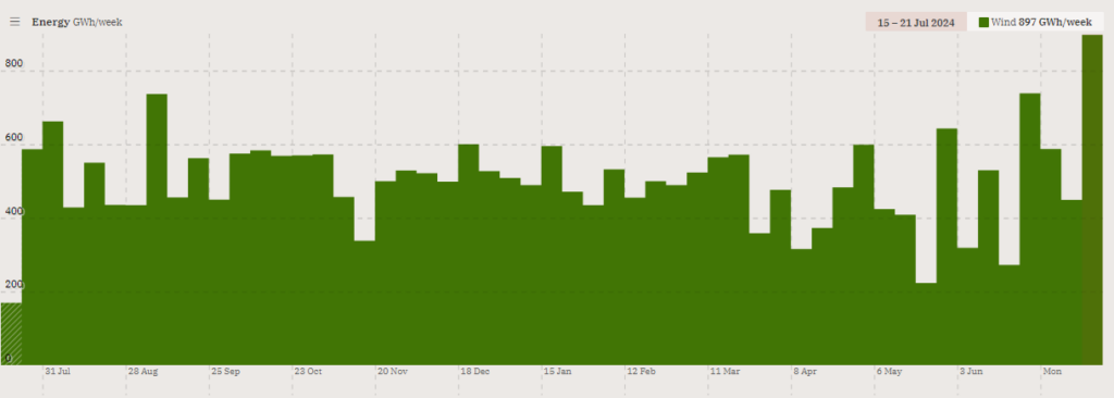
Image: Wind weekly contribution to generation (GWh/week) for the last year leading up to Sunday, July 21, 2024. Source: OpenNEM
The cold front that impacted southern Australia late last week brought widespread damaging winds to several states and territories.
This week will be windy again as several cold fronts sweep across the south of the continent. The image below shows Weatherzone’s NEM wind farm output for the next week.
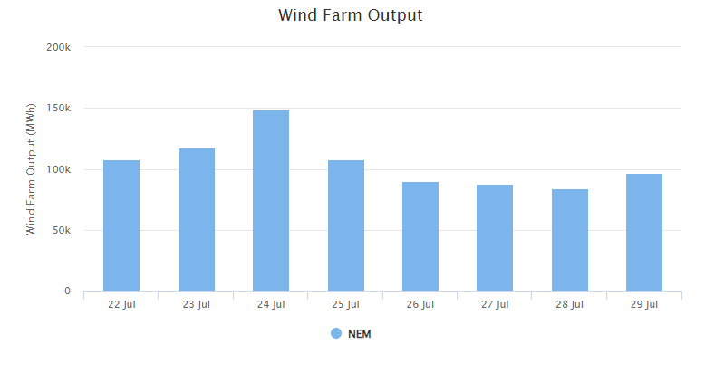
Image: Weatherzone’s National Electricity Market wind farm output for the next 7 days in MWH.
You can see the windiest days this week are expected to be Tuesday and Wednesday, as a cold front moves across southeastern Australia. A low pressure system will then move across the Bight later this week, bringing another burst of strong winds to the region.
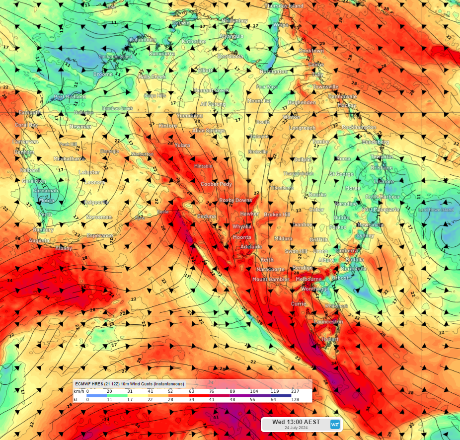
Image: Instantaneous wind gust forecast for 1pm AEST on Wednesday, July 24, according to ECMWF.
Winds are likely to reach damaging strength over parts of southeastern Australia during this week. Tas could see damaging winds impacting the state each day between Tuesday and Saturday.
Meanwhile parts of SA, Vic, NSW and the ACT should see damaging winds on Wednesday and Thursday. These winds have the potential to cause cut outs, where wind turbines are turned off in strong winds to prevent damage. Most wind farms turn off the turbines if the wind speed reaches the ‘cut off’ wind speed of 90km/h (25m/s), which means that the wind power is not being harnessed. During these periods of intense winds, wind power capacities will be reduced if the turbines remain turned off.
This westerly wind pattern will also bring a warm week to parts of southeastern Australia and increased rainfall over parts of southwestern WA, Tas and southern Vic and the western plains in NSW.
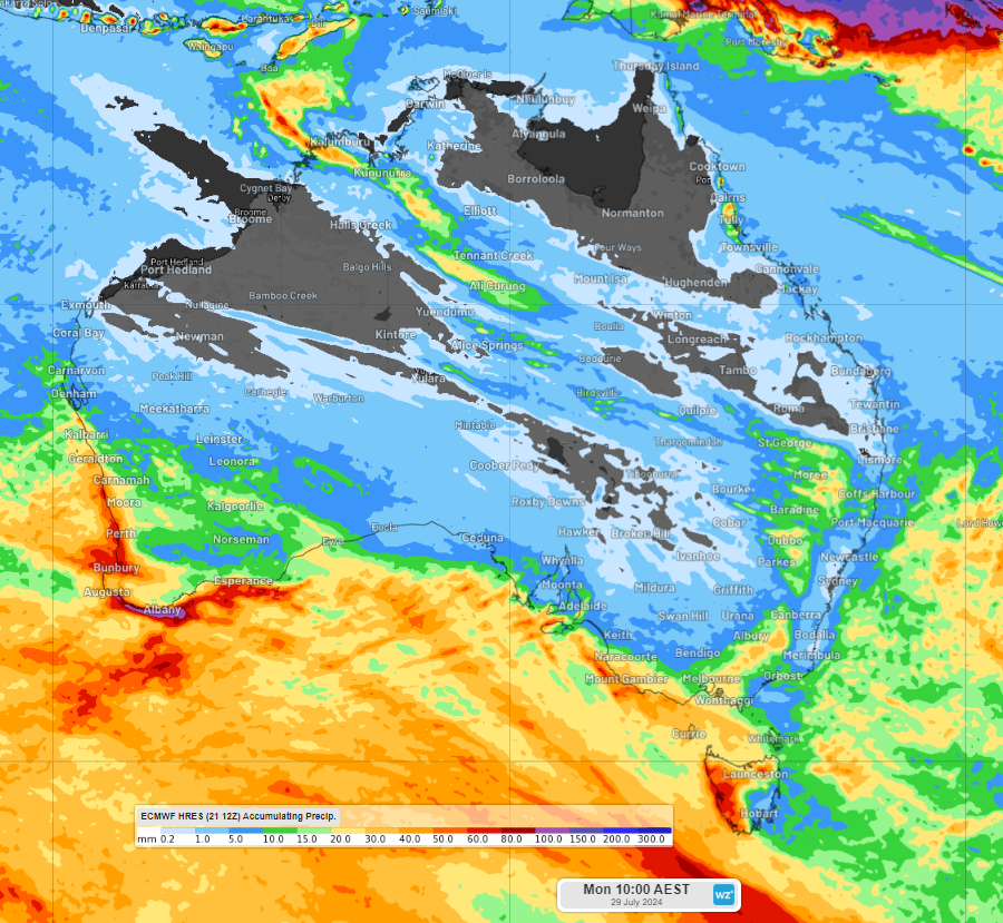
Image: Accumulated rain forecast for the week leading up to 10am Monday, July 29, according to ECMWF
The increased cloud associated with the frontal activity will reduce solar output in these areas.
Looking further ahead, we should continue to see increased wind and frontal activity across southern Australia during late July and August in response to the Sudden Stratospheric Warming event.
DTN APAC delivers industry-leading weather and power generation forecasting and real-time alerting to inform your critical decision-making. Together we can keep your staff and assets safe, and efficiency high.
With lightning strikes, severe weather, flood and fire posing risk to wind farms across Australia, we have tailored solutions that can significantly improve your oversight and response.
Total Lightning Network comprises of regional and global sensors to detect intra-cloud (IC) and cloud-to-ground lightning (CG) strikes within your proximity thresholds. It provides unparalleled detection accuracy (<200m) and real-time lightning alerts to any device across your operations team.
Your customizable Energyzone interface and Weatherguard app will provide access to the Total Lightning Network as well as centralized data from state and territory fire agencies, the Bureau of Meteorology, and over 30 national and international private and state organisations. This enables full situational awareness of weather conditions and fire risk, as well as severe weather alerting via text, email and phone call, so your staff can respond effectively when required. To find out more, please visit our contact page or email us at apac.sales@dtn.com.




