
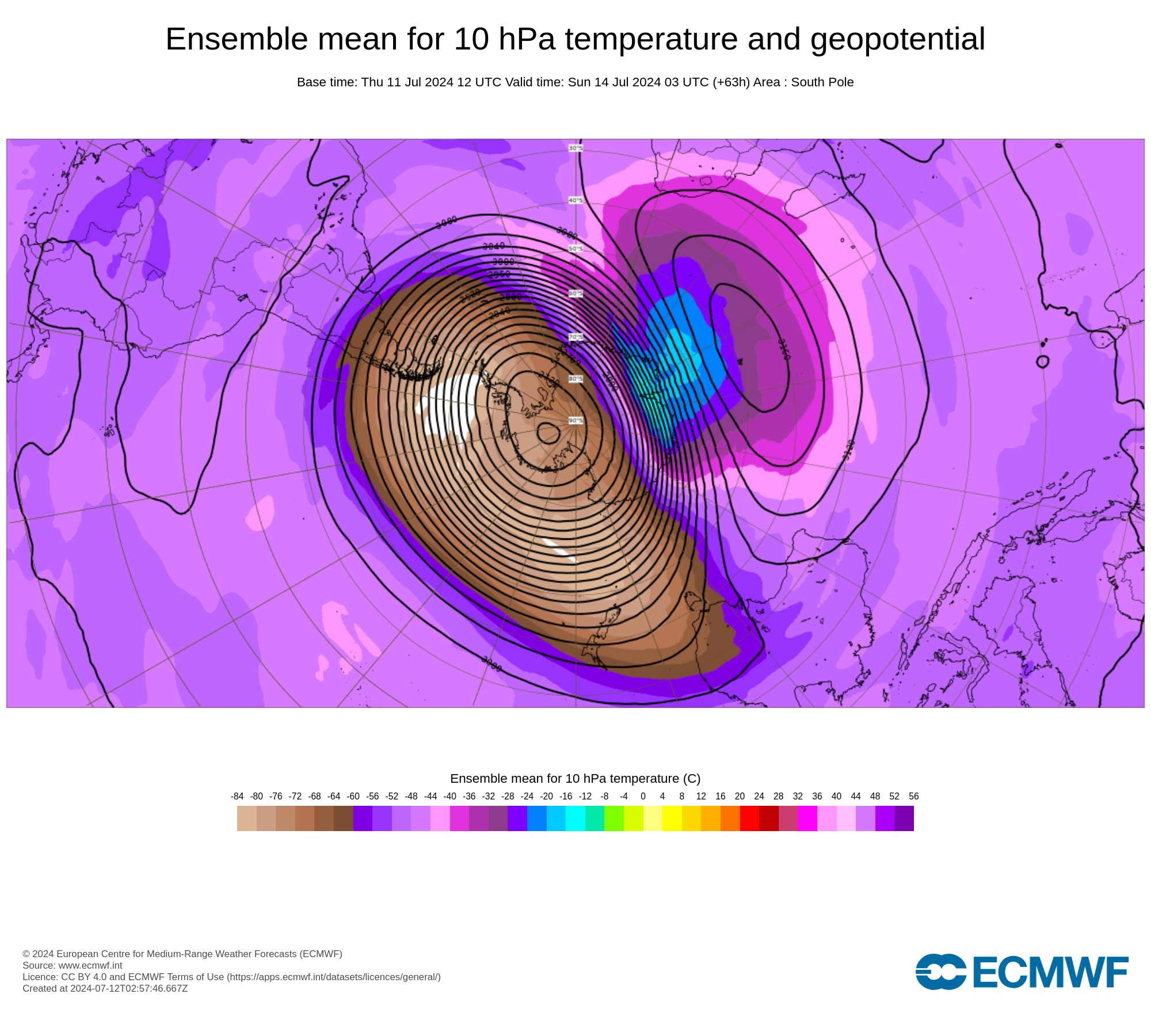
A rare sudden stratospheric warming event is beginning to occur above Antarctica, and it may influence Australia’s weather in the coming weeks.
The term sudden stratospheric warming (SSW) refers to an abrupt increase in air temperature high above either of Earth’s polar regions, typically on the magnitude of tens of degrees Celsius in a few days. This warming occurs in a layer of the atmosphere called the stratosphere, roughly 30 to 40km above the surface.
While warming in the stratosphere does not immediately (or always) affect weather patterns near the ground, SSW events can filter down through the atmosphere and influence tropospheric weather in the weeks following the initial SSW.
If an SSW event does make its way down to the troposphere, it can cause the tropospheric polar vortex to weaken, which allows cold polar air to drift further away from Antarctica (or the Arctic if in the Northern Hemisphere) and spread towards the mid-latitudes.
Through this domino effect, SSW events can cause the Southern Annular Mode (SAM) to shift into a negative phase, which can have the following impacts in Australia during winter:
- More cold fronts and low pressure systems over southern Australia
- Increased rainfall and snow potential in southwest and southeast Australia
- Reduced rainfall in parts of eastern Australia
- Stronger winds in the southern half of Australia
The Southern Annular Mode (SAM) is an index used to monitor the position of the westerly winds that flow from west to east between Australia and Antarctica. When the SAM is in a negative phase, these westerly winds, and the cold fronts and low pressure systems they carry, are located further north than usual for that time of year. When the SAM is positive, the westerly winds, cold fronts and low pressure systems are located further south than usual. |
Sudden Stratospheric Warming underway
Warming has been detected in the stratosphere above the Antarctic region over the past week, revealing that an SSW event is starting to occur in the Southern Hemisphere. Some forecast models predict that this stratospheric warming will continue over the next week and start to filter down through the atmosphere later this month.
The graph below shows observed stratospheric temperatures in red and the forecast from one model in green. From these lines you can see a sudden increase in the temperature beyond the normal range, potentially getting even warmer than any other observed event at this time of year.
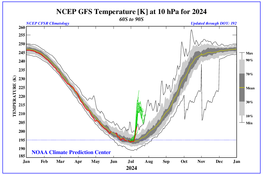
Image: Observed and forecast 10hPa temperature over the Southern Hemisphere’s polar region (90°S to 60°S) according to the GFS model.
It is currently unclear whether the stratospheric warming will influence weather closer to the ground in the coming weeks. However, some models are already showing signs that the SSW signal will descend to lower altitudes during the second half of July. If this trend continues, it will increase the likelihood of a shift towards a negative SAM in late July or August.
Videos: Forecast temperatures at the 10hPa (top) and 100hPa (bottom) levels in the atmosphere, according to the GFS model. The first animation shows warming over East Antarctica during the middle of July, which displaces the cold air within the stratospheric polar vortex. The second animation shows warming predicted to the south of Australia later in the month, indicating the downward progression of the SSW signal.
Since April, Australia has been affected by a stagnant long-wave ridge pattern, leading to persistent high pressure in the Bight. As a result, there has been drought in WA and SA, abnormally wet conditions along the east coast, and very low wind over western Vic. This SSW event may disrupt this pattern for the Australian region.
The images below show one forecast model predicting a shift towards lower sea level pressure near Australia in August, and an associated increase in precipitation for southern Australia, which are both consistent with a shift towards negative SAM.
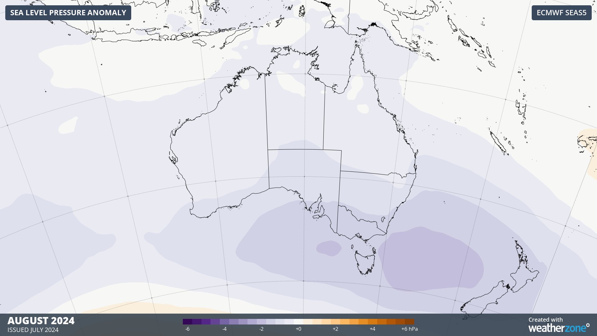
Image: Forecast mean sea level pressure anomaly in August 2024 according to the ECMWF SEAS5 model.
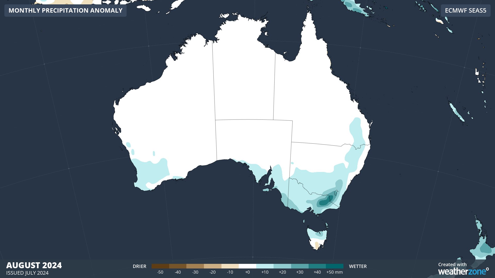
Image: Forecast precipitation anomaly in August 2024 according to the ECMWF SEAS5 model.
What causes Sudden Stratospheric Warming?
SSW can be caused by large atmospheric ‘waves’ propagating upwards through the atmosphere and crashing into the stratospheric polar vortex. These waves can warm the polar stratosphere and weaken, or even reverse, the westerly winds that typically circulate above the poles in winter.
An SSW event can be classified as minor or major based on the magnitude of warming and changes to the wind speed and direction in the stratosphere:
- A minor SSW occurs when the polar temperature increases by 25°C or more within one week at any stratospheric level
- A major SSW requires an increase in temperature AND a reversal of the westerly winds at the 10hPa level in the polar regions.
Only a few SSW events have been observed in the Southern Hemisphere, with the most recent one occurring in 2019.
Weatherzone’s meteorologists will be keeping a close eye on the current SSW signal and updating the Weatherzone News in coming weeks. Book a seasonal forecast with our experts today and learn more about how events like this can impact your business. For more information please contact us at apac.sales@dtn.com.




