

Melbourne saw an unusual spike in temperature last night when the mercury jumped to 21°C at 3am, making the middle of the night feel warmer than an average spring day. Thursday night started off warm for this time of year as light northerly winds had the temperature sitting on 16°C at 10pm. The mercury then […]
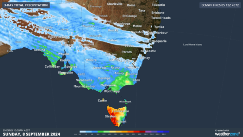
Yet another cold front will bring renewed potential for moderate flooding in Tas and damaging winds, high fire danger and well above average temperatures to southeastern states in the next 48 hours. The satellite image below shows the cold front and associated rain and cloud approaching SA, Vic and Tas on Friday morning. Image: […]
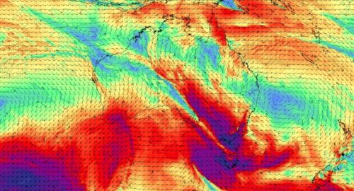
Another surge of powerful winds will spread across Australia’s southeastern states over the next two days, prompting warnings for damaging wind gusts in parts of Victoria, NSW and the ACT. A vigorous northwesterly airstream and embedded cold fronts will cause damaging winds, rain and thunderstorms over southeastern Australia on Thursday and Friday. While this system […]

The Southern Hemisphere’s spring equinox will occur in just over two weeks’ time, meaning days are about to become longer than nights across Australia, increasing solar output across the country. What is the spring equinox in Australia? The term equinox refers to the date when the Sun appears to be positioned directly above Earth’s equator. […]
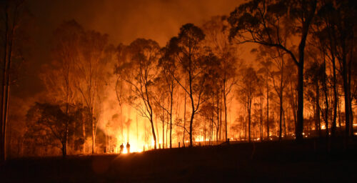
Australia’s warmest August on record has laid the foundations for an increased risk of fires in multiple states and territories this spring. According to the latest Australian Seasonal Bushfire Outlook, which was released on Wednesday, large areas of Australia will have an increased risk of fires this spring. The red shading on the map below […]

Temperatures will bounce around in southeastern Australia this week as contrasting air masses battle it out in a seasonal tug-of-war. Early spring is typically a time for variable temperatures in southern parts of Australia as hot continental air masses interact with much colder pools of air moving up from the south. This temperature see-saw is […]

After weeks of howling winds across southeastern Australia, many places on the mainland are enjoying a brief break this Tuesday. It won’t be totally still out there with smoke rising vertically. But put it this way: it should be possible to walk down the street without getting dust in your eyes, not to mention having […]

August 2024 across Australia was the warmest on record by a considerable margin, with a mean average temperature that was 3.02°C above the long-term average, while the 2024 winter was the second-warmest on record nationwide. That’s an entire month that was three degrees warmer than average when you factor in both minimum and maximum temps […]
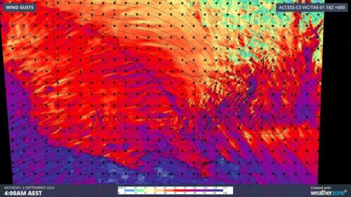
Ferocious winds with gusts equivalent to a category two tropical cyclone have caused widespread damage across Victoria in the last 24 hours, along with huge waves and flooding along the coast. A powerful cold front embedded in an unusually strong pressure gradient caused a burst of damaging to destructive winds in Victoria on Sunday night […]

Australia’s tropical cyclone season is officially underway, but we may not see much activity for few months yet. The season runs from November to April, and for mining operators and businesses across northern Australia, 2026-27 is shaping up to be a season where the headline numbers and the real risk may not line up. On […]

A positive Indian Ocean Dipole is underway, but this one is unlikely to deliver the textbook dry spring and summer that businesses have come to expect from the pattern. The Bureau of Meteorology officially declared a positive IOD on Tuesday, October 27, which typically like El Niño can cause drier and warmer conditions over parts of […]

Waters off Indonesia have cooled in recent weeks, an indication that a positive Indian Ocean Dipole (IOD) event could be developing. It’s an important climate driver for Australia, and it could shape rainfall and temperatures heading into summer, with flow-on effects for farmers, energy and other industries. What is the Indian Ocean Dipole? The IOD […]

Leonora, WA, had its wettest September day on record earlier this month. Three weeks later, more than 1.3 million lightning pulses were detected within 800 km of the town in 48 hours. Why is a stalled trough delivering storms to mining country, and what it could mean for operations? The DTN Total Lightning Network detected […]
