
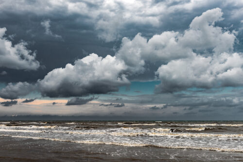
Northern Australia’s 2024-25 wet season featured the busiest cyclone season in 19 years, latest monsoon onset on record and intense thunderstorm outbreaks. The northern Australia (north of 26°S) average wet season rainfall in 2024-25 was 21% above the 1961-1990 average. As seen in the rainfall deciles map below, this above average rainfall was driven by […]

Parts of South Australia, Victoria and Tasmania just endured their driest start to a year on record as a lack of early autumn rain worsened drought conditions in parts of all three states. High pressure systems have been dominating the weather patterns near southern Australia in recent months. These stubborn areas of high pressure, which […]

The National Energy Market (NEM) recorded its highest solar energy generation over the past summer as high pressure dominated southeastern Australia. Australia’s NEM has continued to implement more and more renewable energy sources into its network. Combined with favourable weather, both the summer of 2024-25 and the last quarter (January to March 2025) saw record […]
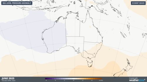
The Pacific and Indian Ocean climate drivers remain in a neutral phase, with weather around Australia continuing to be dominated by more local effects. Pacific Ocean climate driver The El Niño Southern Oscillation (ENSO) has returned to a truer neutral phase, after trending towards a La Niña-like phase during summer. Sea Surface Temperatures (SST) across […]

Halfway through autumn, Adelaide continues to endure an early-year dry spell the likes of which it has not seen since the famously barren decade of the 1980s. Just 14.4mm of rain has been recorded at the city’s main weather station from January 1 to April 15, 2025. That makes it the South Australian capital’s 4th-driest […]
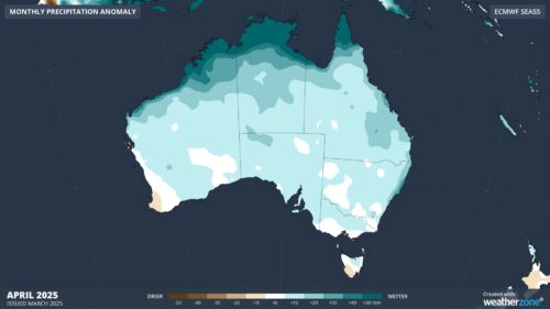
Multiple flooding events have occurred in Queensland since the start of 2025, but why? Last month was Australia’s hottest and 4th-wettest March on record. Queensland was especially wet, registering its 3rd wettest March on record. This moisture combined with the very warm temperatures around the country to bring the warmest March minimum temperatures on record […]
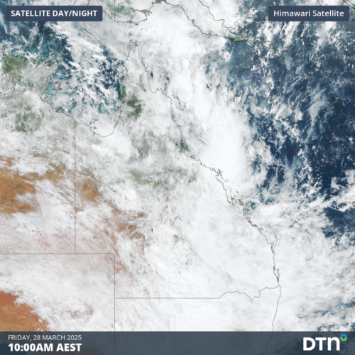
Thick and extensive cloud over Queensland last week caused solar production to plummet to its lowest level since last winter. A monsoonal burst combined with an active phase of the Madden-Julian Oscillation (MJO) over northern Australia last week, leading to widespread flooding rainfall and extensive cloud cover across Queensland. The image below shows the cloud […]
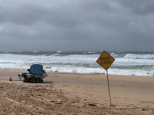
A powerful Tasman Low spinning off Australia’s East Coast is whipping up large waves along coastal NSW. A low pressure trough that slowly made its way from outback Queensland and over NSW over the past week, delivering widespread flooding, moved off the NSW coast this weekend. Very warm sea surface temperatures, along with support from […]
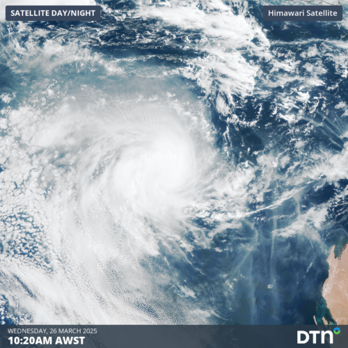
Tropical Cyclone Courtney, currently a Category 1 system, developed in the early morning of Wednesday, March 26, marking the eighth tropical cyclone of the Australian season. Tropical Cyclone Courtney was slow to develop from a tropical low located south of Bali over the weekend, gradually tracking west-southwest over the past few days. Early on Wednesday, […]

Australia’s tropical cyclone season is officially underway, but we may not see much activity for few months yet. The season runs from November to April, and for mining operators and businesses across northern Australia, 2026-27 is shaping up to be a season where the headline numbers and the real risk may not line up. On […]

A positive Indian Ocean Dipole is underway, but this one is unlikely to deliver the textbook dry spring and summer that businesses have come to expect from the pattern. The Bureau of Meteorology officially declared a positive IOD on Tuesday, October 27, which typically like El Niño can cause drier and warmer conditions over parts of […]

Waters off Indonesia have cooled in recent weeks, an indication that a positive Indian Ocean Dipole (IOD) event could be developing. It’s an important climate driver for Australia, and it could shape rainfall and temperatures heading into summer, with flow-on effects for farmers, energy and other industries. What is the Indian Ocean Dipole? The IOD […]

Leonora, WA, had its wettest September day on record earlier this month. Three weeks later, more than 1.3 million lightning pulses were detected within 800 km of the town in 48 hours. Why is a stalled trough delivering storms to mining country, and what it could mean for operations? The DTN Total Lightning Network detected […]
