Parts of South Australia, Victoria and Tasmania just endured their driest start to a year on record as a lack of early autumn rain worsened drought conditions in parts of all three states.
High pressure systems have been dominating the weather patterns near southern Australia in recent months. These stubborn areas of high pressure, which are linked to a predominantly positive Southern Annular Mode (SAM), have prevented any substantial rainfall from reaching large areas of South Australia, Victoria and Tasmania since the start of 2025.
The map below shows the rain that fell across Australia in the first four months of 2025 represented as a percentage of the long-term average. The brown shading shows where rainfall was less than 20 percent of the long-term average for the January to April period.
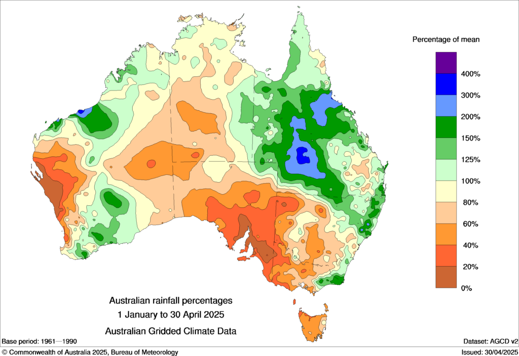
Image: Observed rainfall percentages for the first four months of 2025, showing how the observed rainfall from January to April in 2025 compared to the long-term January-to-April average from the 1961-1990 period. Source: Bureau of Meteorology
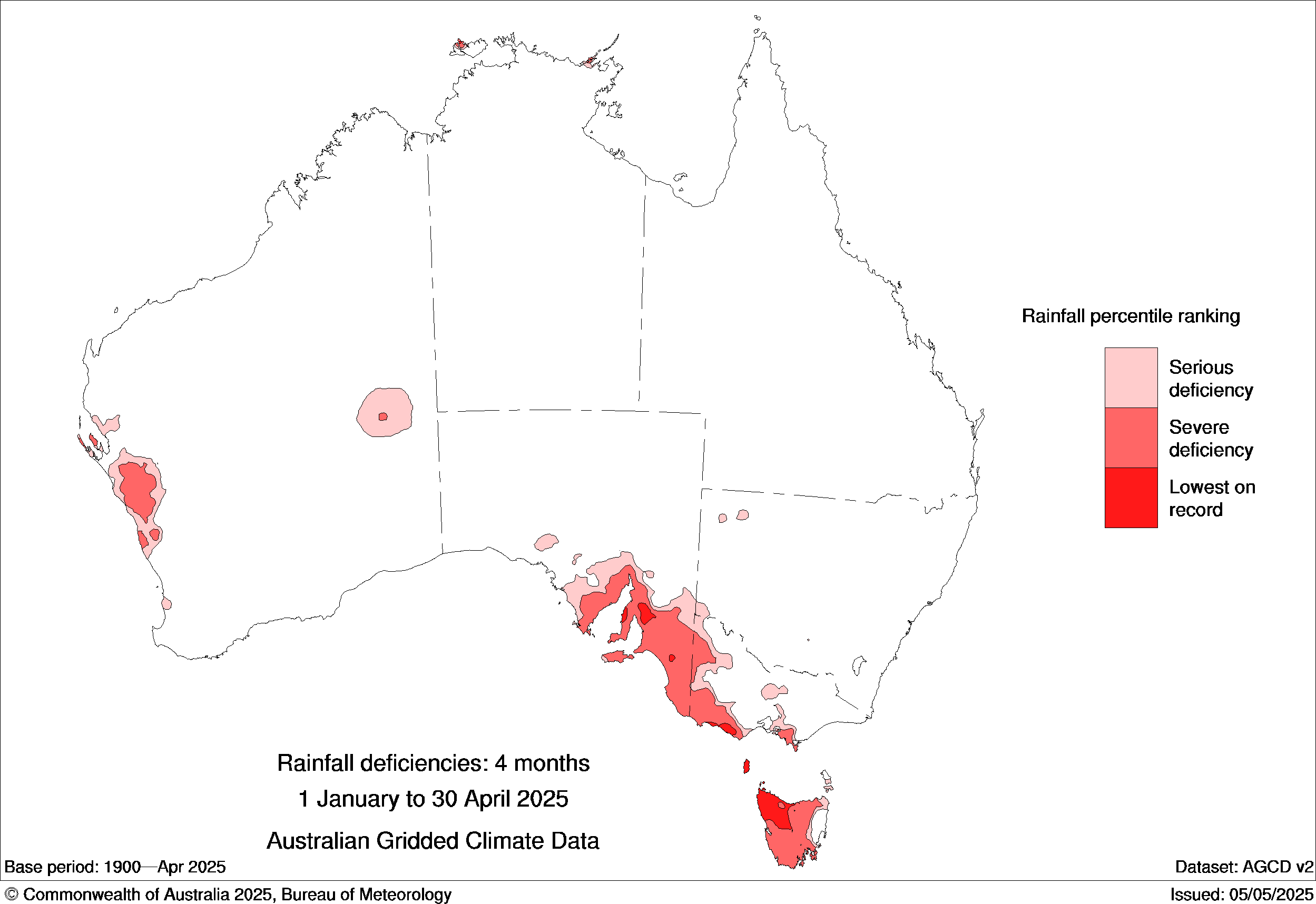
Some areas in southern Australia saw their lowest rainfall on record during the first four months of this year. This included parts of South Australia, southwest Victoria and northwest Tasmania. When averaging rainfall across the entire state, Tasmania also had its driest start to a year on record.
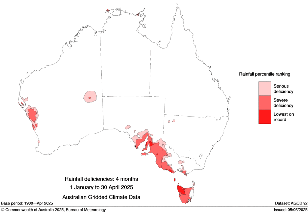
Image: Rainfall deficiencies in the first four months of 2025. Source: Bureau of Meteorology.
The dry start to 2025 comes off the back of two dry southern wet seasons in 2023 and 2024. The period from April to October is when southern Australia receives most of its annual rainfall, but the last two cool seasons were both abnormally dry in the country’s south.
With the opening months of 2025 continuing to see an absence of useful rain, large areas of southern Australia have just seen their driest 15-month and 25-month periods ending in April on record.
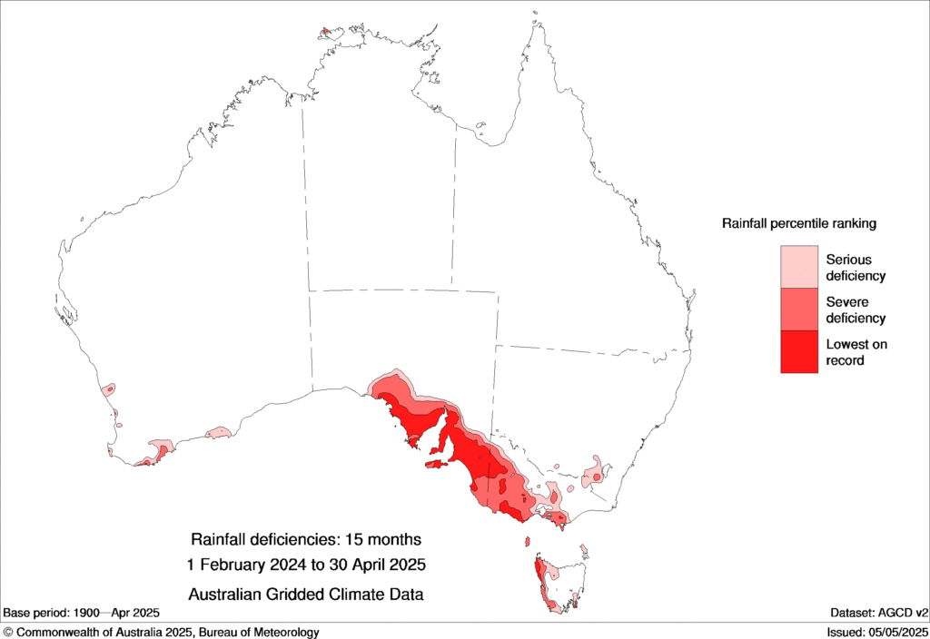
Image: Rainfall deficiencies between February 2024 and April 2025. Source: Bureau of Meteorology.
Unsurprisingly, April saw root-zone soil moisture levels and streamflows in the lowest 10 percent of historical records over large areas of South Australia, Victoria and Tasmania.
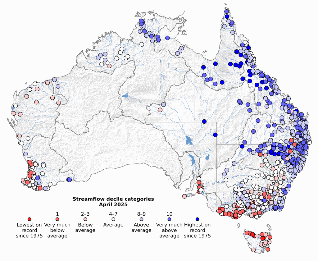
Image: Streamflow deciles in April 2025, showing lower-than-average streamflows across much of southern Australia and much healthier streamflows in parts of eastern and northern Australia.
Looking ahead, seasonal forecast models predict a drier than average end to autumn and start to winter, although there are signs that rainfall could trend above average into the second half of winter. More reliable seasonal rainfall outlooks will become available from June onwards.
How DTN APAC can help
The shifting climate is bringing increased complexity and greater risks to businesses worldwide. We are here for you, delivering trusted weather solutions to optimize your operations and profitability.
DTN APAC is a diverse team, with global forecasting, product development and analytics expertise. Couple this with extensive industry experience spanning Aviation to Energy, and we are primed to assist you in strengthening your response to weather impact.
We work hard to identify your operational pressures and tailor our services and products to meet your needs. Concise communication, giving you full situational awareness exactly when you need it, is our focus. We want to reduce weather risk in your operations, every day.
We deliver clear and comprehensive weather data, personalised risk assessments and briefings to you and your team, so that your critical decisions can be made with confidence.
We are available 365 days a year, so you always have the timely guidance you require, especially when severe conditions hit.
You have our insights to rely on to see you through complex situations, minimising potential loss of profit and maximising the safety of your staff and assets. For more information please visit our website or email us at sales.apac@dtn.com