
Thick and extensive cloud over Queensland last week caused solar production to plummet to its lowest level since last winter.
A monsoonal burst combined with an active phase of the Madden-Julian Oscillation (MJO) over northern Australia last week, leading to widespread flooding rainfall and extensive cloud cover across Queensland. The image below shows the cloud cover across the state last Friday.
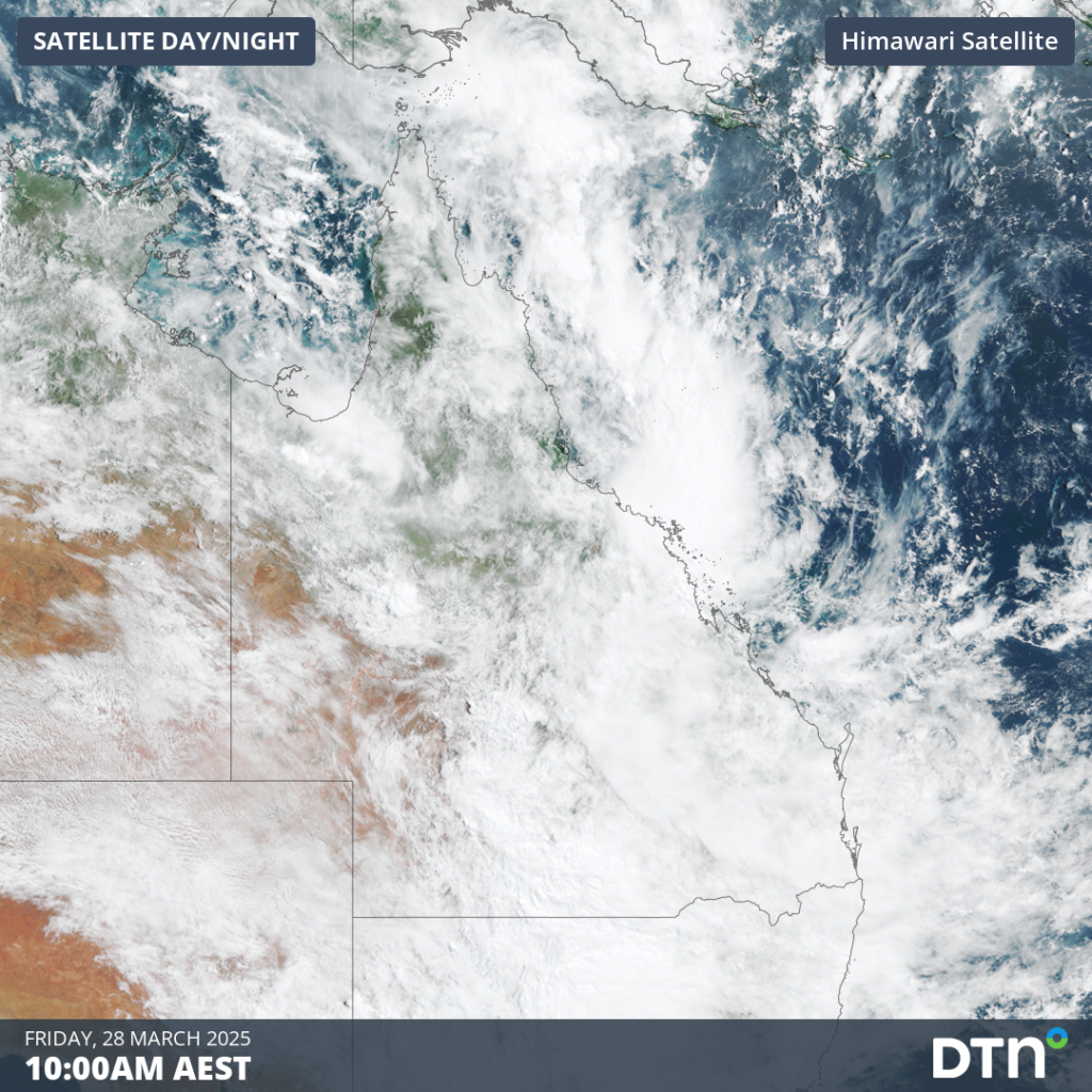
Image: Satellite showing cloud extending across most of Queensland on Friday, March 28.
Blocking the sunshine from reaching solar panels, Queensland’s solar energy production progressively lowered between Monday and Friday last week. On Friday, March 28, the combined rooftop and utility solar generation only amounted to 15.4GWh across Queensland, the lowest since August 12, 2024. Across the whole week, only 166GWh was produced, the lowest production since early July 2024, as seen in the figure below.
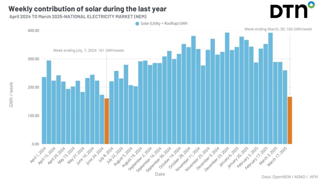
Figure: Weekly contributions from Queensland’s solar generation to the NEM since April 2024. Source: OpenNEM.
The March equinox was only 12 days ago but since then, nights have been growing progressively longer than days, resulting in fewer hours of sunlight to produce solar power. It’s expected for summer months to produce much more solar power than winter months. This makes this March low remarkable, with only one week in the dead of winter producing less solar power.
Solar production gradually ramped up over the past weekend, returning to average levels on Sunday, March 30. Another influx of moisture from the remnants of Tropical Cyclone Dianne will bring more rainfall and cloud cover through Tuesday and Wednesday, as seen below, but will be much less extensive than last week’s event.
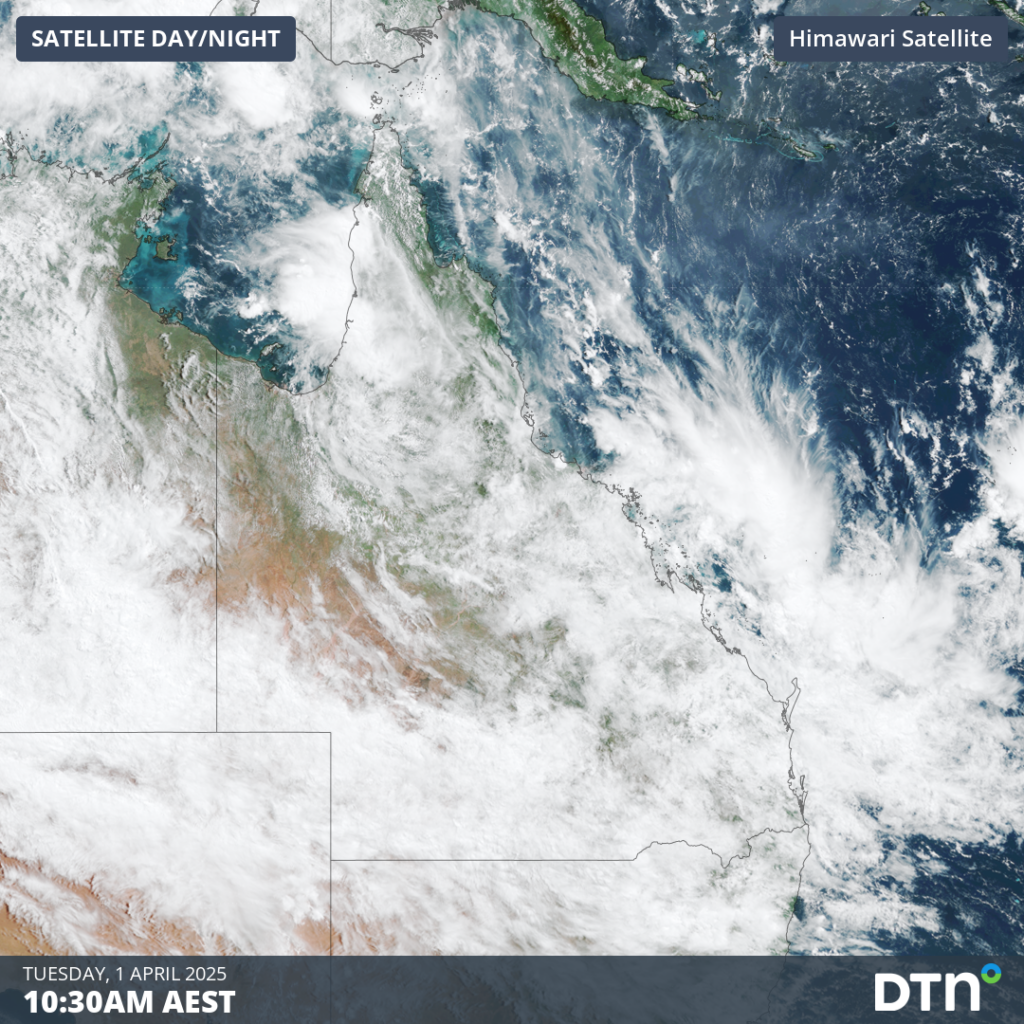
Image: Satellite image showing cloud cover over Queensland on Tuesday, April 1, as tropical moisture streams over the state.
Cloud cover should retreat over the coming week as the MJO weakens over the Australia region. By late April, another burst of the MJO could be making its way into the Australian longitudes. Combined with these periods of increased tropical activity, ample moisture from very warm sea surface temperatures in the Coral Sea should maintain above average cloud cover over much of Queensland in the coming month, as seen in the image below.
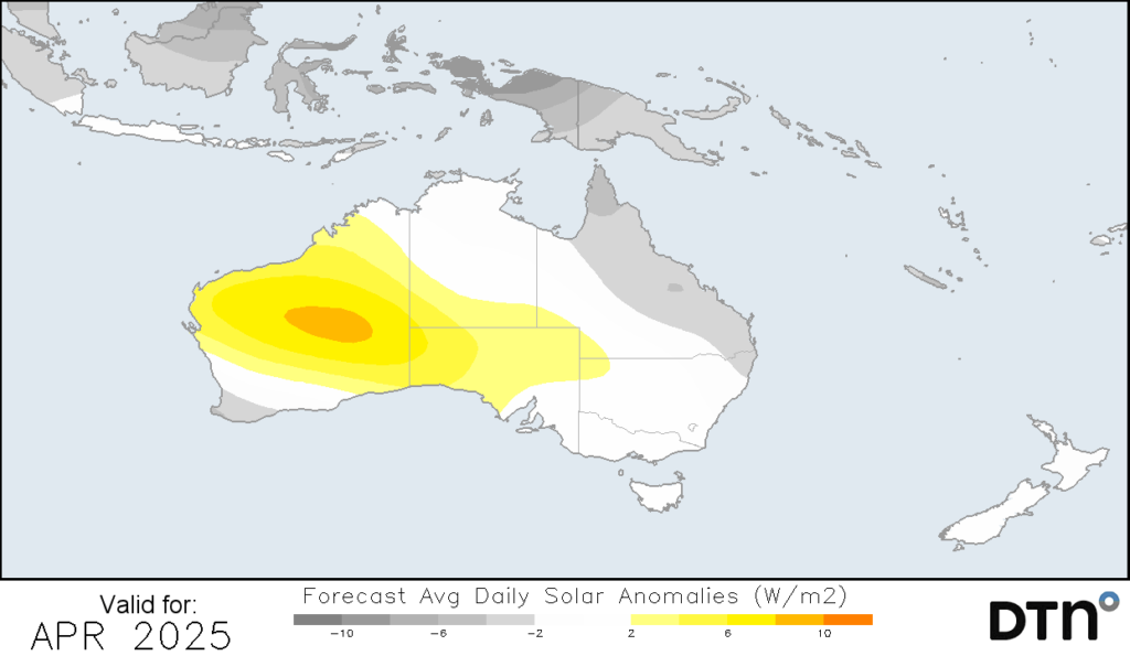
Image: forecast solar anomalies for April 2025 with increased cloud cover leading to decreased solar energy over Queensland’s north and east.
The National Energy Market (NEM) has progressively seen the introduction of more renewable energy sources into the network. As seen in the figure below, solar generation contributes a greater proportion of the overall energy supply each year. Renewable energy sources are highly dependent on the weather, as seen over the past week. To ensure a constant and reliable supply of power to consumers, other sources of energy, whether it’s wind or non-renewable, need to be used during low solar generation period.
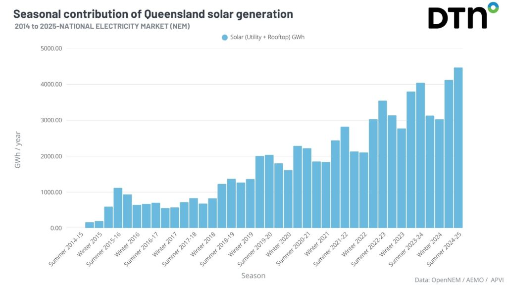
Figure: Seasonal contributions from Queensland’s solar generation to the NEM since starting in 2014. Source: OpenNEM.
DTN APAC and Solcast, a DNV company are a market-leading partnership delivering highly specialised solar data to the Australian renewable energy industry.
Designed for utility scale solar sites, we offer you a globally proven solution.
With low upfront CAPEX and powerful cloud-based information systems, you can access a complete suite of irradiance and weather data to ensure forecast accuracy and improve site efficiency.
Solcast is the world leader in real-time actuals and rapid-update solar forecasts. This solution utilises Solcast’s centralised Amazon Web Services’ (AWS) cloud infrastructure for all complex algorithmic processes and data plumbing. You will gain the power of AWS to interpret and deliver your data at top speed, providing real-time, historical and forecasting estimates direct to your API.
Receive monitoring and support from the DTN APAC and Solcast teams, 24/7.
To find out more about large range of products and services contact us at sales.apac@dtn.com


