Dry air causing cold mornings across the NEM
Large areas of Australia are enduring cold and frosty mornings this week as high pressure systems keep skies clear across much of the country. While June featured several northwest cloud bands and widespread rain across Australia, clearer skies have...
Days of high wind power but low solar for the WEM
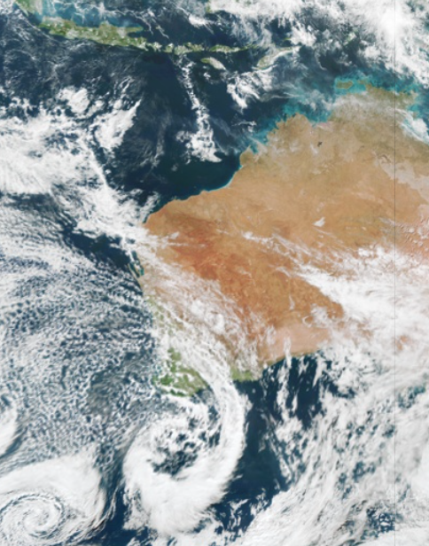
Wild and windy weather has begun in southwestern WA, as a low-pressure system lingers off the southern coastline. Damaging winds were recorded in the southwest of WA on Monday morning, with gusts reaching 120 km/h at Cape Leeuwin, 96 km/h at Busselton...
Introducing the new features of Oracle
Australia’s climate varies greatly throughout the eight states and territories, which certainly keeps Australian businesses on their toes. In some parts of Australia, winter is marked with frosts and freezing temperatures, while heatwaves and extreme temperatures are frequent in the summer months. The...
Sydney lost in fog for two days straight
Today is the second morning Sydneysiders have woken up beneath a thick blanket fog. The low visibility caused by this morning’s fog has created issues and disruptions to operations and services for several businesses, including ferries, ports and aviation. Unfortunately, the fog lasted well into the morning...
Rain, storms and low solar on the horizon for eastern Australia
Rain is going to sweep across a broad area of Queensland and NSW during the next 4-5 days, with thunderstorms and flooding possible in some areas. Moisture-laden air interacting with a low pressure trough has been causing cloud, showers and the odd thunderstorm to...
Wild weather crossing the NEM
A thick northwest cloud band is currently sweeping across the country, with the moisture-laden air originating off the far northwest shelf of Australia. The northwest cloud band has been dragged southeast across the country this week by a deep low-pressure system. The combination of the low-pressure system and northwest...
Negative Indian Ocean Dipole developing – here’s what that means for Australia.
There are growing signs that much of Australia will experience unusually cold and wet weather this winter and spring, with a negative Indian Ocean Dipole (IOD) emerging in recent weeks. Climatologists have been keeping a close eye on...
Northwest cloudband to bring rain, storms and thick cloud this week
Cloud, rain and thunderstorms are expected to impact a large area of Australia this week, as a northwest cloudband and low-pressure system sweep across the country. Northwest cloudbands are vast layers of cloud which stretch from Australia’s northwest to southeast. They form when humid and warm tropical air over the Indian ocean moves across Australia, producing cloud as the air...
Look out for the Tasman Low
A deepening Tasman Low will bring a burst of wind, rain, and large waves to parts of Tasmania, Victoria, and NSW during the next 3 days. The low could be seen clearly in satellite images last night, sitting roughly 350 km to the east of...