
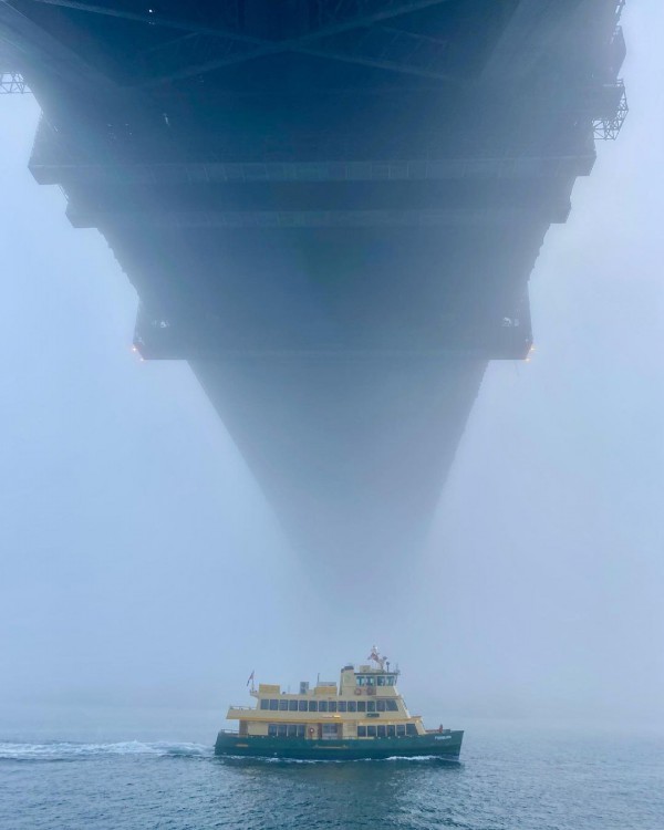
Today is the second morning Sydneysiders have woken up beneath a thick blanket fog.
The low visibility caused by this morning’s fog has created issues and disruptions to operations and services for several businesses, including ferries, ports and aviation.
Unfortunately, the fog lasted well into the morning on both occasions, reducing visibility until after 10am.
Sydney’s fog rarely forms in the city Centre, but instead arrives as a wall of fog rolling in from the west.
The fog usually forms near suburbs like Richmond and with the right wind direction and atmospheric set up, it can move across Sydney and spread into the eastern suburbs.
Light northwesterly winds are known to advect, or blow, thick fog along the Parramatta River and into Sydney Harbour. In the right set up, the fog can also drain along the Georges River, which sometimes impacts the airport and Port Botany, like it has the past couple of mornings.
Let’s circle back to the atmospheric set up that we mentioned above.
Fog forms when there are high levels of humidity in the atmosphere, light winds and cool temperatures.
When the humidity is near 100%, such that the temperature cools to the dewpoint temperature, condensation occurs. This causes airborne water vapor to condense into tiny water droplets, which stay suspended in the air as fog.
During this working week until 9am Thursday, July 1, 32.8mm of rain has fallen at Sydney’s Observatory Hill. The rainfall has meant the humidity in Sydney since Wednesday has been above 80%.
As of 9am on Thursday, the humidity was at 100%, which means the air was completely saturated with tiny water particles. This thick fog was reducing visibility to 800 metres at Sydney Airport and 300 metres at Bankstown Airport and Olympic Park at 9am.
So, what made the last two mornings so conducive to fog?
After days of rainfall and thick cloud, the sky cleared on Wednesday and Thursday evenings, which allowed the minimum temperatures overnight to drop. Clear skies are necessary for fog to form as cloud can trap daytime heat in.
A high-pressure system in the Tasman Sea was also generating light northwesterly winds each night, which moved the fog into Sydney’s eastern suburbs during the last two mornings.
Fortunately for businesses, this high-pressure system is moving east, making thick fog less likely over the Sydney Basin for a third night.
How can DTN APAC reduce the fogs impact on port and offshore rigs operations?
Weatherzone forecasts fog risk, density, onset and clearance times out to seven days, which enables efficiency and safety. Weatherzone has developed a traffic light system for port and marine clients, with green having no impact on operations, yellow a moderate impact and red having a high impact.
We can alert for fog down to the hour, what the density will be, and we fine tune our models dependent on the individual port requirements and local topography. Weatherzone’s traffic light system enables ports to make decisions and plan well in advance.
Fog density alerts can be also set up, which go off up to 36 hours in advance. Of course, Opticast has many other weather solutions for ports, including alerts of thunderstorms and wind gusts. All the thresholds can be adapted to your individual port. For more information, please contact us at apac.sales@dtn.com.




