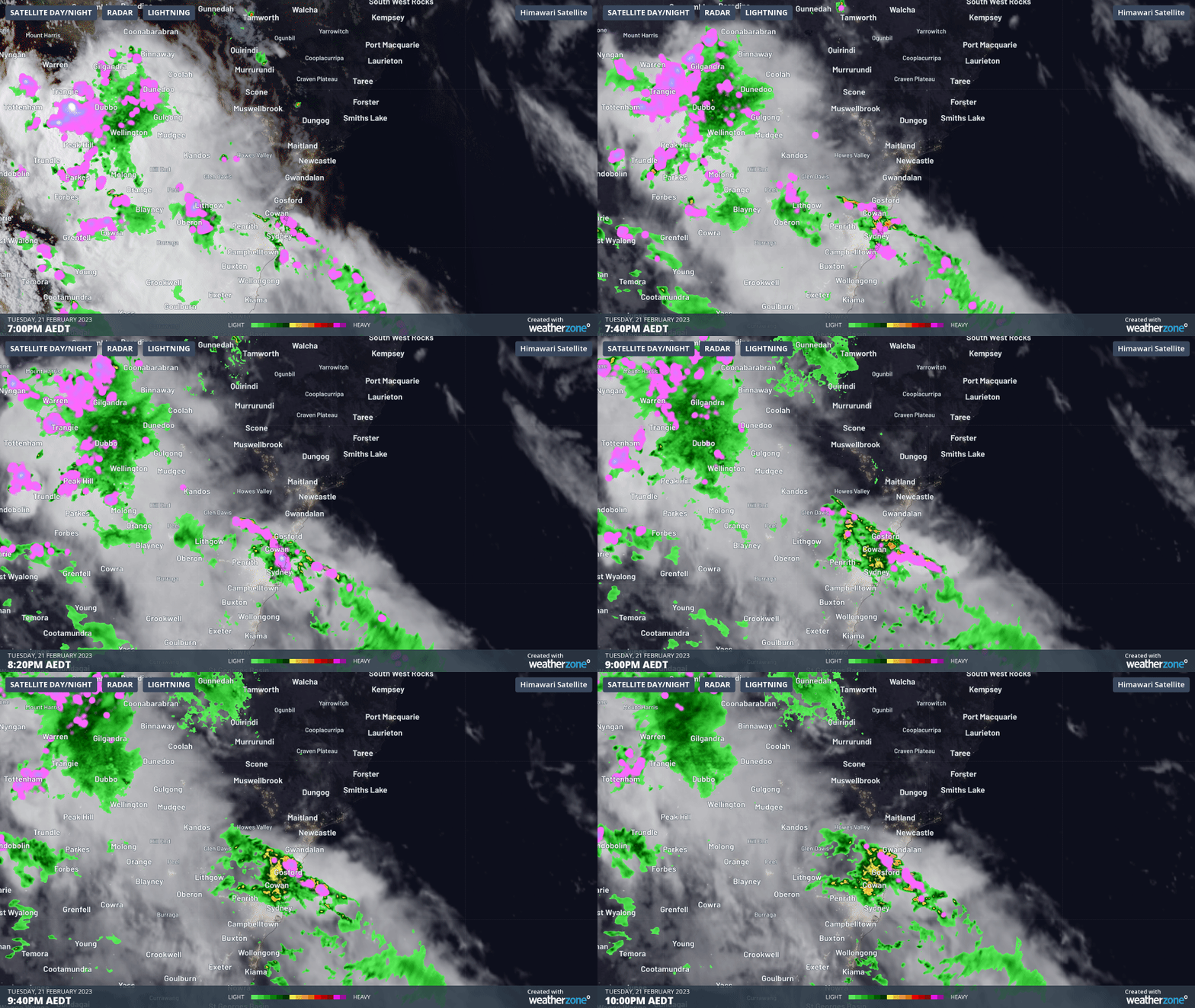
A barrage of rain and intense thunderstorms swept over Sydney and surrounding areas of central eastern NSW on Tuesday night, triggering flash flooding, damaging winds and even a waterspout.
Heavy rain and storms developed near a southerly change that swept up the NSW coast on Tuesday, forced warm and humid air to rise into the atmosphere. This rising air created thick storm clouds that were loaded with moisture thanks to near-record warm water in the western Tasman Sea.

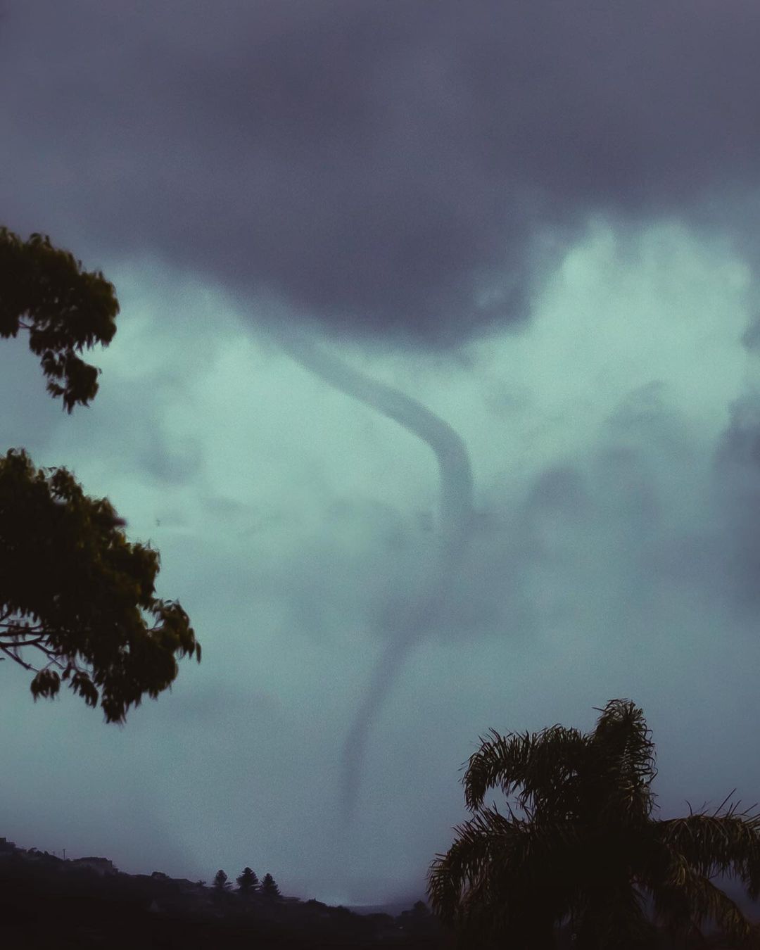
The abnormally warm water off the NSW coast is likely to have helped produce a waterspout that was spotted near Dee Why shortly before 7:00pm on Tuesday.

Image: A waterspout spotted near Dee Why in Sydney’s Northern Beaches on Tuesday evening. Source: @carriebrockphoto / Instagram
Tuesday night’s rain and storms delivered more than 100mm of rain to some areas, causing localised flash flooding. Some of the highest totals in the 24 hours to 9am on Wednesday were 127 mm at Terrey Hills, 116 mm at Belrose and 110 mm at Lisarow. This was close to a month’s worth of rain for Terrey Hills.
The southerly change and storms also whipped up blustery winds that brought down trees and branches in the rain-softened soil, with Wattamolla registering wind gusts around 85 km/h around 7pm.
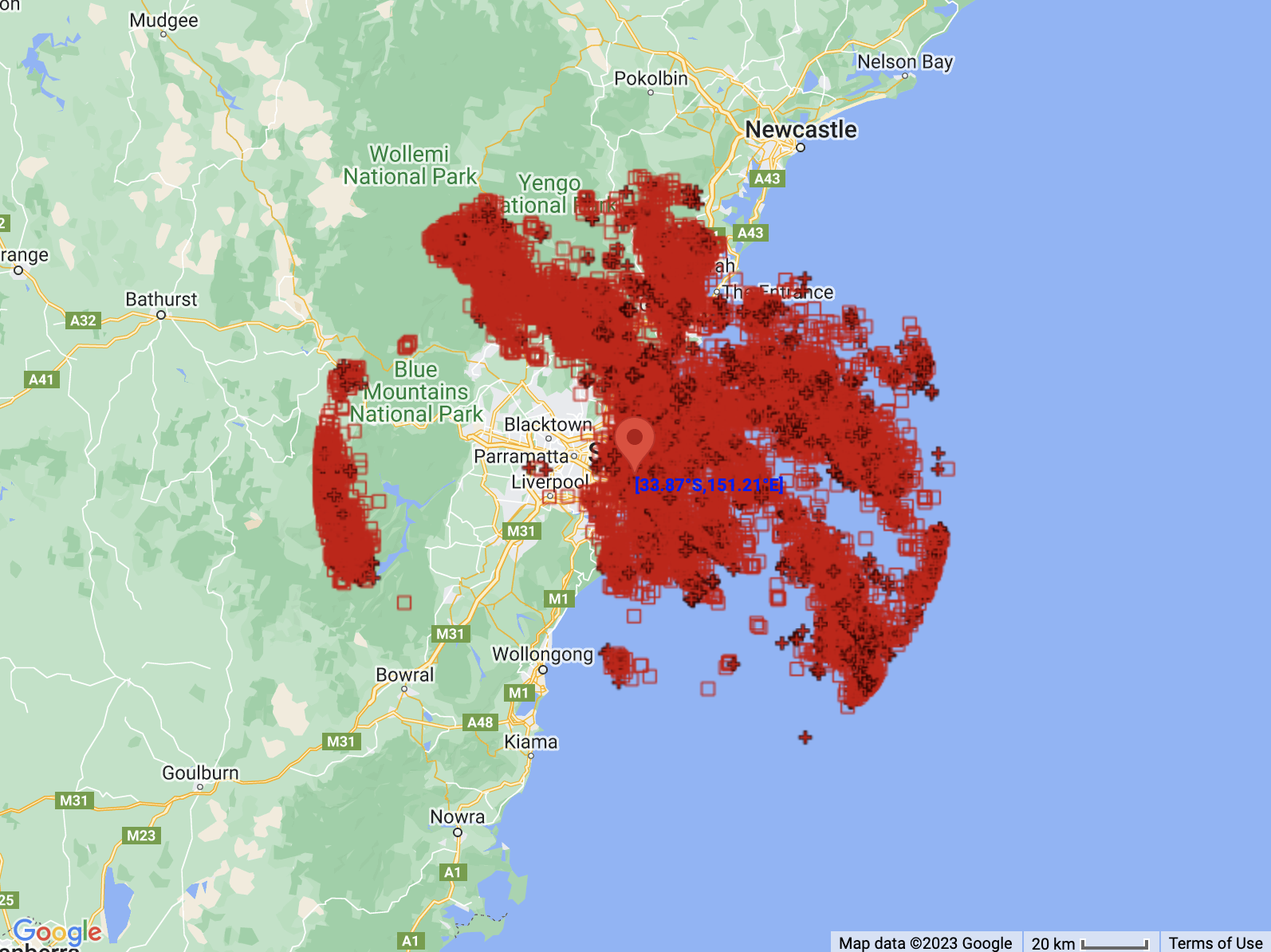
Total Lightning Network detected just over 22,000 lightning strikes within 100 km of Sydney during the 12 hours ending at 3:00am on Wednesday.

Image: The locations of 22,162 lightning strikes detected within 100 km of Sydney between 3:00pm on Tuesday and 3:00am on Wednesday.
While most of the rain has now cleared from Sydney, heavy rain and potentially severe storms have moved north and will continue about the Lower Hunter district on Wednesday. Cessnock Airport had already received 63.6 mm between 4:00am and 9:00am, its highest daily total in February for 14 years.
Check the latest warnings for the most up-to-date information on today’s thunderstorms. To find out more about what DTN APAC can do for you, please email us at apac.sales@dtn.com.


