
Prosper in a dynamic world
Search

Waterspouts and 20,000 lightning strikes hit Sydney region

A barrage of rain and intense thunderstorms swept over Sydney and surrounding areas of central eastern NSW on Tuesday night, triggering flash flooding, damaging winds and even a waterspout.

Heavy rain and storms developed near a southerly change that swept up the NSW coast on Tuesday, forced warm and humid air to rise into the atmosphere. This rising air created thick storm clouds that were loaded with moisture thanks to near-record warm water in the western Tasman Sea.
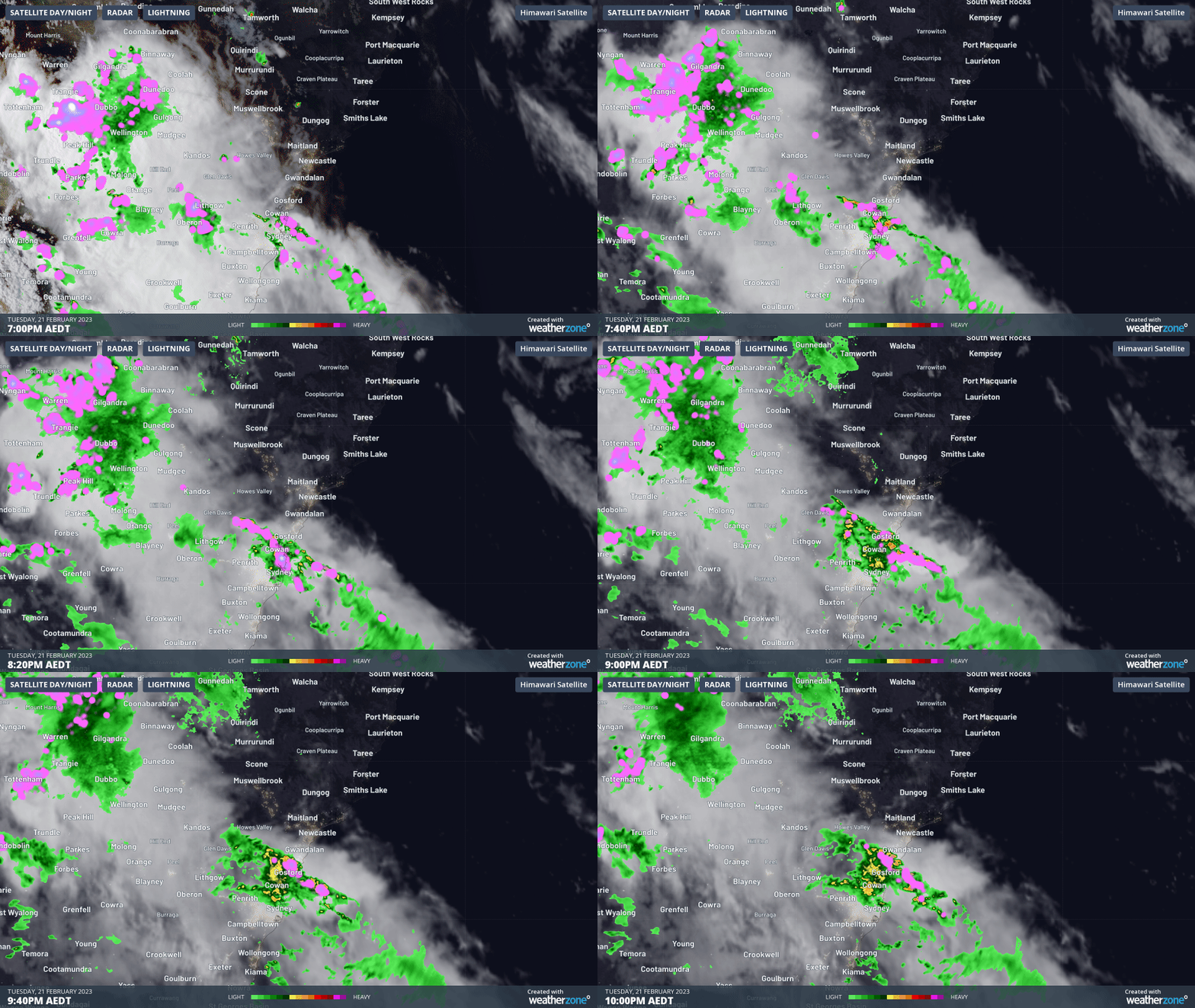
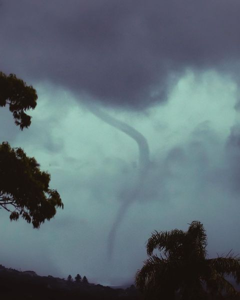
The abnormally warm water off the NSW coast is likely to have helped produce a waterspout that was spotted near Dee Why shortly before 7:00pm on Tuesday.
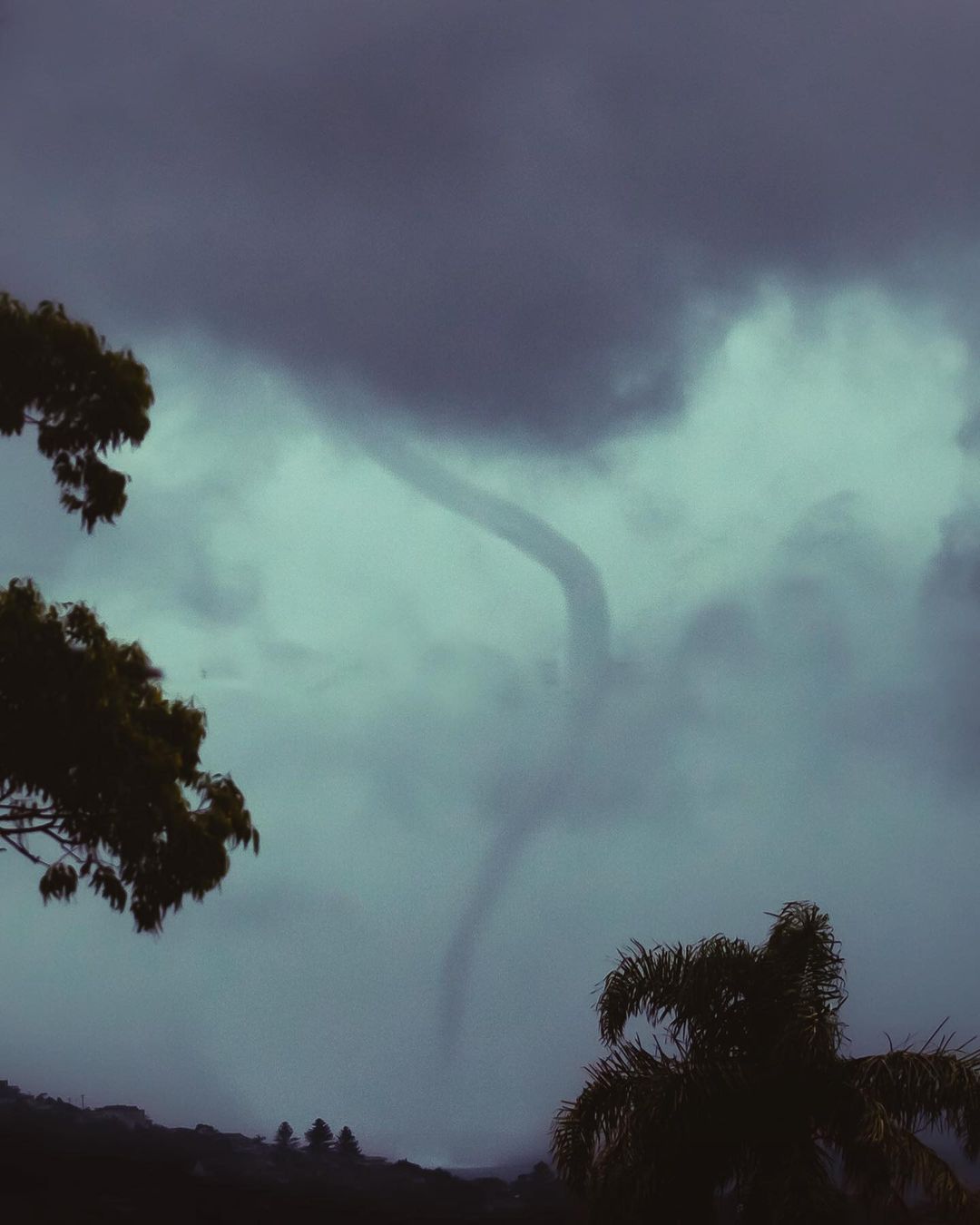
Image: A waterspout spotted near Dee Why in Sydney’s Northern Beaches on Tuesday evening. Source: @carriebrockphoto / Instagram

Tuesday night’s rain and storms delivered more than 100mm of rain to some areas, causing localised flash flooding. Some of the highest totals in the 24 hours to 9am on Wednesday were 127 mm at Terrey Hills, 116 mm at Belrose and 110 mm at Lisarow. This was close to a month’s worth of rain for Terrey Hills.

The southerly change and storms also whipped up blustery winds that brought down trees and branches in the rain-softened soil, with Wattamolla registering wind gusts around 85 km/h around 7pm.

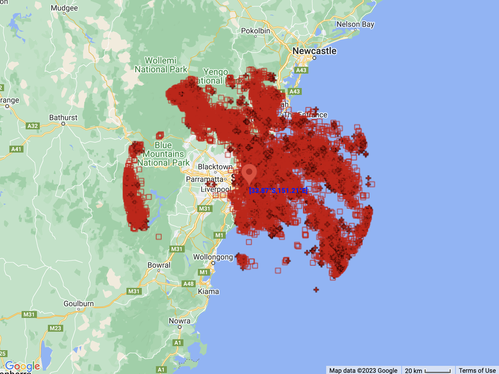
Total Lightning Network detected just over 22,000 lightning strikes within 100 km of Sydney during the 12 hours ending at 3:00am on Wednesday.
Waterspouts. lightning strikes hit Sydney region

Image: The locations of 22,162 lightning strikes detected within 100 km of Sydney between 3:00pm on Tuesday and 3:00am on Wednesday.

While most of the rain has now cleared from Sydney, heavy rain and potentially severe storms have moved north and will continue about the Lower Hunter district on Wednesday. Cessnock Airport had already received 63.6 mm between 4:00am and 9:00am, its highest daily total in February for 14 years.

Check the latest warnings for the most up-to-date information on today’s thunderstorms. To find out more about what DTN APAC can do for you, please email us at apac.sales@dtn.com.


Latest news

Satisfy your weather obsession with these news headlines from around the nation, and the world.

Habagat and successive typhoons trigger widespread flooding in the Philippines

Three consecutive weeks of enhanced southwest monsoon (Habagat) and back-to-back typhoons have flooded Luzon and the Visayas, grounding flights, triggering distribution power outages, cutting off transport corridors, and raising landslide risk across mining-dense provinces like Benguet and the Cordillera. The disruption is far from over with PAGASA expecting the monsoon to remain in place until […]

Australia’s Spring 2026 Bushfire Outlook: Increased Risk Across Seven States and Territories

Fire agencies, land managers and businesses are being urged to prepare as the AFAC spring seasonal bushfire outlook, released on August 19, 2026, warns of elevated bushfire risk across Australia this season. The outlook identifies above-average fire danger across seven states and territories, with conditions driven by a combination of elevated fuel loads, an El Niño […]

Businesses under pressure: how this powerful high will affect Australian industries

A very strong high pressure system centred over Tasmania will impact southern and eastern Australia’s weather over the coming days. How strong is this high pressure system? Mean Sea Level Pressure (MSLP) has already reached 1039.3 hPa at Ouse, Tasmania on Sunday morning, and is forecast to peak at 1041 or 1042 hPa on Monday […]

Northwest Cloudband looms despite sunny and dry outlook

A thick cloudband will stretch thousands of kilometres next week from the warm tropical waters off northwest Australia to southeastern Australia, bringing rain and low solar output despite a sunny, dry seasonal outlook.   The cloudy week may come as a surprise given the warm, dry, and sunny climate drivers currently in play – a very strong El Niño and a […]

