Prosper in a dynamic world
Search

Canberra breaks October rainfall record

We’ve seen no shortage of places across the eastern half of Australia break their rainfall record this soggy October, and the nation’s capital is the latest.

  • Weather records have been kept in Canberra since 1939, and the old record for the wettest October was 161 mm in 1976.
  • To 9 am on Thursday morning, the monthly tally for October 2022 was sitting on 160 mm, but a heavy burst of rain during the early afternoon delivered 3.4 mm by 3 pm.
  • That brought the monthly tally for October to a record 163.4 mm.
  • For the record, Canberra’s rainfall tends to be reasonably evenly distributed throughout the year, but October is on average the city’s second-wettest month with an average of 62.4 mm. So it is heading towards triple its monthly average.
  • It’s also worth mentioning that Canberra’s rainfall to date for 2022 was 739 mm as at 9 am this morning, which means it is now sitting on 742.4 mm as we write this story on Thursday afternoon.
  • The long-term annual average rainfall is 615.4 mm, so Canberra is again looking at a much wetter year than usual. The wettest year on record was 1950 with 1062.5 mm.

Meanwhile, after such a wet year to date, and with significantly above-average monthly rainfall in both August and September, it’s little wonder that the lawns of the bush capital and its nearby hills are looking especially green right now.

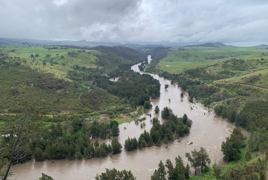
Image: The Murrumbidgee River just west of Canberra from Shepherds Lookout. Source: Patrick Tobin.

The local wildlife has also been snapped looking somewhat miserable during heavier downpours!

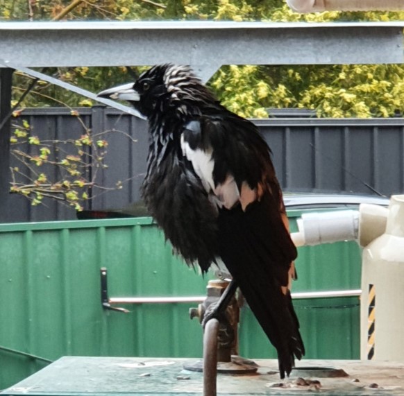
Image: Maggie here is not the only Canberran who is sick of getting wet. Source: Maria Del’Amore.

More rain is in store for Canberra this month, with showers likely on each day of the remainder of October except for Saturday.

To find out more about Weatherzone’s weather and climate products, please email apac.sales@dtn.com.

Latest news

Satisfy your weather obsession with these news headlines from around the nation, and the world.

El Niño Is Here: What a Potential Record Event Means for Southeast Asia and Australia

  El Niño was officially declared in June 2026, raising the prospect of widespread impacts across Southeast Asia, from extreme heat and water shortages to higher energy demand and agricultural stress.   The World Meteorological Organization has warned countries to “prepare for it to be severe”, while several global forecast models suggest the event could rank among […]

How El Niño will shape Australian port operations in winter-spring 2026

Australian ports and marine pilots can expect a season of shifting wind and swell patterns through winter and spring 2026, as a developing El Niño brings the likelihood of drier conditions and more variable operating windows across the country’s coastline.  Will El Niño develop in 2026?  There are clear signs that an El Niño pattern is becoming […]

From Kimberley to northern NSW: Bushfire outlook flags risk for resources sector this winter

Bushfire risk doesn’t usually make headlines in June, but AFAC’s winter seasonal outlook is putting mining and resources operators on alert from the Kimberley to the NSW.  Australia’s official seasonal bushfire outlook for winter 2026 was released by AFAC on Thursday, May 28. The outlook predicts increased fire risk across the northern parts of the Great Sandy Desert and surrounds […]

The signal was there weeks earlier: forecasting one of the year’s biggest wind events

In mid-May 2026, DTN APAC meteorologists flagged a strengthening Southern Ocean pattern in model guidance, signalling an extended run of record-challenging wind conditions across the NEM.  Nearly three weeks later, NEM wind generation climbed from around 1.5GW to more than 9GW, supplying roughly one-third of the grid and coming within 1GW of the all-time generation record.  The event highlighted […]