Prosper in a dynamic world
Search

Tropical Cyclone names this season


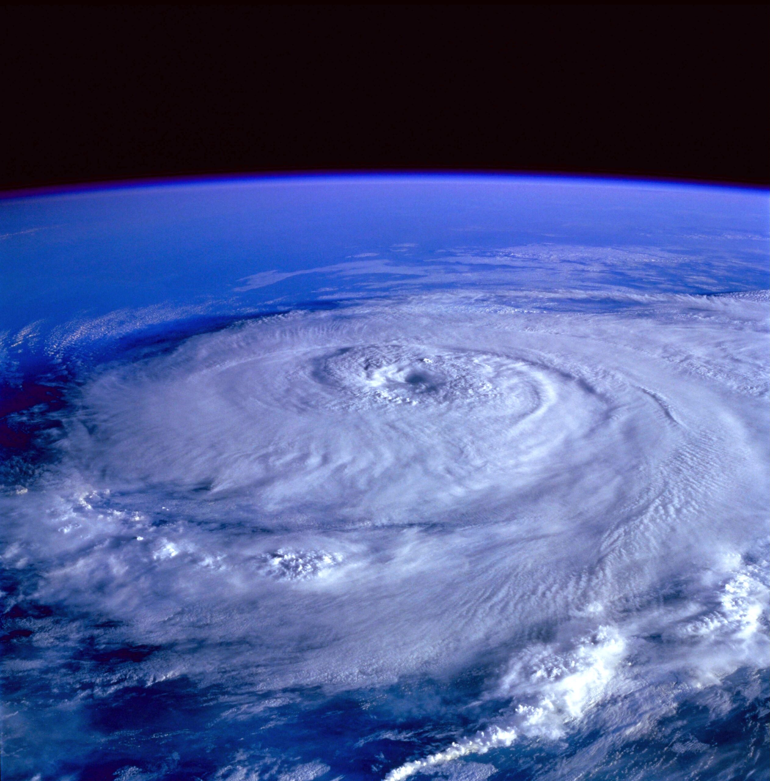
Australia’s 2021/22 tropical cyclone season starts in just under two weeks. So, how many tropical cyclones will we see this season and what will they be called?

The Australian tropical cyclone season officially runs from November 1st to April 30th. During this six-month period, we usually see around 9 to 11 tropical cyclones in Australia’s area of responsibility and about four of these make landfall.

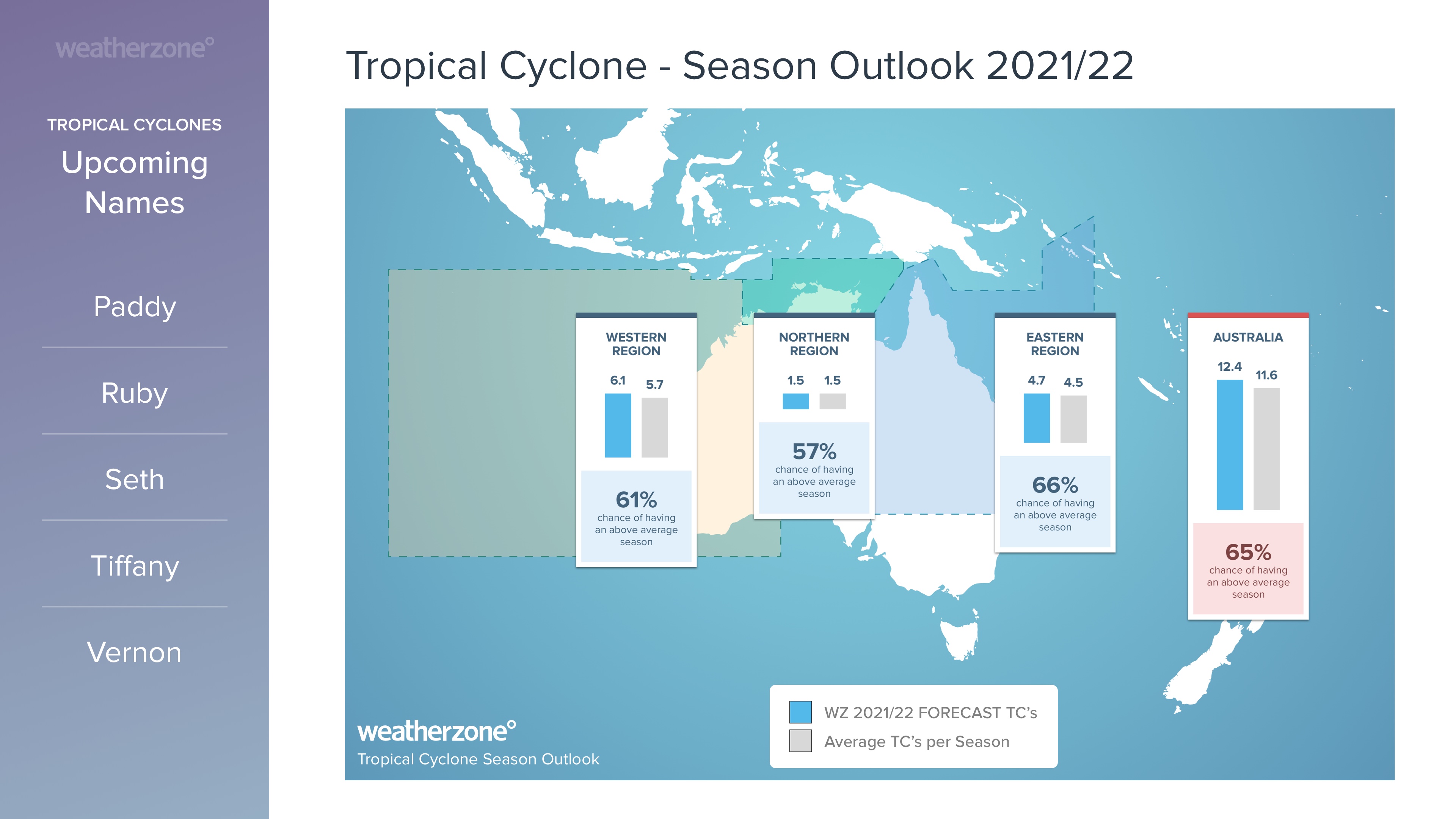
This season, the Australian region is expected to be a bit more active than usual thanks to a developing La Niña in the Pacific Ocean and warmer-than-average sea surface temperatures near Australia.

Weatherzone’s internal model predicts that we will see about 12-13 tropical cyclones in our region between November and April.

The first tropical cyclone of the season usually develops around early-to-mid December, however, the abnormally warm waters near northern Australia could cause it to happen earlier this year.

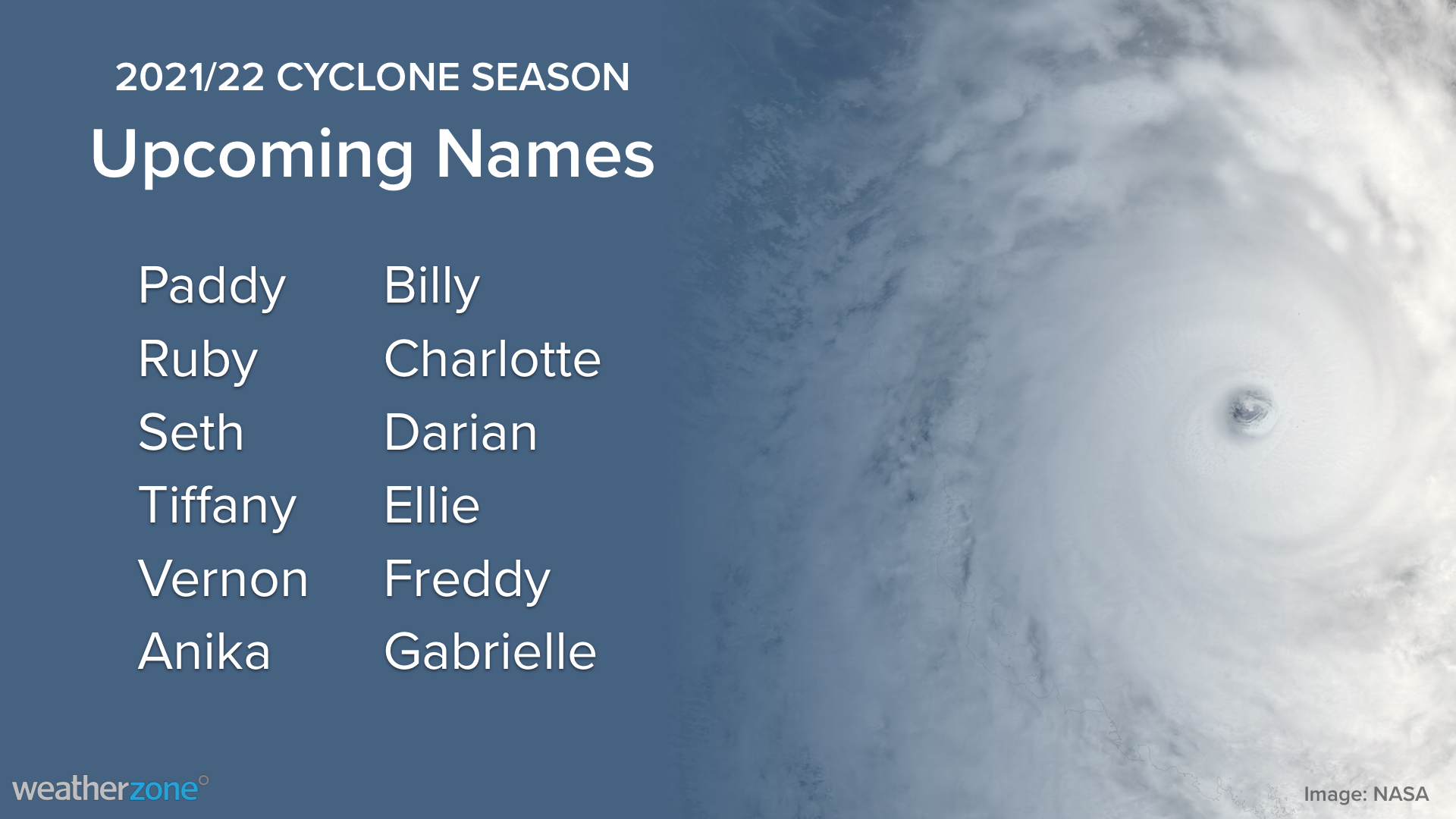
Regardless of the date it develops, the first tropical cyclone to form in Australia’s area of responsibility will be named Paddy, followed by Ruby and Seth.

Tropical cyclones that develop inside Australia’s area of responsibility are assigned names from a predetermined list that is maintained by the Bureau of Meteorology.

You can even request to have you name included on the list for an upcoming cyclone. All you have to do is submit a written request to the Bureau of Meteorology. But even if your request does get accepted, don’t expect to see it used any time soon. There are already enough names to last at least another decade.

For more information on Weatherzone’s tropical cyclone detailed 7 day forecast and risk assessment, please contact us at apac.sales@dtn.com.

Latest news

Satisfy your weather obsession with these news headlines from around the nation, and the world.

Tropical lows, heavy rainfall and earthquakes impacting Indonesia and the South Pacific

Tropical lows, monsoonal winds, heavy rainfall and earthquakes are affecting areas around Australia, bringing weather much more typical to the wet season. Tropical Lows 33U and 34U Tropical lows and cyclones can form at any time of year but become much less frequent over the Australian region during the Southern Hemisphere winter. This is due […]

Northern Australia’s 2024-25 wet season wrap up

Northern Australia’s 2024-25 wet season featured the busiest cyclone season in 19 years, latest monsoon onset on record and intense thunderstorm outbreaks. The northern Australia (north of 26°S) average wet season rainfall in 2024-25 was 21% above the 1961-1990 average. As seen in the rainfall deciles map below, this above average rainfall was driven by […]

Record dry start to year for South Australia, Victoria and Tasmania

Parts of South Australia, Victoria and Tasmania just endured their driest start to a year on record as a lack of early autumn rain worsened drought conditions in parts of all three states. High pressure systems have been dominating the weather patterns near southern Australia in recent months. These stubborn areas of high pressure, which […]

NEM’s highest solar generation ever

The National Energy Market (NEM) recorded its highest solar energy generation over the past summer as high pressure dominated southeastern Australia. Australia’s NEM has continued to implement more and more renewable energy sources into its network. Combined with favourable weather, both the summer of 2024-25 and the last quarter (January to March 2025) saw record […]