
A barrage of dangerous thunderstorms will strike southeast Qld on Thursday afternoon and evening, with large hail, damaging winds and heavy rain all likely.
October has been a very dry month so far across southeast Qld, with Brisbane only receiving 3.6 mm of rain since the start of the month, and even less falling around Gympie and Bundaberg.
This lack of mid-spring rainfall has occurred alongside a quiet start to the region’s thunderstorm season, which typically ramps up in spring and peaks over summer.
Despite this slow start to the storm season, a flurry of severe thunderstorms is about to hit southeast Qld.
The combination of an upper-level trough, warm and humid air near the surface, and a low-level south-to-southeasterly wind change will create an ideal environment for thunderstorm development in southeast Qld on Thursday afternoon and evening.
Thursday’s storms will most likely develop from the Sunshine Coast region up to the Central Highlands and Coalfields District. Any storms that form over southeast or central Qld on Thursday could produce damaging winds, large hail and heavy rain that could cause flash flooding.
Storms are less likely in and south of the Brisbane CBD on Thursday, although anyone living in southeast Qld should keep a close eye on the warnings throughout the afternoon and evening to track dangerous storm cells as they develop.
Some storms are likely to continue into the night before they clear offshore on Friday morning.
Rain in NSW
The same upper-level trough that’s about to generate thunderstorms in Qld will also cause welcome rain in parts of NSW.
The satellite images below show thick cloud covering the northern half of the NSW coast and ranges on Thursday morning.
.gif)
This cloud will cause rain to increase across central and northeast NSW on Thursday and continue into Friday, before easing by Saturday.
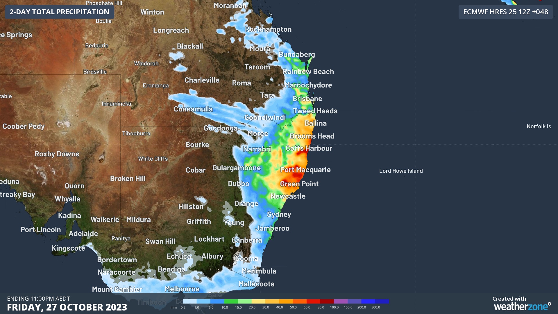
Image: Forecast accumulated rain on Thursday and Friday, according to the ECMWF-HRES model.
The heaviest rain from this system will fall north of the Hunter, with parts of the Mid North Coast and Northern Rivers Districts expected to pick up around 30 to 60 mm in 48 hours. This rain will help extinguish or reduce some of the fires currently burning in eastern NSW.
Stormtracker is our Global Information System (GIS) tracking tool, providing multiple weather layers and zoom controls overlaid on a map of your location and infrastructure. You can choose a snapshot or full screen view, depending on your requirements. The maps allow you to monitor all weather, and specifically any systems likely to cause risk for your business. You also have the capacity to observe:
- real time lightning and thunderstorm alerts
- localised lightning strike frequency
- official warnings for storm, cyclone, wind, flood and fire
- sentinel hotspot fires and fire agency current incidents
Stormtracker’s radar imagery updates every 10 minutes, so you are always able to respond rapidly to changing conditions. You can customise alerting to notify you when your staff or infrastructure are under threat. With increased situational awareness, your ability to make informed decisions quickly is optimised.
DTN APAC’ experience and intelligence gives you a clear path through complex situations. Let us assist you, offering actionable insight when extreme weather poses risk to your business. For more information please contact us at apac.sales@dtn.com.


