Prosper in a dynamic world
Search

Could Australia hit 50C this week?


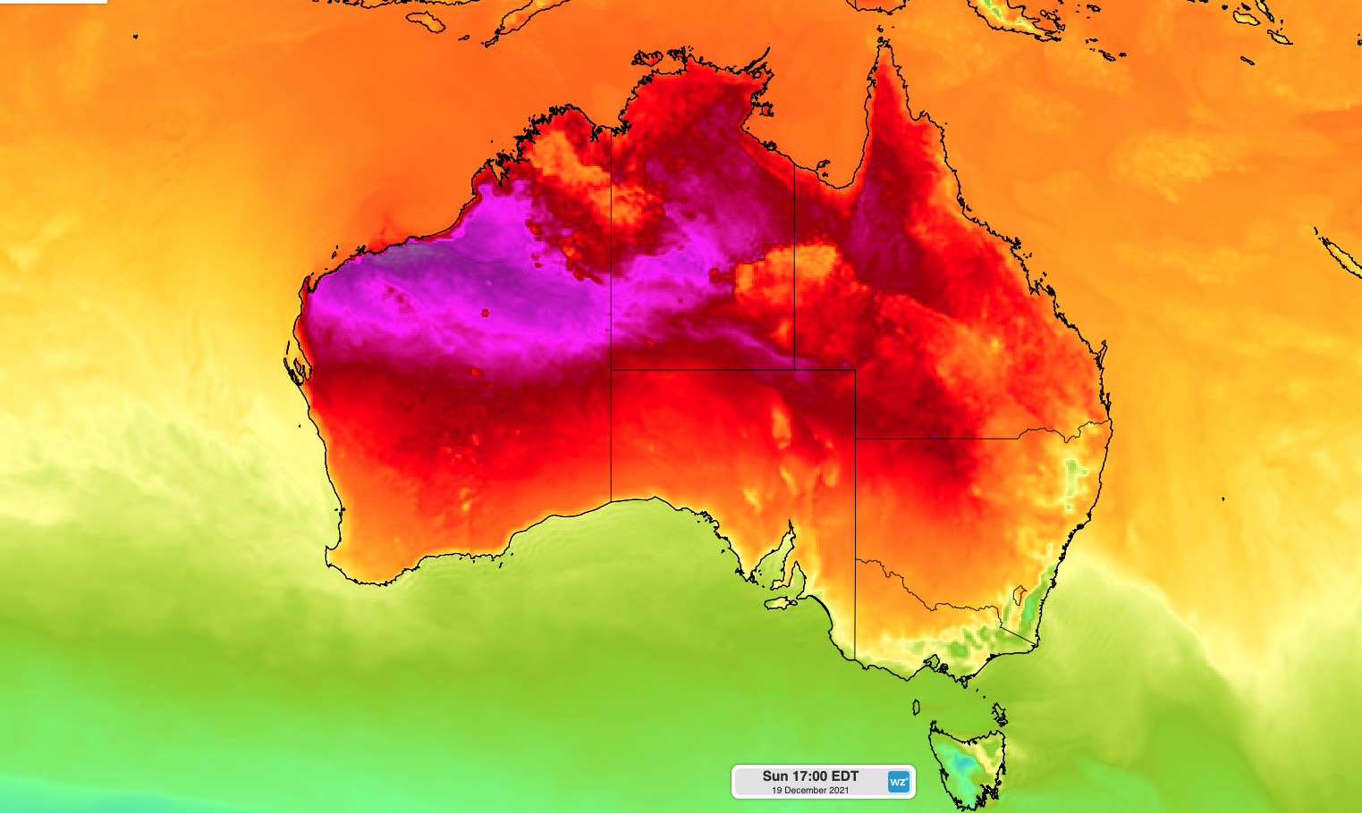
However, once the hot air spreads to low-lying regions in norhwestern Australia later this week, temperatures could approach 50ºC.

The image below shows predicted surface air temperatures from the ECMWF-HRES model on Saturday and Sunday. Both days of the weekend have the potential to see temperatures of around 50ºC somewhere in the north of WA.

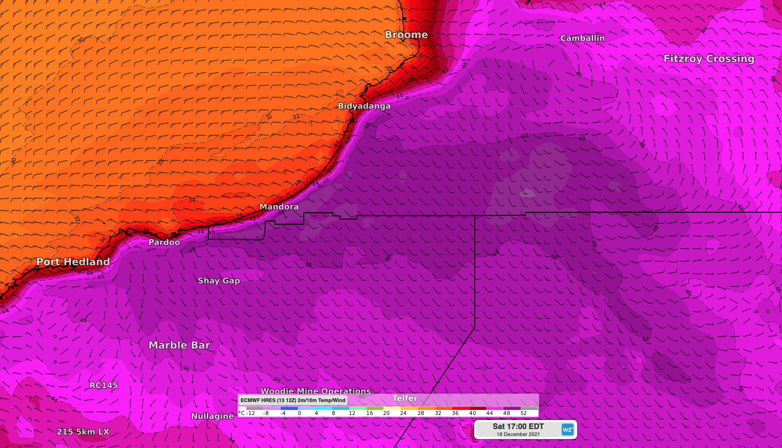
Image: Forecast surface air temperature and wind at 2pm AWST on Saturday, December 18, according to the ECMWF-HRES model.

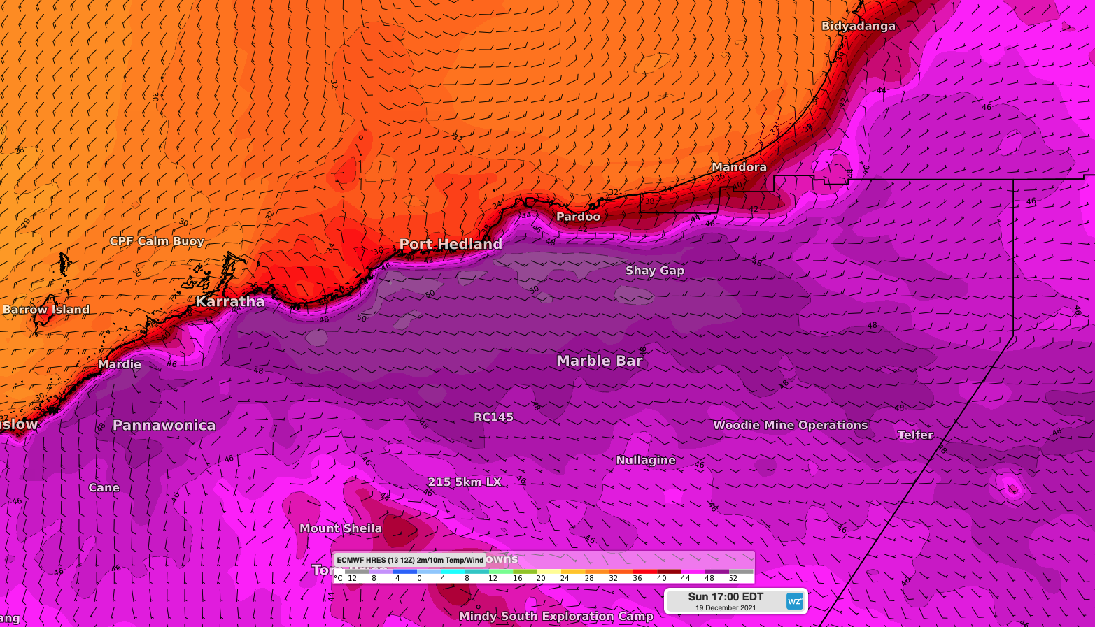
Image: Forecast surface air temperature and wind at 2pm AWST on Sunday, December 19, according to the ECMWF-HRES model.

While 50ºC is a chance in the north of WA this weekend, it’s unlikely that this type of heat will occur at one of the state’s official weather stations in the region.

Port Hedland may be too close to the coast for 50ºC and is currently forecast to reach 47ºC on Sunday. However, it could exceed this forecast if the sea breeze is delayed enough and may challenge the site’s December record of 47.9ºC from 1954.

Australia’s highest officially-recorded temperature in December was 49.9ºC at Nullarbor in SA in 2019. Weatherzone provides detailed 14-day temperature forecasts, confidence intervals and extreme temperature forecasting, for more information, please contact us at apac.sales@dtn.com.

Latest news

Satisfy your weather obsession with these news headlines from around the nation, and the world.

Perth sets rainfall streak not seen in 18 years as water storage levels fall

For four months in a row, Perth has exceeded its average monthly rainfall – the first time this has happened in the traditionally wet winter and spring period since 2007. Perth reached its September average of 79.3mm during light showers on Tuesday and Wednesday. Another 13.2mm of rain then fell in the 24 hours to […]

DTN remote sensing captures rain and thunderstorms lashing Solomon Islands

Aviation, mining and shipping industries in the Solomon Islands and other South Pacific nations are often unable to use traditional radar to warn of incoming storms that disrupt operations and put workers in harm’s way. DTN APAC offers a suite of remote sensing weather solutions that give businesses and industries in remote areas around the […]

Negative Indian Ocean Dipole officially underway – here’s what it means for Australian businesses and industries

A negative Indian Ocean Dipole (IOD) event is now underway, increasing the likelihood of above average rain over large parts of Australia in the coming months. What is the Indian Ocean Dipole (IOD)? The IOD is an index used to monitor sea surface temperatures across the tropical Indian Ocean. It’s an important index for the […]

La Niña more likely this year after BoM switches to new index – what does this mean for Australian businesses?

The likelihood of La Niña occurring in 2025 has increased due to a change in the way the Bureau of Meteorology calculates sea surface temperature anomalies in the tropical Pacific Ocean. What is La Niña? La Niña refers to a distinct pattern of sea surface temperatures across the tropical Pacific Ocean. When La Niña is […]