Prosper in a dynamic world
Search

Australia’s first tropical cyclone of the season


Tropical Cyclone Paddy has just developed near Christmas Island, becoming the first named cyclone in Australia’s 2021/22 tropical cyclone season. 

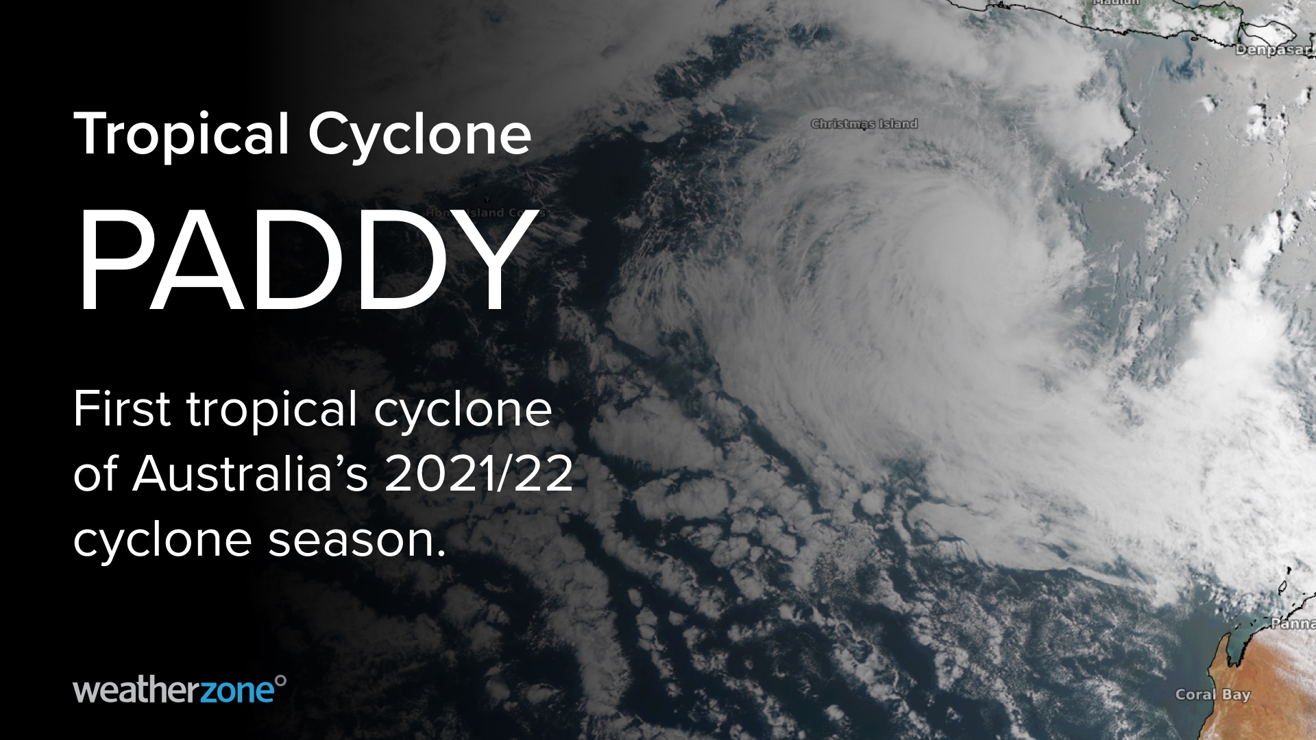
 An unassuming low pressure system that had been spinning away near Christmas Island over the weekend quickly gained strength on Monday morning.  By 11am AWST, the system had become a tropical cyclone located around 390 km to the southeast of Christmas Island and close to 1200 km north northwest of Exmouth in WA. 

  MicrosoftTeams-image (117)

Image: Satellite image of Tropical Cyclone Paddy on Monday morning. 

 The tropical cyclone was named Paddy, becoming the first tropical cyclone to develop inside the Australian region since the 2021/22 tropical cyclone season started at the beginning of November. 

 Paddy’s life as a tropical cyclone will be short-lived. The system is expected to move south during the next 24 hours, before turning west and then weakening as it moves out into the Indian Ocean, away from Australia. 

 This season is likely to see a near to slightly above average number of tropical cyclones in the Australian region due to La Niña and warmer-than-average sea surface temperatures near northern Australia. 

 The next tropical cyclone to develop in Australia’s area of responsibility will be named Ruby. Weatherzone provide our clients with detailed 7-day tropical cyclone forecasts, consultancy and risk analysis, for more information, please contact us at apac.sales@dtn.com. 

Latest news

Satisfy your weather obsession with these news headlines from around the nation, and the world.

Perth sets rainfall streak not seen in 18 years as water storage levels fall

For four months in a row, Perth has exceeded its average monthly rainfall – the first time this has happened in the traditionally wet winter and spring period since 2007. Perth reached its September average of 79.3mm during light showers on Tuesday and Wednesday. Another 13.2mm of rain then fell in the 24 hours to […]

DTN remote sensing captures rain and thunderstorms lashing Solomon Islands

Aviation, mining and shipping industries in the Solomon Islands and other South Pacific nations are often unable to use traditional radar to warn of incoming storms that disrupt operations and put workers in harm’s way. DTN APAC offers a suite of remote sensing weather solutions that give businesses and industries in remote areas around the […]

Negative Indian Ocean Dipole officially underway – here’s what it means for Australian businesses and industries

A negative Indian Ocean Dipole (IOD) event is now underway, increasing the likelihood of above average rain over large parts of Australia in the coming months. What is the Indian Ocean Dipole (IOD)? The IOD is an index used to monitor sea surface temperatures across the tropical Indian Ocean. It’s an important index for the […]

La Niña more likely this year after BoM switches to new index – what does this mean for Australian businesses?

The likelihood of La Niña occurring in 2025 has increased due to a change in the way the Bureau of Meteorology calculates sea surface temperature anomalies in the tropical Pacific Ocean. What is La Niña? La Niña refers to a distinct pattern of sea surface temperatures across the tropical Pacific Ocean. When La Niña is […]