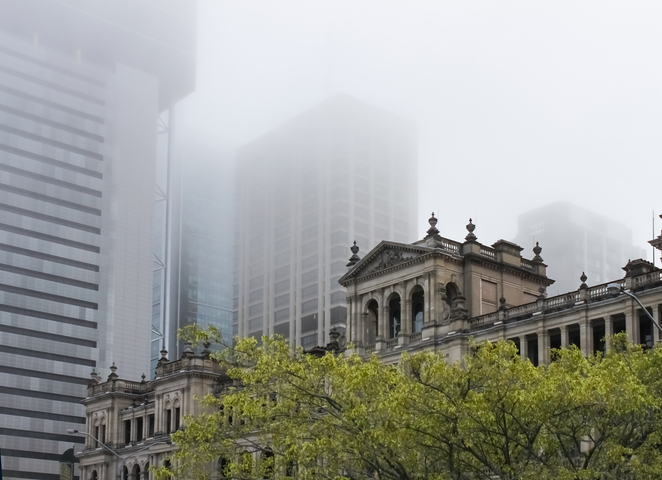
A thick fog developed over southeast Queensland last night, with visibility reduced to less than 200 m at Brisbane Airport early this morning.
A combination of light winds and plentiful atmospheric moisture created ideal conditions for fog to develop across a broad area of southeast Qld on Tuesday night.
As the sun rose on Wednesday, fog could be seen stretching from Brisbane to Warwick and there were also patches visible across the Darling Downs and into the NSW North West Slopes and Plains.
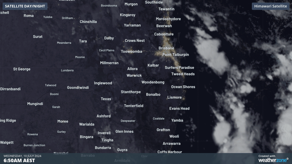
Video: Visible satellite images showing fog and cloud over southeast Qld and northeast NSW on Wednesday morning. The fog appears as near-stationary areas of white, while the clouds are the faster-moving white areas.
Wednesday morning’s fog reduced visibility to about 190 m at Brisbane Airport shortly before 6am local time. Visibility was even lower further west, dipping below 130 m at Archerfield and getting to 110 m at Amberley in the early hours of Wednesday morning.
The thick fog prompted a road weather alert from the Bureau of Meteorology, due to reduced visibility making road conditions more dangerous than usual. The fog also slowed ground movement at Brisbane Airport and caused delays to some flights.
???? PSA: Widespread fog across Brisbane is also impacting BNE.
Find out more about fog at the airport ???? https://t.co/2v1u7WBjid pic.twitter.com/jJ3x7hJCq6
— Brisbane Airport ?? (@BrisbaneAirport) July 9, 2024
Wednesday’s fog may linger until around lunch time in parts of Qld and NSW, although most of it will clear up as temperatures climb during the morning.
Fog is likely to return to parts of eastern Australia on Thursday and Friday mornings.
Weatherzone forecasts fog risk, density, onset and clearance times out to seven days, which enables efficiency and safety. Weatherzone has developed a traffic light system for port and marine clients, with green having no impact on operations, yellow a moderate impact and red having a high impact.
We can alert fog down to the hour, giving an indication of its potential density, and we fine tune our models dependent on the individual port requirements and local topography. Weatherzone’s traffic light system enables ports to make decisions and plan well in advance.
Fog density alerts can also be set up, which go off up to 36 hours in advance. Of course, Opticast has many other weather solutions for ports, including alerts of thunderstorms and wind gusts. All the thresholds can be adapted to your individual port.
To find out more, please visit our contact page or email us at apac.sales@dtn.com.


