
The balmy NSW weather will end abruptly on Tuesday as another low-pressure system brings another bout of fierce winds, thunderstorms, rain and cooler temperatures to the state.
The image below shows the remnants of the low-pressure system and cloud mass in the central Tasman Sea which caused the heavy rainfall and flooding event in NSW and Qld late last week. Meanwhile there are clear skies ahead of a strong cold front sweeping across the Bight approaching Vic and SA on Monday morning, April 8.
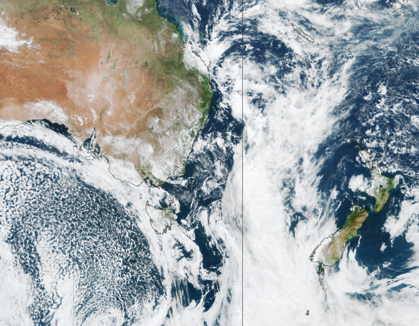
Image: Himawari-9 satellite image at 11:18am on Monday morning, April 8.
The mostly clear skies across NSW today will see temperatures hitting the mid to high 20’s ahead of this cold front.
This brief period of barmy weather will end on Tuesday as a southerly change makes its way up the NSW coast in the early hours of Tuesday morning, reaching Sydney during the middle of the day.
The southerly winds will be fierce, adding to the wind chill as the temperature drops behind the change. While the showers and thunderstorms associated with the change are also likely to be gusty, they should remain below severe severity.
On Tuesday morning, a low-pressure system will develop off the NSW coast, which will strengthen winds across the coastal strip in NSW later Tuesday into Wednesday.
The image below shows one models wind gust forecast for the early hours of Wednesday morning, with gale force winds off the NSW central coast.
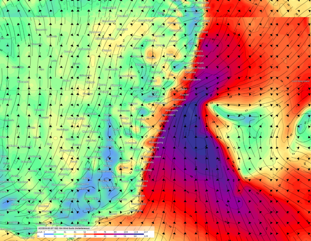
Image: Instantaneous wind gust forecast at 4am on Wednesday, April 10, according to Access-G.
The strongest winds should impact exposed areas along the Sydney Metro, Hunter and lower Mid-North Coast coastlines on Tuesday night and Wednesday.
The strong southerly winds will also whip up some large swell across the central and northern NSW coast between Tuesday afternoon and Thursday.
The image below shows that wave heights are forecast to reach 5-7 metres off the central NSW coast in the early hours of Wednesday morning.
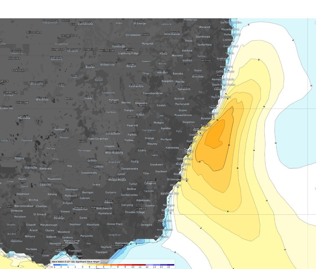
Image: Significant wave height at 4am on Wednesday, April 10, according to WaveWatch III
The large waves will move up to the northern half of the NSW coast later Wednesday before easing on Thursday. The winds will also ease from Thursday as the low moves further east into the Tasman Sea away from eastern Australia.
DTN APAC offers a comprehensive suite of services, refined through years of collaboration with the marine, ports and offshore industries, to optimise the safety and efficiency of your operations.
We work with you to understand your intrinsic operational challenges and customise high-precision forecasting, metocean and aviation services to your exact location and operational scope.
When working offshore, our solutions can underpin planning and safe execution for offshore oil and gas enterprises and wind farms. Our data can support your exploration, development, rig moving, shuttle tanker operations, and production and decommissioning phases. Whether your crews are on-site, being transported to shore, or diving to perform maintenance, we deliver tailored weather risk briefings to ensure you choose the optimal time to proceed.
Weatherzone’s trusted nowcasting and forecasting system, OpticastTM, allows you to rapidly respond to changing conditions offshore, en route and in port. We take your port topography and berth orientation into account, ensuring site-specific forecasts. For offshore oil & gas, wind farms, ports and logistics, we have your weather situational awareness covered, no matter where you are. We deliver real-time severe weather and lightning alerts to your team via your integrated dashboard: Portzone, and our Weatherguard app.
Weatherzone’s Total Lightning Network (TLN) ensures you avoid hours of unnecessary downtime by providing the most accurate technology in lightning detection and alerting. Safeguard your teams and assets with lighting and Dangerous Thunderstorm Alerts (DTAs), customised to your existing parameters and delivered in real-time across all devices in your network. You gain full spatial awareness of developing severe weather systems, allowing you to plan ahead and, where needed, execute your shutdown and evacuation procedures.
With extreme conditions slowing production and affecting infrastructure, safety and transport, trust us to deliver Australia’s most precise weather data and tailored insight, giving you decisive confidence when it’s most needed. For more information, please contact us at apac.sales@dtn.com.


