Prosper in a dynamic world
Search

More thunderstorms in eastern NSW today

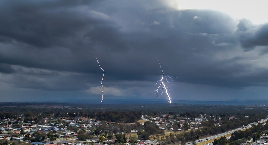
Parts of eastern NSW, including Sydney, will face another day of heavy showers and potentially thunderstorms today.

A broad upper-level low and numerous surface-based low pressure troughs are producing wet and stormy weather over NSW at the start of this week.

On Monday, heavy showers and severe thunderstorms soaked parts of eastern, central and northern NSW, triggering warnings for flash flooding in Sydney and other parts of the state.

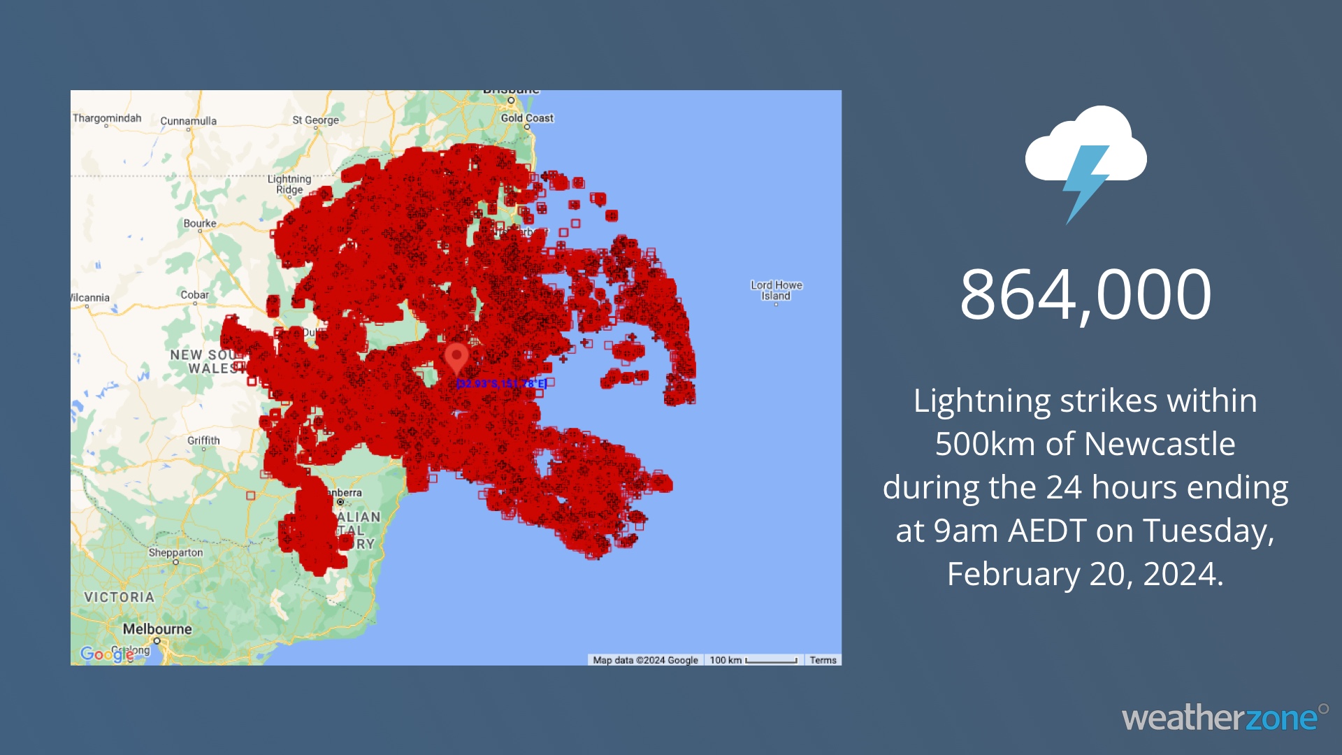
Total Lightning Network detected 864,000 lightning strikes within a 500 km radius of Newcastle between 9am on Monday and 9am on Tuesday. These included strikes over Sydney, and as far north and south as the Vic and Qld borders.

Rainfall totals of around 40 to 80 mm were recorded in the last 24 hours from Sydney up to southeast Qld, with falls of 20 to 40 mm also seen in a few places on the western side of the ranges in northern NSW.

Sydney Airport’s 39 mm in the 24 hours to 9am on Tuesday was its heaviest rain in two months, while Kings Langley and Little Bay both saw more than 50 mm in this period.

While Monday was the peak of this storm outbreak for many areas of NSW, a coastal trough will continue to generate showers and thunderstorms in the state’s east on Tuesday. The most likely areas to see more storms on Tuesday are the central and northern coast and ranges. Some storms could also develop over the southern ranges in NSW and extend across the border into eastern Vic.

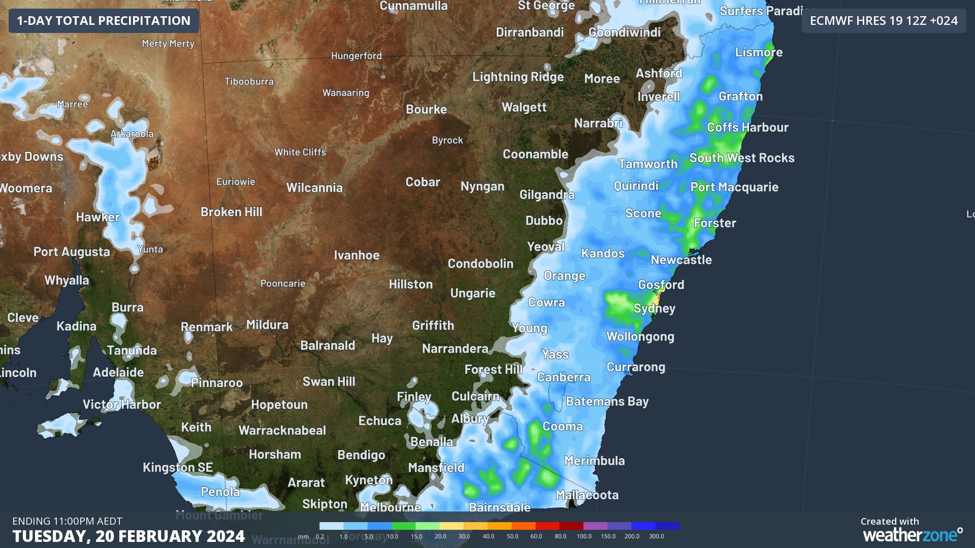
Image: Forecast accumulated rain on Tuesday, February 20, according to the ECMWF-HRES model.

Tuesday’s thunderstorms have an increased risk of heavy rain and flash flooding, due to their slow movement in weak steering winds. If severe storms do form, you can check the latest severe thunderstorm warnings for the most up-to-date information. For more information on our thunderstorm services, please contact us at apac.sales@dtn.com

Latest news

Satisfy your weather obsession with these news headlines from around the nation, and the world.

Tropical cyclone season begins with warm oceans surrounding northern Australia

The 2025-26 tropical cyclone season has begun with abnormally warm oceans surrounding northern Australia, signalling an increased risk for severe tropical cyclones in the coming months. The Australian tropical cyclone season runs from November 1 to April 30. During this six-month period, there are usually about 9 to 10 tropical cyclones in the Australian region, […]

7.8 million lightning pulses detected by DTN’s Total Lightning Network over Australia in one week

A barrage of thunderstorms battered large areas of eastern and northern Australia over the past week, producing close to 8 million lightning pulses across the country and more than 4 million over Queensland alone. DTN’s Total Lightning Network (TLN) detected around 7.79 million lightning pulses above Australia last week. This lightning was observed over every […]

Warmest October on record for Sydney, Brisbane

Sydney and Brisbane just had their warmest October on record, despite a relatively cool end to the month. A surge of cold air caused temperatures to plummet in eastern Australia earlier this week. In Brisbane, the temperature only reached 22.2°C on Tuesday, while Sydney’s maximums remained below 18°C on both Tuesday and Wednesday. These chilly […]

Australia’s 2025-26 tropical cyclone outlook

The Australian region is primed for severe tropical cyclones this season, despite an ongoing trend of reduced tropical cyclone activity over Australian waters in recent decades. Australia’s tropical cyclone season officially runs from the start of November to the end of April. During this six-month period, the Australian region usually sees around 9 to 10 […]