There are early signs that parts of SA, the NT, NSW and Qld could get soaked on the Easter long weekend, as moisture left behind by ex-Tropical Cyclone Megan spreads south.
Tropical Cyclone Megan made landfall over the southwest Gulf of Carpentaria on Monday, March 18. The system then weakened to a tropical low and caused several days of heavy rain and flooding across the NT
While ex-Tropical Cyclone Megan has now lost a lot of its structure, the map below shows that thick cloud was still covering large areas of WA, the NT and Qld on Friday morning in the system’s wake.
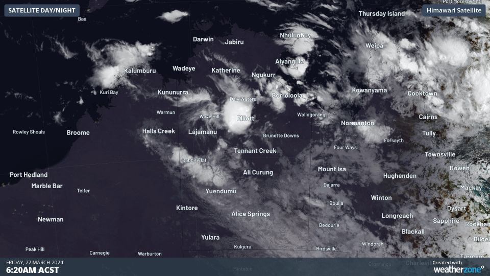
Image: Himawari-9 satellite image for 3 hours leading up to 9:20am ACST on Friday, March 22
The remnants of Tropical Cyclone Megan are continuing to cause heavy rain. Rabbit Flat recording 128mm in the 24 hours leading up to 9am on Friday, March 22.
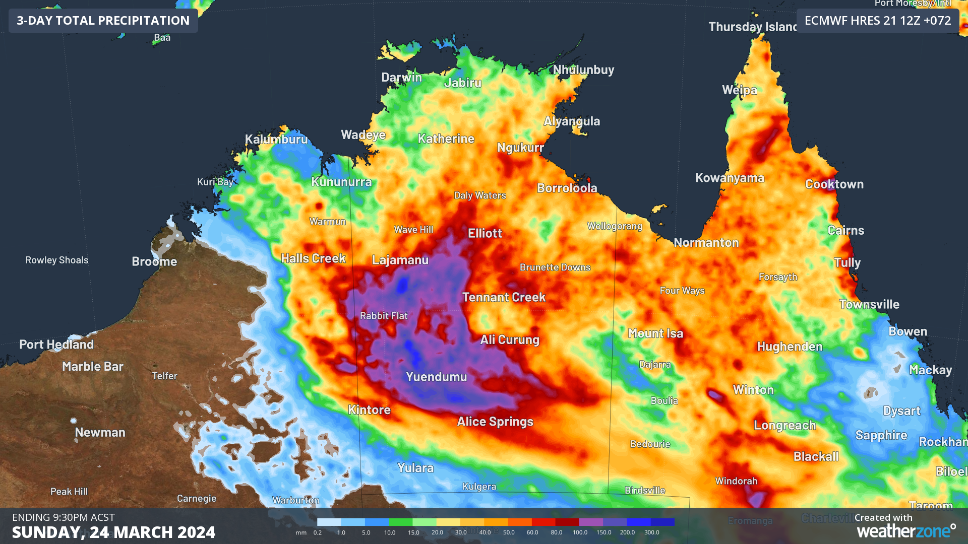
The rainfall is expected to continue through Friday and over this weekend, with some areas in central NT forecast to see another 100-200mm, with some isolated areas exceeding 200mm.

Image: Accumulated forecast rainfall for the 3 days leading up to 9:30pm ACST on Sunday, March 24, according to ECMWF.
The image above shows that rainfall should spread into southern parts of the NT and Qld over the next few days.
Some forecast models suggest that a low pressure trough and low pressure system could allow this tropical moisture to spread even further south next week, possibly bringing heavy rainfall to parts of NSW the ACT and SA.
While Easter is more than a week out, there are some indications that this rainfall could hang around for the long weekend.
Some models suggest that a low pressure trough sweeping across the south of the continent could transport tropical moisture and rainfall as far south as Vic and Tas on easter Sunday or Monday.
There is still a high degree of uncertainty around where and how much rainfall will fall next week, so be sure to check the latest forecasts as they get updated in the leadup to Easter.
Stormtracker is a severe weather solution that can assist you in observing, in real-time, any storm or event that has the potential to impact your business. Stormtracker’s radar imagery updates every 10 minutes, so you are always able to respond rapidly to changing conditions. You can customise alerting to notify you when your staff or infrastructure are under threat. With increased situational awareness, your ability to make informed decisions quickly is optimised. For more information, please contact us at apac.sales@dtn.com.


