Rainfall is set to intensify over the weekend and early next week, with hundreds of millimetres in just three days possible across parts of the central NSW coastline.
The heavy rainfall forecast at the end of this week will follow a prolonged period of rainfall which began on Tuesday, generated by a coastal trough lingering off the NSW coast for days.
Nord’s Wharf Oval in the Hunter Valley recorded 93mm in the 24 hours leading up to 9am Wednesday, May 5. To the west of that station Cooranbong recorded its wettest day in 13 years with 52.4mm falling during the same period.
The satellite image below shows a mass of cloud and rainfall around the central NSW coastline on Wednesday afternoon.
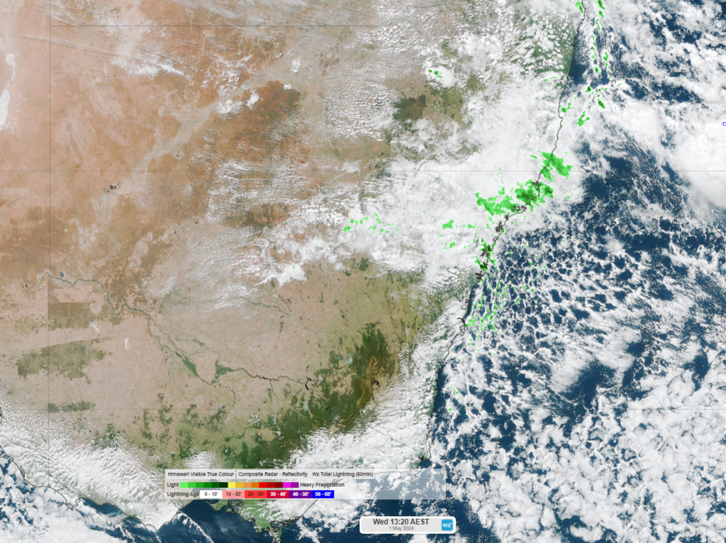
Image: Himawari-9 satellite image at 1:20pm AEST on Wednesday, May 1
While rainfall is expected to fall each day from now until the weekend, the heaviest falls are expected between Saturday and Tuesday as an upper-level low approaches NSW. During this period the central and northern NSW coasts, including Sydney, are forecast to see widespread falls of 60-120mm with isolated falls exceeding 200mm in some areas.
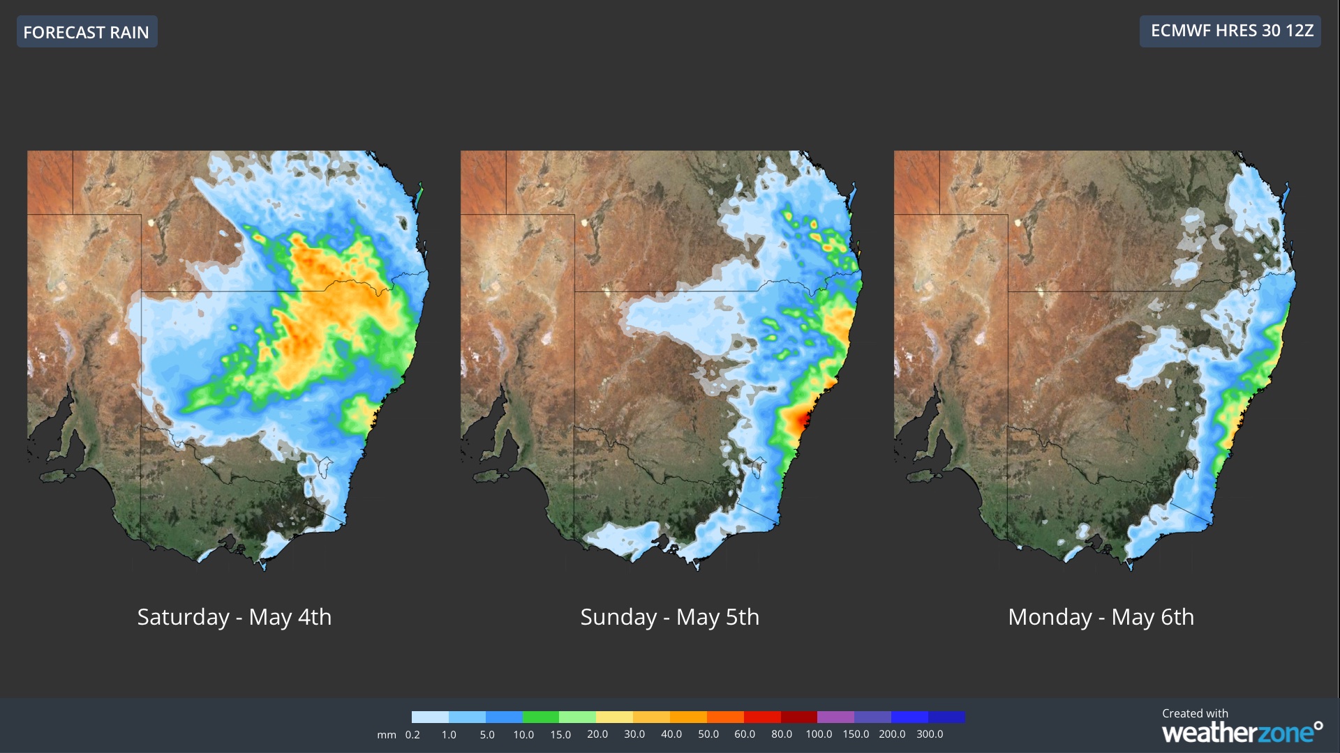
The map below shows one model’s daily rainfall forecast from Saturday, May 4 to Monday, May 6.

You can see that the largest daily totals are expected across central and northeastern NSW and southern Qld on Saturday, including some high totals in NSW’s west.
The rainfall will then focus on eastern NSW and southeastern Qld on Sunday and Monday, with the heaviest falls along the central and northern NSW coastline on Sunday.
This rainfall could cause flooding in NSW and southern Qld during this period, with this rainfall as it falls on a sodden landscape from the wet days preceding it.
Visualise adverse conditions affecting your network with Stormtracker, our powerful GIS mapping system. Multiple weather and alert layers animate over your infrastructure and operating regions. Full-screen mode serves large control room monitors, whilst hyperlocal alerting provides real-time communication of weather and environmental threats. For more information, please contact us at apac.sales@dtn.com.


