Severe thunderstorms are expected to impact Vic on Wednesday, after wild and dangerous thunderstorms lashed Melbourne on Tuesday afternoon, causing havoc at its bustling airport.
The thunderstorms brought torrential rain, damaging winds, and large hail to parts of Victoria on Tuesday as a low-pressure trough moved across the region.
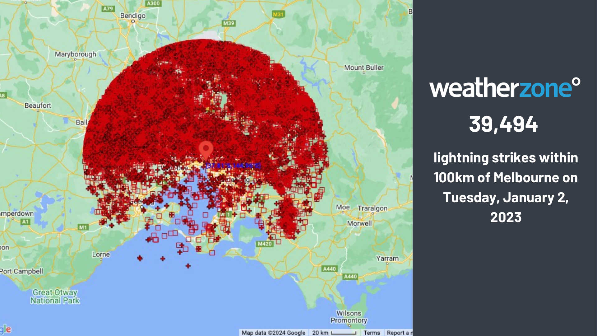
About 40 thousand lightning strikes were recorded within 100km of Melbourne on Tuesday, January 2.

The thunderstorms produced a 103.7 km/h wind gust at Wangaratta, while large hail was reported in Bendigo.
Heavy rainfall also impacted parts of the state with Coldstream recording 25.6mm in the 10 minutes leading up to 4:10pm AEDT. Meanwhile Melbourne airport recorded its most intense rainfall around 3pm, with 10.2mm falling in 10 minutes.
The image below shows the massive line of thunderstorms rolling into Melbourne airport and the flooding they caused in Essendon, Fawkner and Benalla on Tuesday afternoon.
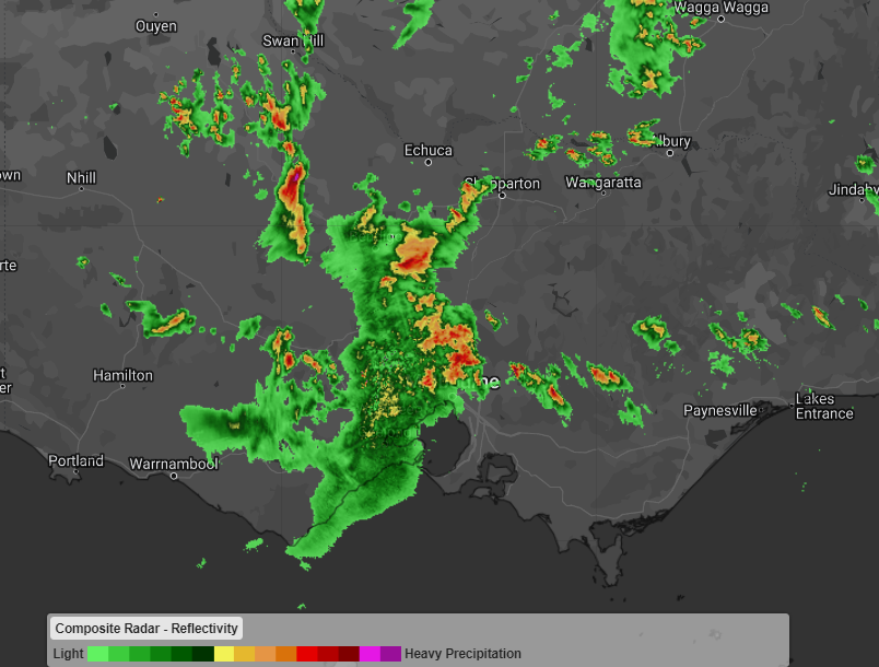
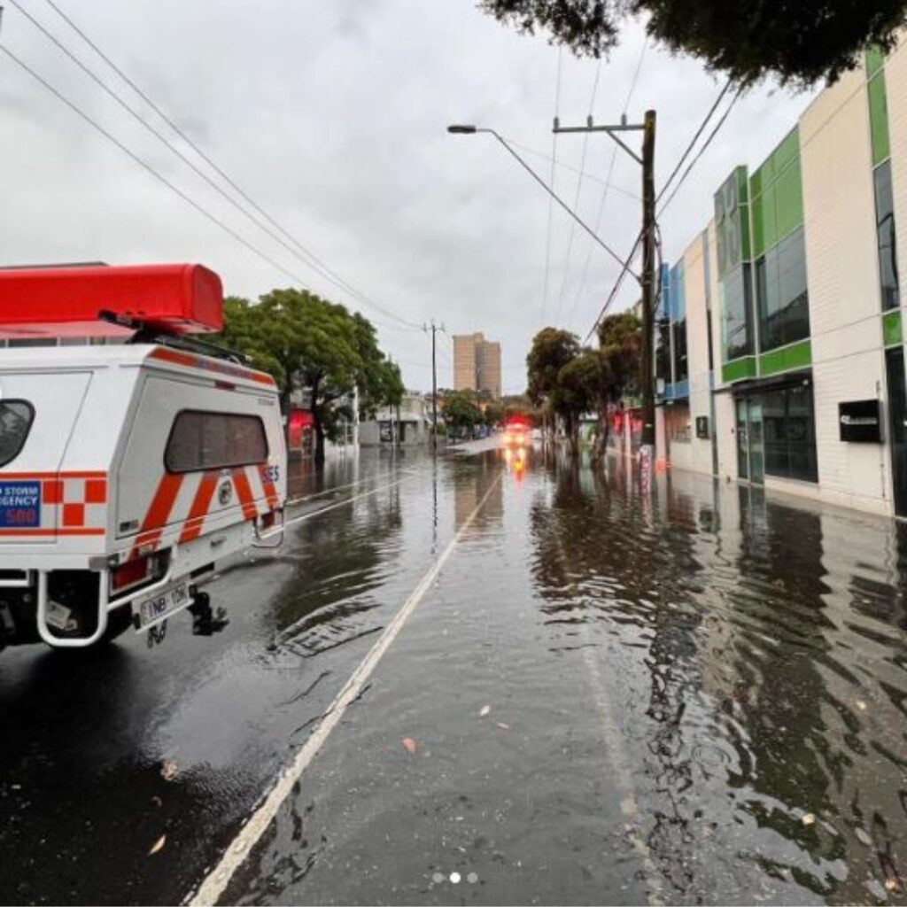
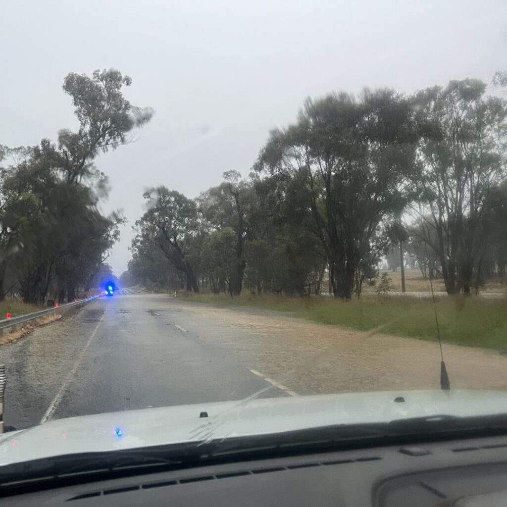
Images: Radar image at 3:40pm AEDT (top) and flooding in Essendon, Fawkner and Benalla (bottom) on Tuesday, January 2, Source: VicEmergency
The heavy rainfall at Melbourne airport meant that passengers could not disembark their flights and baggage handlers could not unload or load baggage.
Ground operations at airports are typically halted when lightning is within 5km of the airport, causing multiple delays and cancellations at the airport on Tuesday afternoon.
The thunderstorms impacted the airport for an hour or so before airport operations resumed around 4:30pm.
The threat of severe weather in Victoria remains, as severe thunderstorms are forecast across much of the state on Wednesday.
Thunderstorms impacted southern parts of Vic on Wednesday morning and are expected across much of the state including Melbourne in the afternoon.
Severe thunderstorms are most likely to form along the eastern ranges and the Gippsland this afternoon and evening, with heavy rainfall likely and damaging winds and hail possible.
Looking ahead, thunderstorms will clear southern Vic on Thursday, however the threat of severe thunderstorms remains in the far northeast of the state.
DTN APAC delivers a proven aviation weather briefing system, developed in collaboration with the industry, to keep your enterprise performing at peak efficiency.
We meticulously tailor actionable weather intelligence to suit the scope of your company’s work, on the ground and in the air. Accurate and comprehensive international data informs your daily decisions on safety, fuel loads and staffing.
Working alongside our global network of partners and suppliers we collate the data to give you full situational awareness of both en route and port specific conditions. Weatherzone is accredited and adheres to standards for aviation meteorology set by the World Meteorological Organisation (WMO) and the International Civil Aviation Organisation (ICAO). Registered with the ICAO and providing safety critical OPTMET data with permission from Air Services Australia, our aviation services meet the industry’s stringent requirements.
This is weather intelligence delivered in an easy to visualise format. No matter what the weather has in store, we give you clear foresight to make informed decisions. For more information, please contact us at apac.sales@dtn.com.


