Prosper in a dynamic world
Search

Total Lightning Network – Keeping Your Business Safe

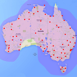
The Weatherzone Total Lightning Network (WZTLN) is Australia’s most advanced solution for maximising the safety of outdoor workers, whilst minimising downtime. Additionally it can be used by the Insurance industry to warn customers of severe weather, so that losses can be reduced through the moving of cars indoors and similar evasive action.

Weatherzone utilises the world leading Earth Network’s technology, which is a superior solution in the detection accuracy for both cloud-to-ground and cloud-to-cloud strikes than any other method.

This ‘total lightning’ aspect of the WZTLN provides the earliest possible alert of impending danger, as cloud to cloud strikes are often the precursor to the more life-threatening cloud to ground variety.

Additionally, researchers have shown that in-cloud lightning often serves as an early indicator of severe weather, from heavy rain to hail to damaging winds.

Therefore the use of a ‘total lightning’ solution can provide the earliest possible guidance on threatening weather through Weatherzone’s Dangerous Thunderstorm Alerts.

Since its launch in late 2014, the WZTLN has been utilised across Australia by various industry sectors, including;

  • Mining
  • Construction
  • Ports and Transport Networks
  • Aviation
  • Electricity Networks
  • Insurance

The benefit of the network is keeping workers safe, whilst maintaining a balance with productivity.

Latest news

Satisfy your weather obsession with these news headlines from around the nation, and the world.

Intense complex low to bring powerful easterly swell to NSW and southeast Queensland ports

Heavy rain, strong winds and powerful waves are on the cards from this weekend for eastern NSW businesses and industries as an intense complex low rapidly intensifies. Rapidly intensifying low pressure system near northeastern NSW An area of low pressure forecast to be off the northern NSW coast on Friday is expected to rapidly intensify […]

The Indian Ocean Dipole plunges into negative IOD territory

The Indian Ocean Dipole (IOD) index has dropped below -0.4°C – the critical threshold for a negative IOD event if sustained. Could Australia see its first negative IOD event since 2022? What is the Indian Ocean Dipole (IOD)? The IOD is a measure of the difference in Sea Surface Temperatures (SST) across the equatorial Indian […]

Cold week ahead for Australia with rain looming for east coast businesses

A cold Southern Ocean air mass will spread across Australia this week, causing a run of wintry days and nights for much of the country before possibly culminating in heavy rain along the east coast. The image below shows a tongue of cold air extending from the Southern Ocean towards southwestern Australia on Monday. This […]

Perth’s wettest day in over a year

Significant rain has fallen across the southwest of WA, with Perth recording 41mm in the 24 hours to 9am Monday, making it the city’s wettest day in just over a year. This latest soaking means that Perth has now exceeded its average monthly rainfall, with 174.2mm in the gauge for July 2025 to date, compared […]