Heavy rain, thunderstorms and flooding could impact parts of northwestern WA during the next 48 hours as moisture-laden air travels towards WA from the Indian Ocean.
The satellite image below shows thick cloud streaming across western WA on Friday morning with rain falling along the coast.
Image: Visible satellite image and radar at 10:20am on Friday, September 2.
This cloud is forming as tropical moisture from the Indian Ocean feeds into a low-pressure system currently sitting off the Gascoyne coast.
This system is expected to bring moderate to heavy rainfall and thunderstorms to parts of the southern Pilbara, Gascoyne Coast and Central West districts on Friday.
Heavy rainfall and thunderstorms will continue and spread further east on Saturday, impacting the Pilbara, Gascoyne and parts of the South Interior, Goldfields, Central West and Central Wheatbelt districts.
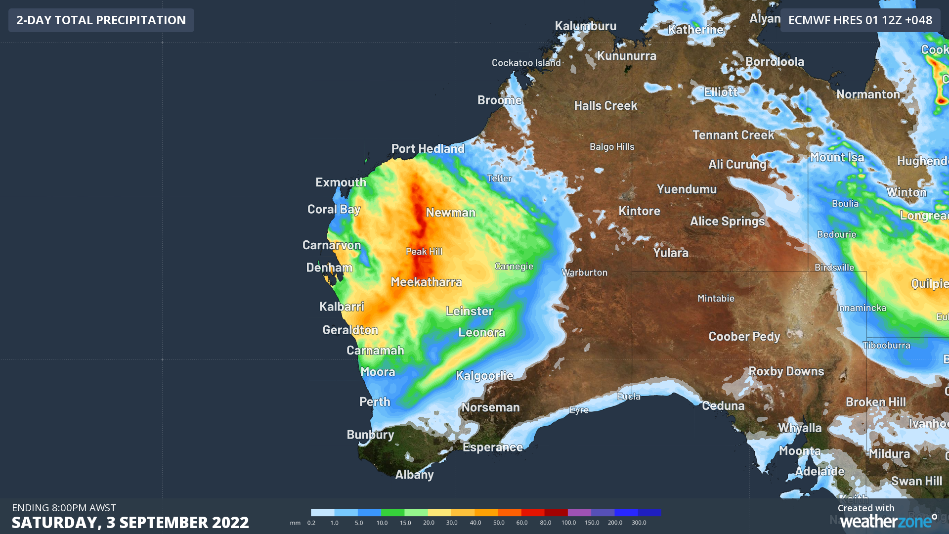
The map below shows the forecast rainfall expected during the next 48 hours.
Image: ECMWF 48 hour forecast rainfall to 10pm Saturday, September 3.
Unfortunately, many catchments in these districts are already wet, which makes river rises and flooding of low-lying areas a heightened risk.
The heavy rainfall and flooding could also cut off roads, highways and may isolate communities in these districts.
Heavy rainfall should ease over the northwest of WA on Sunday as the wet weather moves into the state’s Northern and Southern Interior.
Looking further ahead, another frontal system will deliver another burst of rain across most the state on Monday and Tuesday next week. Fortunately, the falls from this system shouldn’t be too heavy for most areas.
The map below shows one model’s forecast rainfall for the next seven days, with widespread falls of 30-60mm forecast across western WA and isolated pockets of 60-80mm forecast in the Pilbara and Gascoyne regions.
Image: ECMWF weekly rainfall forecast to 8pm, Thursday, September 8.
For more information on Weatherzone’s thunderstorm or heavy rainfall alerting, please contact us at apac.sales@dtn.com.


