Prosper in a dynamic world
Search

Sydney’s wettest summer in 30 years

More than 120mm of rain during the last two days means Sydney is now having its wettest summer in 30 years.

A persistent stream of moisture feeding into a slow-moving low-pressure trough caused 105.2mm of rain to fall in Sydney’s Observatory Hill rain gauge during the 24 hours to 9am on Wednesday. This was the city’s highest rainfall daily total in two years.

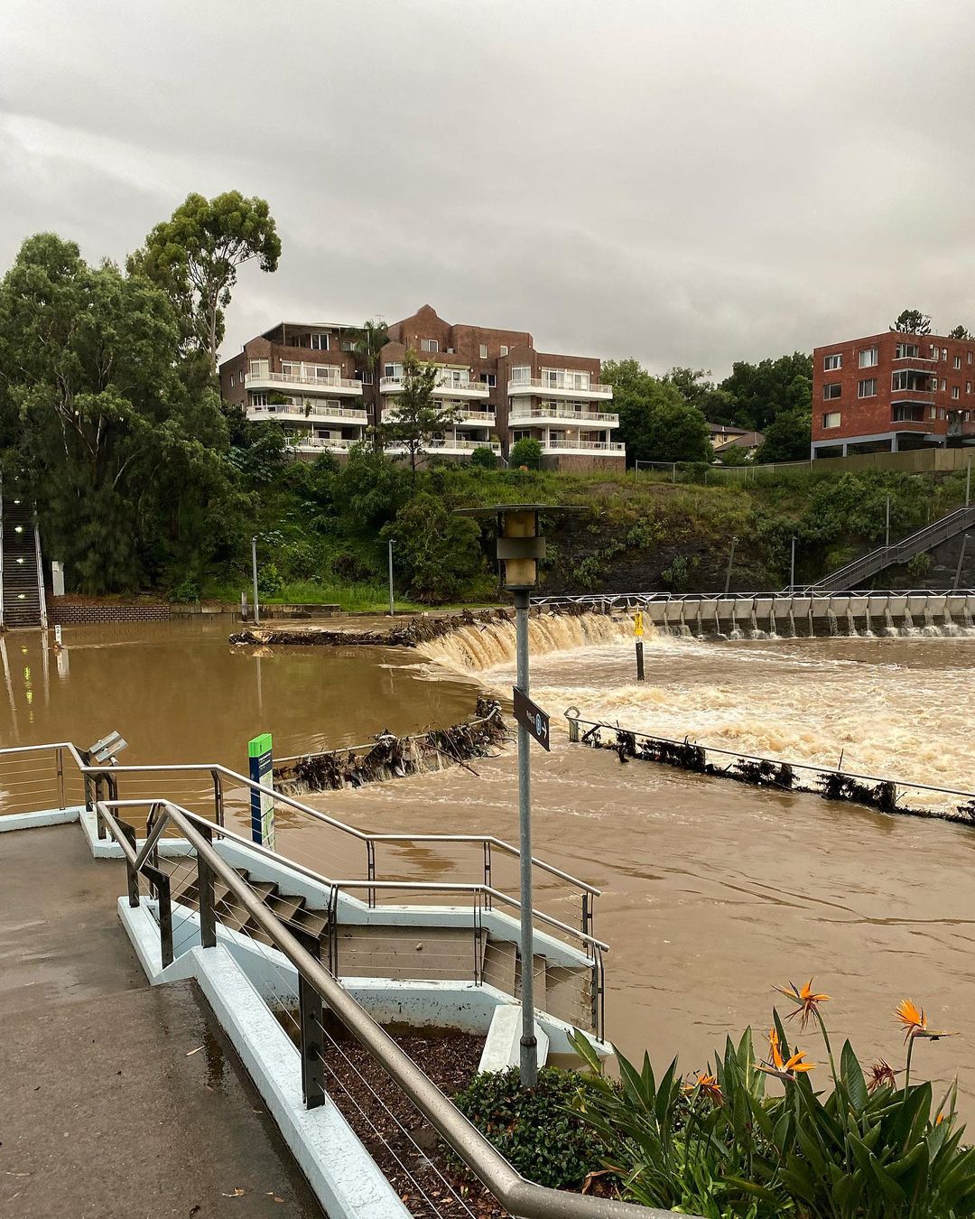
Image: Rain inundated the Parramatta River on Tuesday. Source: @sarah_loves_the_outdoors / Instagram

By 3pm on Wednesday, another 17.2mm had fallen, making a 30-hour total of 122.4mm in the city’s main rain gauge. This is more than a month’s worth of rain for Sydney, with the long-term February average sitting at 119.4mm.

This soggy 30-hour period has brought Sydney’s running summer total up to 518.4mm, making this now the city’s wettest summer since 1991/92.

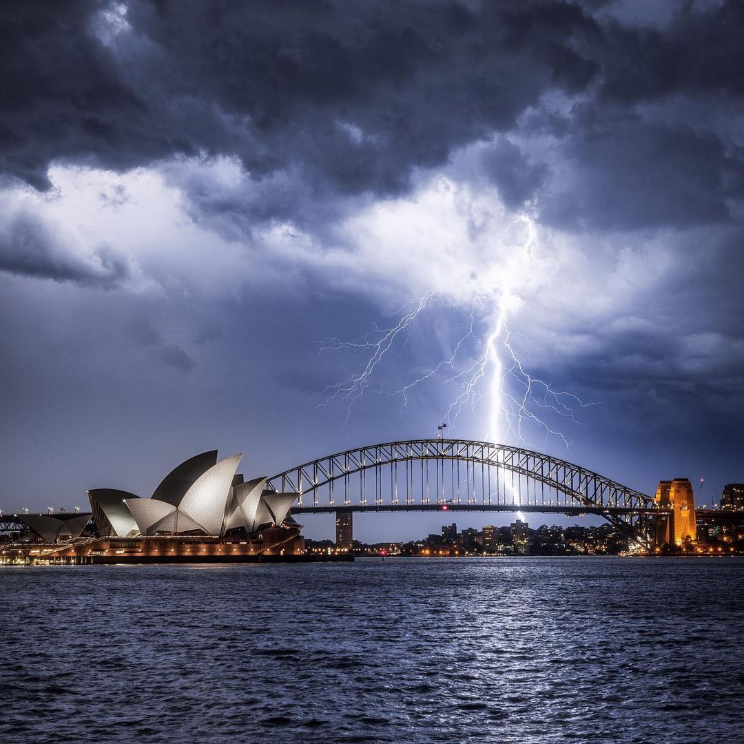
Image: One of the many thunderstorms that affected Sydney this summer, this one in mid-December. Source: @matt.lambley / Instagram

It’s unusual for Sydney to see half a metre of rain during summer, with the long-term seasonal average sitting at 298.8mm. In 164 years of records, only 21 summers have collected more than 500mm.

Sydney’s wettest summer on record was 886.3mm in 1955/56. Despite more rain on the forecast every day during the coming week, this record is unlikely to be broken this season.

For more information on Weatherzone’s heavy rainfall alerts, please contact us at apac.sales@dtn.com.

Latest news

Satisfy your weather obsession with these news headlines from around the nation, and the world.

How does DTN help businesses monitor bushfire induced pyrocumulonimbus thunderstorms that ignite more fires?

Intense heat from bushfires during elevated fire danger days can trigger fire-induced pyrocumulonimbus thunderstorms that ignite additional fires. In early January 2026, an extreme heatwave sweeping over southeastern Australia brought catastrophic fire danger to Victoria. Intensely hot bush and grass fires spread erratically and quickly in hot, dry and gusty winds, with pyrocumulonimbus generating lightning, […]

Active seas to the north and east of Australia disrupting port and maritime operations

Seas to the north and east of Australia are experiencing periods of increased activity this week, leading to disruptions to port, maritime and offshore operations. Intense and hazardous Tasman Sea Ocean conditions across NSW’s South Coast rapidly deteriorated last Friday as a deep feed of easterly winds whipped up large and dangerous seas. The Batemans […]

Transport, emergency and energy industries flooded across Greater Sydney with weekend deluges

Transport, emergency, energy and port industries in eastern NSW and Sydney were impacted by significant flash flooding with intense and heavy rainfall this weekend. Rainfall rates between 80 and 140mm in one to three hours were registered across parts of Sydney’s Northern Beaches and Central Coast on Saturday afternoon and evening. In some areas, these […]

DTN Dangerous Thunderstorm Alerts in action with severe thunderstorms disrupting Perth industries

Severe thunderstorms impacted southwest WA and the Perth region on Sunday, December 14, 2025, triggering Dangerous Thunderstorm Alerts (DTA) by DTN for industries and businesses in the region. DTN operates Dangerous Thunderstorm Alerts (DTA) which alert businesses and industries to thunderstorms based on intensity and movement. These alerts provide advanced notice of thunderstorms moving into […]