Australia is continuing to feel the impact of a strong negative Indian Ocean Dipole, with a band of thick rain and thunderstorms likely to cause flooding in parts of NSW during the next two days.
A low pressure trough and associated cut-off low pressure system will cause widespread rain and potentially severe thunderstorms over Australia’s eastern states between now and Thursday.
Rain and storms will initially develop in far western NSW, southwest QLD and western VIC on Tuesday afternoon and evening.
This band of thick cloud, rain and thunderstorms will then spread towards the east across NSW and southern QLD on Wednesday, mainly affecting inland districts but also reaching parts of the coast in the evening.
Wednesday’s rain will be heavy enough to cause flash and riverine flooding in western NSW, with a flood watch and severe weather warning already in place. In addition to this heavy rain, some inland areas of northern NSW and southern QLD could see severe thunderstorms on Wednesday afternoon or evening.
Some forecast models suggest that six-hour rain rates of 60 to 70 mm are possible Central West NSW on Wednesday morning and afternoon. This rain would likely cause dangerous flash flooding.
On Thursday, showers and thunderstorms will contract to eastern districts of NSW and southern QLD. Severe storms are possible over northeast NSW and southeast QLD on Thursday as the cut off low passes over the region and creates an environment ripe for dangerous storms.
Numerous flood warnings and severe weather and thunderstorm warnings are likely to be issued during the next two to three days. The map below shows how much rain one computer model predicts between now and Thursday night.
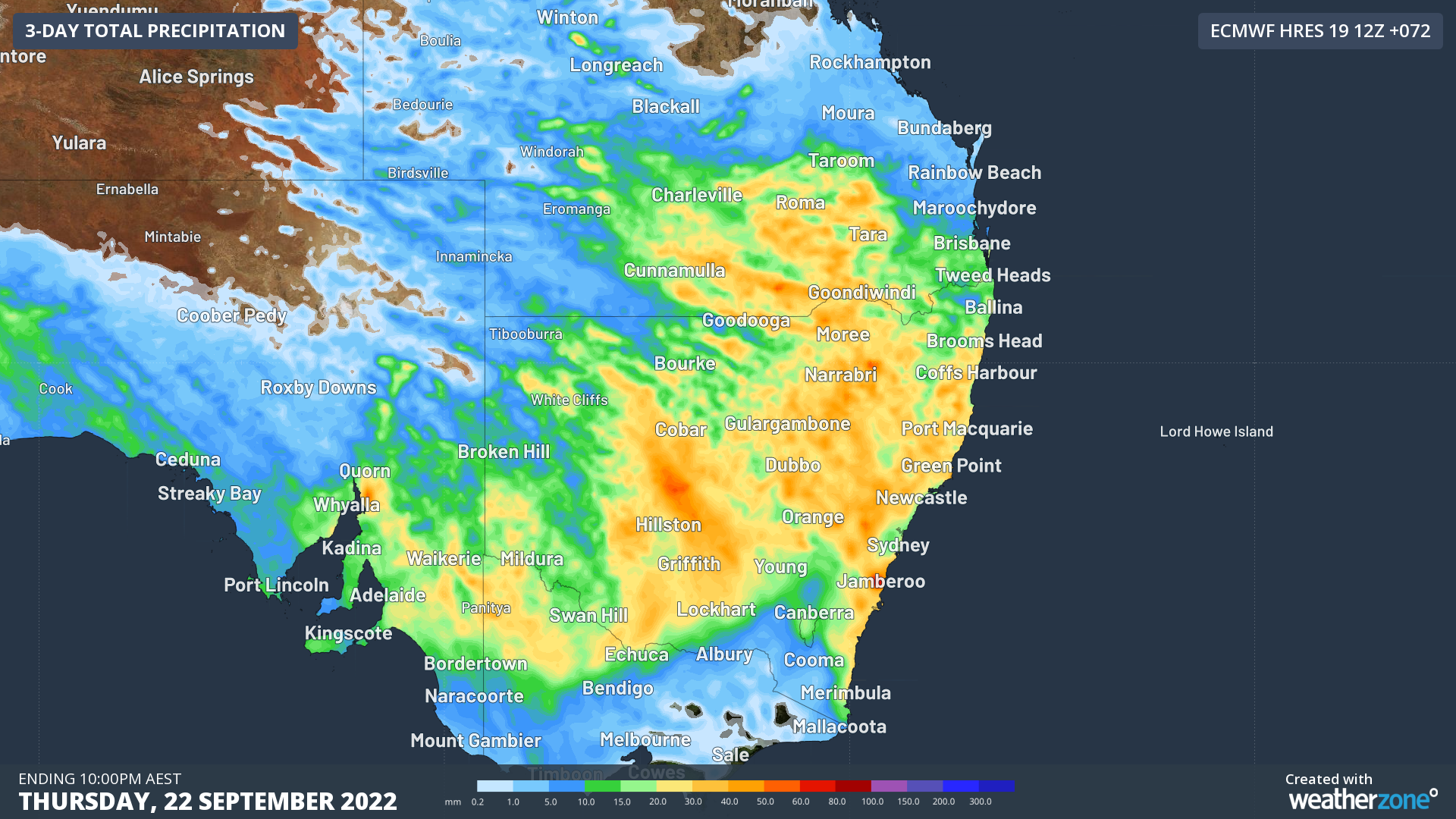
Image: Forecast accumulated rain during the 72 hours ending at 10pm AEST on Thursday, September 22.
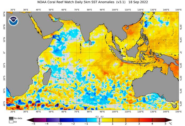
This week’s wet and stormy weather is the latest in a series of rain-bearing systems that have targeted eastern and southeastern Australia over the last several weeks, fuelled by a strong negative Indian Ocean Dipole (IOD).
A negative IOD refers to a pattern of sea surface temperature anomalies in the tropical Indian Ocean that cause more moisture-laden air to flow towards Australia from the northwest.
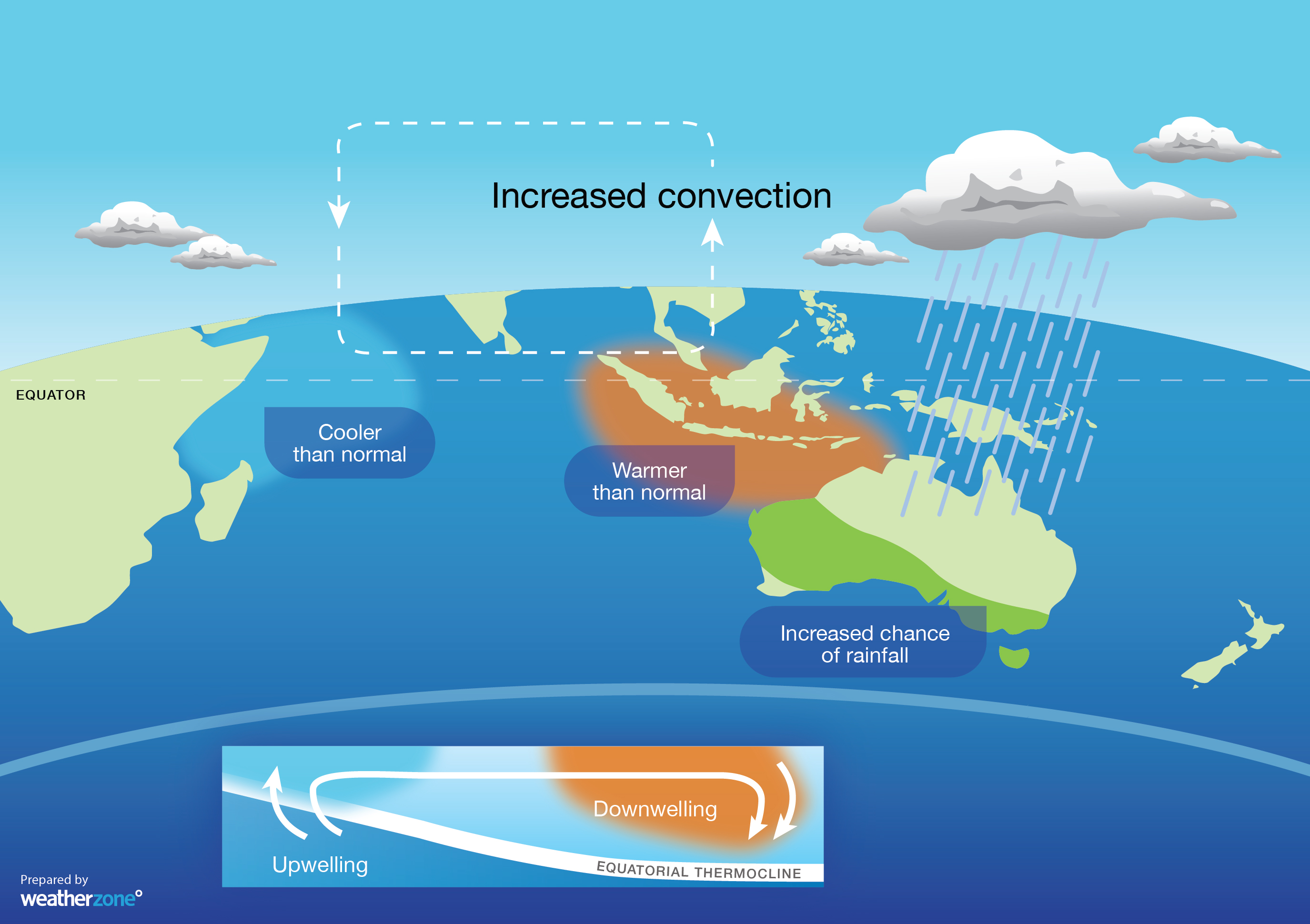
These negative IOD events, which occur on average once every five years, typically enhance northwest cloudbands over Australia and produce above-average rain over large areas of country’s south and southeast during winter and spring.
The current negative IOD was officially declared at the beginning of August and has since become the strongest negative IOD event we have seen since 2016. After weakening briefly at the end of August, the negative IOD has regained strength in the last fortnight.
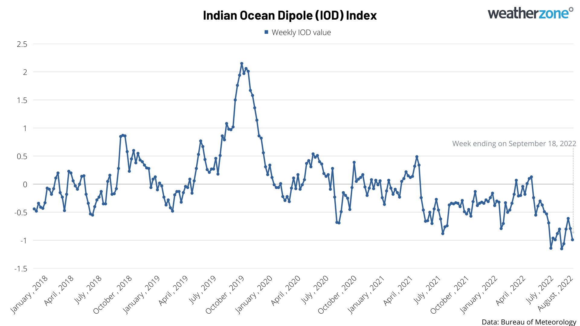
Image: Weekly IOD index values during the last four-and-a-half-years.
This week’s wet and stormy weather over eastern Australia shows that the negative IOD is still having a significant impact on our weather.
Most international forecast models predict that the negative IOD will persist through the rest of the Southern Hemisphere’s spring before breaking down at the start of summer.
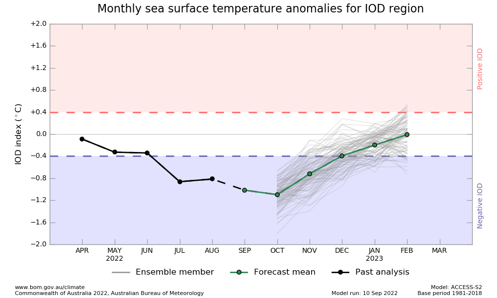
Image: IOD outlook from the Bureau of Meteorology’s ACCESS-S model, predicting the negative IOD will peak in October and break down at the start of summer.
For more information on Weatherzone’s heavy rainfall, thunderstorm and cloud forecasting services, please contact us at apac.sales@dtn.com.


