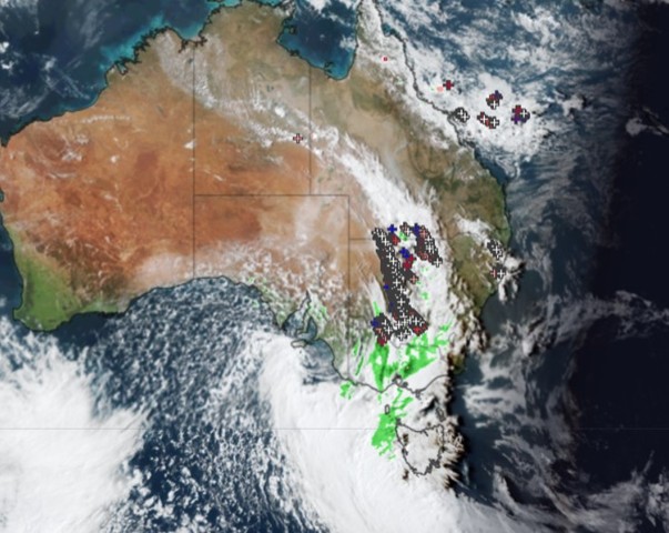
The strong early spring cold front continues its march across eastern Australia, generating wild winds and a huge line of storms stretching from southern Qld, all the way through NSW, and into Victoria.
No notable rainfall totals have been reported yet with this system in NSW or Vic as it’s moving pretty quickly and tending to drop just a few millimetres of rain in most places.
But winds are extremely wild, with a reading at 3:45 pm of 122 km/h at Mt William in The Grampians in western Vic, and just under 100 km/h at several locations in the Victorian Alps.
Severe weather warnings are in place for two states, as well as numerous other alerts, so please check our warnings page for the latest.
Another feature of Thursday afternoon’s wild weather is the sharp temperature contrasts either side of the front.
As mentioned this morning, Adelaide was around six degrees cooler at midday than midnight, while numerous locations lost up to 10 degrees during daylight hours after the front passed through.
- For example, Hay Airport in the NSW Riverina region reached 28.2°C just before 12:30 pm, but by 3:30 pm it was 17.4°C
As for Melbourne, it was still sitting above 20 degrees as we write this story late on Thursday afternoon, having reached a top of 22.1°C just before 3 pm. But those conditions won’t last too long, with the change due in the early evening.
Are you safeguarding your utilities assets and personnel from the threat of increasingly volatile weather?
DTN APAC, a DTN company, offers precise weather intelligence and alerting to protect your utilities network when severe weather, floods and fires threaten.
Over 80% of Australian transmission and distribution networks already rely on our proven nowcasting and forecasting out to 15 days. You can rest assured yours is protected by market-leading analysis. With this foresight you can gain lead time to prepare for possible outages, reduce risk and protect your people and profits.
You will never be left in the dark when conditions suddenly worsen. We deliver reliable, up-to-the-minute weather forecasts and analytical tools that give you the power to enhance your operational management and response to weather risk. Our Total Lightning Network is a globally proven solution that accurately identifies and alerts you to lightning strikes within your defined thresholds, supporting the safety of your team.
Your customisable interface has GIS mapping, showing multiple weather layers over your utilities network and offering full situational awareness. You can quickly recognise any threat to your assets in real-time. 24-hour asset monitoring allows you to track lightning, bushfires and other severe weather systems that approach your service territory.
Advanced and actionable analytics allow you to act decisively and improve your planning and outage response strategy. For more information, please contact us at apac.sales@dtn.com.


