Prosper in a dynamic world
Search

Coldest morning of the year in Melbourne, Canberra


Parts of Victoria and the ACT just had an early taste of winter, with Melbourne and Canberra both shivering through their lowest temperature so far this year.

Earlier this week, a pair of cold fronts crossed southeastern Australia, dropping temperatures and delivering a dusting of snow in the Tasmanian highlands.

While the fronts have now cleared out, cold air is lingering in their wake. On Friday night, this chilly air mass combined with clear skies and light winds, causing temperatures to plummet in parts of Victoria, NSW and the ACT.

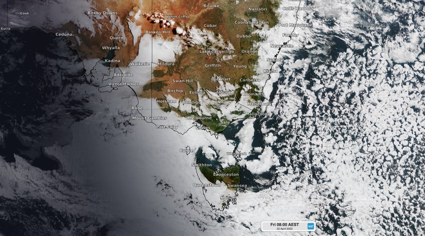
Image: Visible satellite image showing clear skies above Melbourne and Canberra shortly after sunrise on Friday.

Melbourne’s minimum of 7.7ºC shortly after 7am on Friday was the city’s lowest temperature since mid-November last year.

In Canberra, the mercury dipped to 3.1ºC just after 6am, which was also its coldest morning since November.

The next few mornings will be a couple of degrees cooler than average in both Melbourne and Canberra as a slow-moving high pressure ridge maintains predominantly clear skies and light winds across southeastern Australia. Daytime maximums will reach the high-teens to low-twenties in both cities for the next few days.

Latest news

Satisfy your weather obsession with these news headlines from around the nation, and the world.

High tropical cyclone risk near northern Australia this week

A tropical low currently developing over the Timor Sea has a high chance of becoming a tropical cyclone later this week, with a possibility of landfall somewhere in the Northern Territory or Western Australia. Key industries could be impacted including Ports, Mining, Transport, and Agriculture. The satellite images below show cloud circulating around the developing […]

Madden-Julian Oscillation increasing tropical cyclone potential for northern Australia industries

Sea surface temperatures exceeding 31°C off the coast of northern Australia and an active phase of the Madden-Julian Oscillation (MJO) are increasing the likelihood of early-season tropical cyclone activity, with hints of the season’s first tropical cyclone coming as early as next week. Tropical cyclones require sea surface temperature of 26.5°C or warmer to develop, […]

Tropical cyclone season begins with warm oceans surrounding northern Australia

The 2025-26 tropical cyclone season has begun with abnormally warm oceans surrounding northern Australia, signalling an increased risk for severe tropical cyclones in the coming months. The Australian tropical cyclone season runs from November 1 to April 30. During this six-month period, there are usually about 9 to 10 tropical cyclones in the Australian region, […]

7.8 million lightning pulses detected by DTN’s Total Lightning Network over Australia in one week

A barrage of thunderstorms battered large areas of eastern and northern Australia over the past week, producing close to 8 million lightning pulses across the country and more than 4 million over Queensland alone. DTN’s Total Lightning Network (TLN) detected around 7.79 million lightning pulses above Australia last week. This lightning was observed over every […]