A dangerous mixture of hot, dry and windy weather is causing catastrophic fire danger ratings in parts of western Victoria today.
The term ‘catastrophic fire danger’ refers to the highest rating on the Australian Fire Danger Rating System, which has four tiers:
- Moderate
- High
- Extreme
- Catastrophic
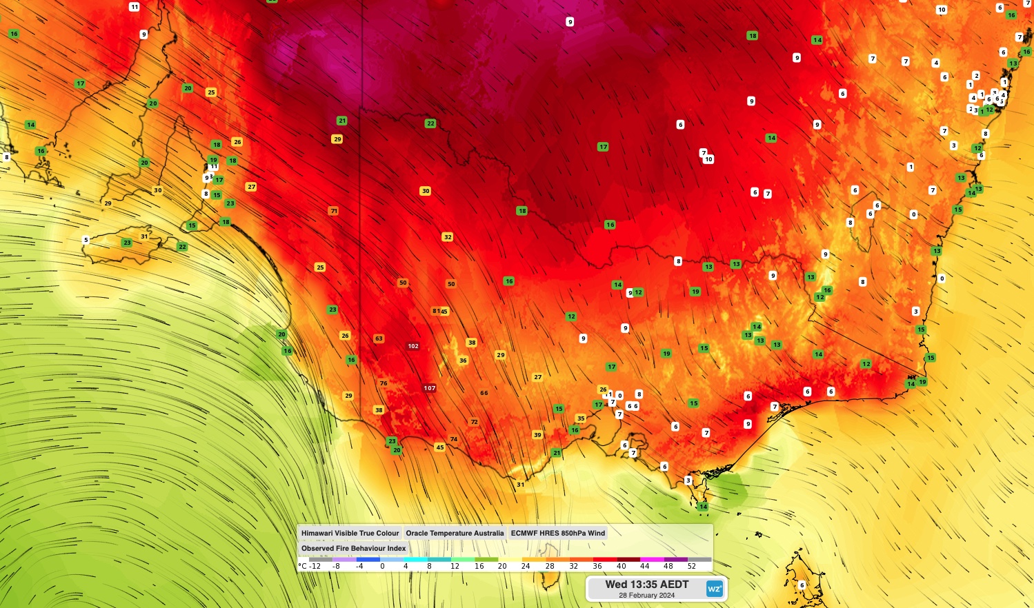
Each category corresponds to a range of values in the Fire Behaviour Index (FBI), which is an index that incorporates weather elements like wind and temperature in real time.
Catastrophic fire danger occurs when the FBI reaches 100 or above, which represents the most dangerous possible conditions for a fire. If a fire starts under conditions and takes hold in a populated area, lives and homes are likely to be lost.
This Wednesday, February 28, 2024, had been identified as a potential day for catastrophic fire danger in parts of western Victoria, due to a combination of very hot, dry and windy weather associated with the passage of a frontal system.
While a band of cloud and showers limited heating in parts of western Victoria on Wednesday morning, clearer skies ahead of and behind this cloud band allowed temperatures and fire danger ratings to soar.
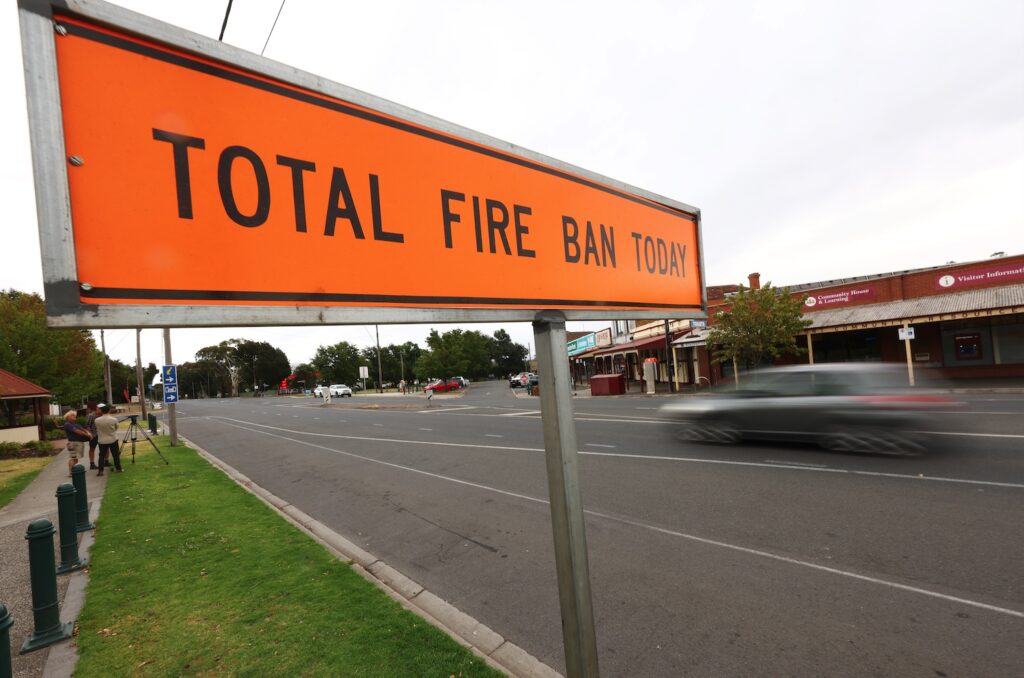
Image: A total fire ban sign is seen in Beaufort, Victoria, Wednesday, February 28, 2024. (AAP Image/Con Chronis)
At 1pm AEDT on Wednesday, temperatures had already reached 40ºC at Swan Hill in the state’s northwest and above 35ºC at Cape Nelson in the southwest.
Fire danger ratings had already reached Extreme levels in parts of southwest Victoria and southeastern SA before midday on Wednesday. Then, shortly after 1:30pm AEDT, the FBI tipped over 100 at Hamilton, Casterton and Kanangulk, representing catastrophic fire danger.
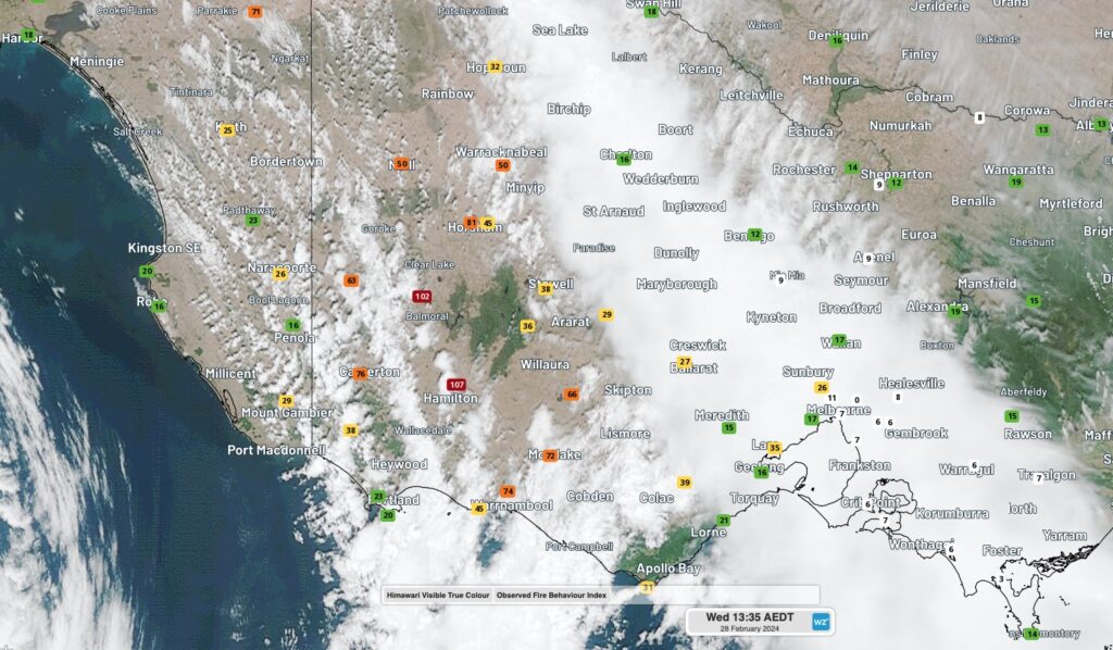
Image: Observed FBI values at 1:35pm AEDT on Wednesday. February 28, 2024. Fire danger
Fire danger will fluctuate throughout the remainder of Wednesday with ebbs and flows in wind, temperature and humidity. In general, fire danger will remain elevated in parts of western Vic and adjacent areas of SA and southwest NSW into Wednesday afternoon and evening, before reducing overnight and into Thursday.
Any fires that start in western Vic, eastern SA and southwest NSW on Wednesday will be very dangerous and difficult to control. Be sure to stay up to date with the latest information on current fires in each state by visiting these pages:
DTN APAC can provide solutions for your business to alert you of the most likely weather conditions and hazards to look out for during the upcoming season. Now is a good time to get a good look at the forecast for autumn and a look deeper into 2024. To find out more please email apac.sales@dtn.com.


