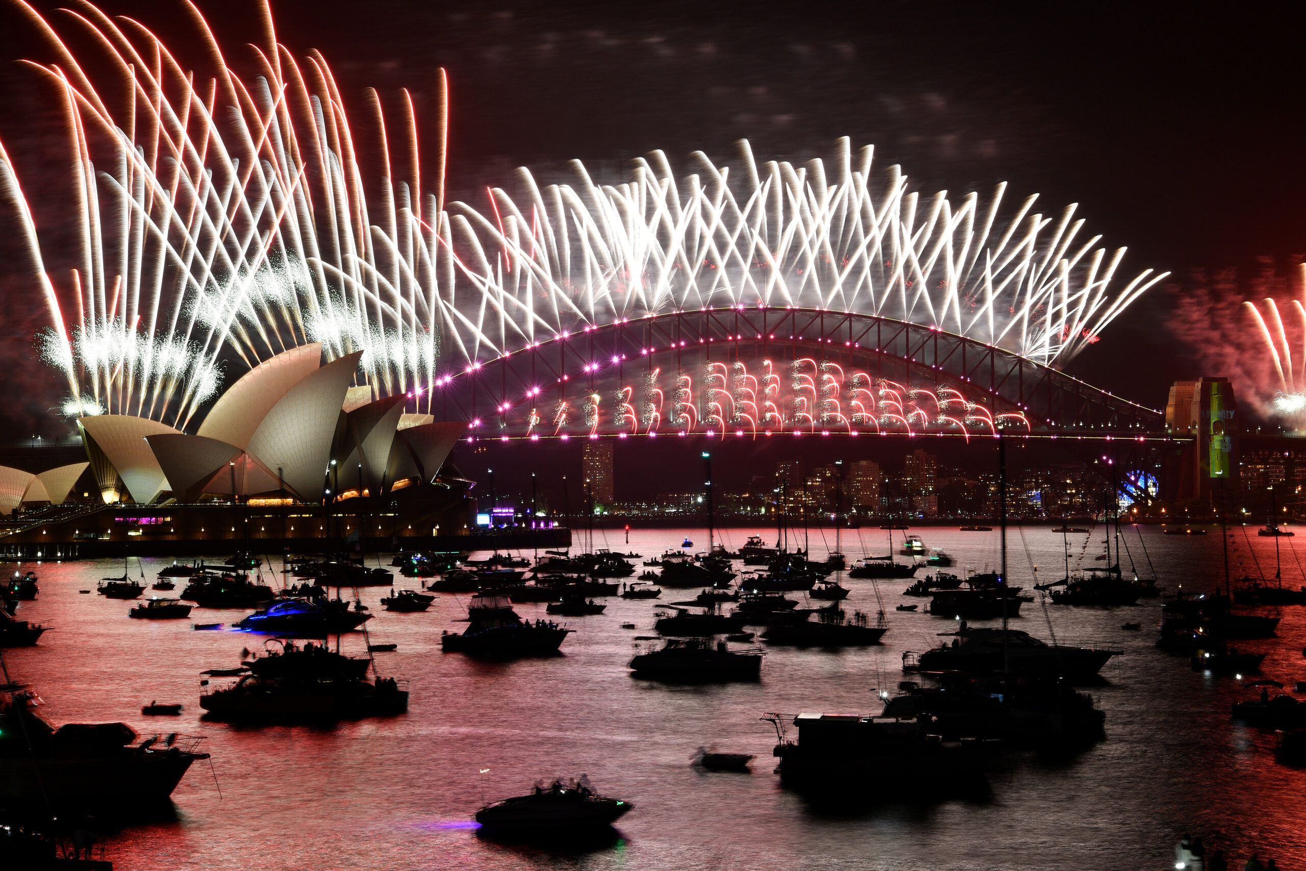
The Sydney New Year’s Eve fireworks are a spectacular display, but sometimes bad weather can get in the way.
While it is extremely rare for Sydney’s famous NYE fireworks to be cancelled, fierce winds and thunderstorms can cause delays or cancellations on rare occasions.
According to the City of Sydney, ‘cancelling fireworks is a last resort decision that will only be taken if the city believes extreme winds may adversely affect the direction of fireworks and put the safety of spectators at risk.’
We also spoke to Tim Gray, a pyrotechnician from Foti International Fireworks, who delved a little deeper into the weather’s impacts during the set-up phase of the fireworks display:
- Rain can make the setup phase of fireworks display difficult as they are not waterproof during this time. This is often planned for but at times rain could cause a delay in the display. However, once the display is set up, it is waterproof.
- Heat impacts the crews that are setting up the fireworks display, and measures are taken to keep them hydrated and cool.
- Thunderstorms can stop the pyrotechnicians from setting up the displays as there is a risk of stray electrical currents interfering with the firing systems. This is where they use the Weatherzone radar and app to monitor the incoming weather.
Weather during the fireworks display
Once the fireworks are set up, the main remaining weather risk to the fireworks is wind speed and direction.
Wind can cause debris produced from the fireworks to drift and land outside the designated zones, which can be a hazard to the community and properties.
Pyrotechnician Tim Gray said that ”We are lucky with Sydney Harbour that it is quite a large body of water, and a lot of our firing positions have exclusion zones that are more than what we need to enforce in accordance with the SafeWork NSW regulations. It is all considered on the night of the event with all stakeholders that manage the event through the NYE control room to ensure everyone’s safety.’
He added, ‘The firing platforms are mobile and can be shifted up wind to consider the wind speed and direction during firing as to ensure the safe firing of the display and the safe fallout of any debris produced.’
Have the fireworks in Sydney been cancelled or delayed?
The 9pm Sydney fireworks were cancelled for the first time during the 2002-03 NYE, with wind speeds reaching 83 km/h. The midnight fireworks display has never been cancelled.
A thunderstorm during NYE 2018-19 delayed all the barges moving into position and therefore delayed the 9pm fireworks. Thunderstorms usually only delay the fireworks, with crews waiting for the storm to pass. However, thunderstorms can also pose a safety risk to the spectators that gather around the harbour to view the display.
Total fire bans and bushfire risk during the 2019-20 Black Summer fires lead to some NYE fireworks cancellations. However, the Sydney fireworks went ahead with planning and extra precautions put in place after consultation from all the relevant stakeholders.
Weatherguard gives you and your staff a visual understanding of incoming weather systems, with GIS mapping and radar. Personal push notifications give users real-time severe weather and lightning alerts, based on their phone’s GPS position. Real-time alerting works to keep staff safe and enables operational decisions to be made quickly.
Field crews can see the full picture and understand the spread and magnitude of risk to people and assets, providing enhanced synergy between crews and the control room.
Weatherguard delivers complete situational awareness, enhancing critical decision making. Reduce health, safety and environmental impacts associated with weather threat, and improve efficiency across your operations. For more information, please contact us at apac.sales@dtn.com.


