Tropical Cyclone Charlotte strengthened rapidly overnight, becoming Australia’s second severe tropical cyclone so far this season.
Charllotte was located around 1000 kilometres to the northwest of Port Hedland at 6:40am WST on Tuesday, March 22. The system is moving slowly to the southwest away from mainland WA.
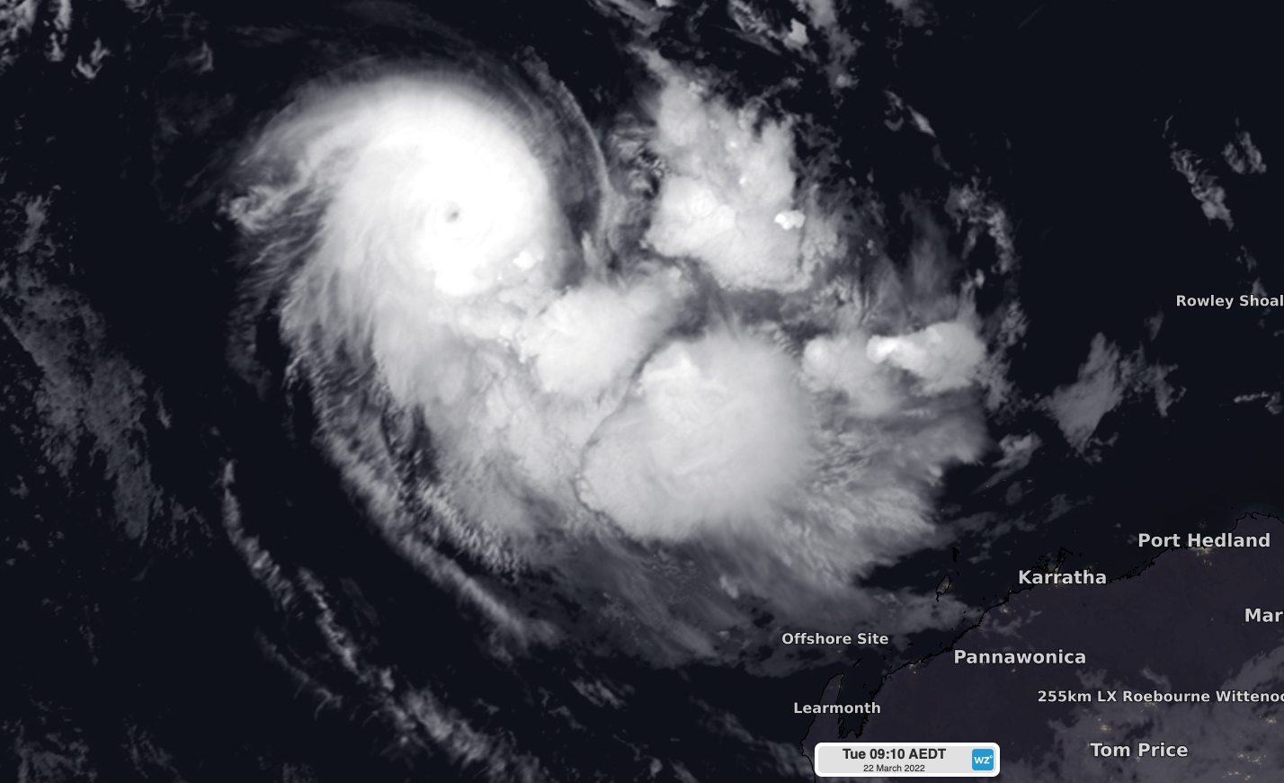
Charlotte became a category 1 cyclone on Monday morning and by early Tuesday morning, it had reached category 3 strength, with wind gusts reaching 165 kilometers per hour near its centre.
In response to this rapid deepening, Charlotte has developed a clear eye at the centre of the storm, which can be seen on the satellite image below.

Image: Infrared satellite image of Severe Tropical Cyclone Charlotte at 6:10am AWST on Tuesday, March 22, 2022.
What is the eye of a cyclone?
The eye is the centre of a tropical cyclone and is where the lowest pressure is found. Once fully-formed, a tropical cyclone consists of towering thunderstorms and rainbands surrounding a relatively clear and calm eye. The most violent weather is usually found inside the eye-wall of a tropical cyclone.
The average tropical cyclone eye typically measures about 10-60 km in diameter. However, they can get bigger or smaller than this. The eye of tropical Cyclone Tracy, which was a very small but powerful cyclone, only had a diameter of 12km.
Where will Charlotte go next?
Charlotte is expected to gain more strength on Tuesday and may become a high-end category three system. However, Charlotte is expected to weaken from Wednesday as it moves towards the southwest into a less favourable environment.
Forecast models suggest that Charlotte should weaken below cyclone strength on Thursday and turn towards the south, allowing the ex-tropical cyclone to track roughly parallel to the Australia’s west coast from Friday into the weekend.
At this stage, most models suggest that Ex-Tropical Cyclone Charlotte will remain offshore, however there is a high degree of uncertainty in the system’s movement beyond Thursday.
It is possible that ex-tropical cyclone Charlotte will cause wind and rain to increase over western districts of WA this weekend or early next week. However, this depends on the future track and strength of the system.
More reliable forecasts for WA will become available towards the end of this week as Charlotte tracks south and gets closer to the state. Once a tropical cyclone or potential tropical cyclone has been identified, detailed forecasts are promulgated with tracking information and risk assessment.
Detailed Tropical Cyclone forecasts are provided in addition to the tropical cyclone outlook and summary. Detailed Tropical Cyclone charts and data are updated at regular intervals by our meteorologists 24 hours a day, 7 days a week, 365 days a year. For more information, please contact us at apac.sales@dtn.com.


