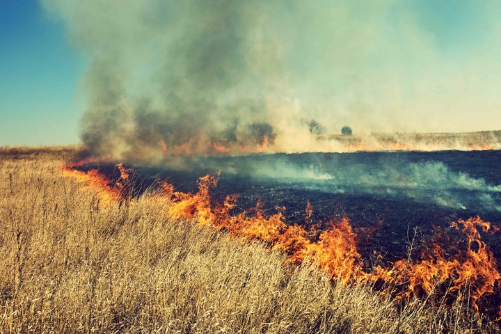
An abundance of drying vegetation off the back of three consecutive La Niña events could fuel record-challenging grass fires across Australia later this year, warns a former Commissioner of Fire and Rescue NSW.
Unprecedented rain and flooding in recent years, fuelled by three back-to-back La Niña events, has created a boom in vegetation growth across large areas of Australia. But this protracted La Niña episode is almost over and there are early signs that El Nino may return later this year.
This rapid transition towards a drier climate state in Australia has the potential to cause “powder keg-like conditions for fires”, according to a new report published by the Climate Council and Emergency Leaders for Climate Action (ELCA).
According to Greg Mullins, former Commissioner of Fire and Rescue NSW and founder of the ELCA, “there is an increased risk this year of major grass fires breaking out during hot, dry and windy weather across NSW, Queensland, Victoria, SA, and Western Australia up to and possibly including April.”
Things could get even worse later this year, with the report suggesting that “the summer of 2023 – 2024 will almost certainly see a return to normal or above normal fire conditions across most of Australia and, given the prolonged wet period that Australia has experienced, it is quite possible that fires as large as those in 1974 – 1975 could occur.”
1974 was a La Niña year and Australia’s wettest year on record. The vegetation that followed this rain provided fuel for fires that scorched around 117 million hectares of land, accounting for about 15 percent of Australia’s land mass.
The satellite images below help reveal how the rain from the past three years has transformed the landscape over inland areas of eastern and central Australia.
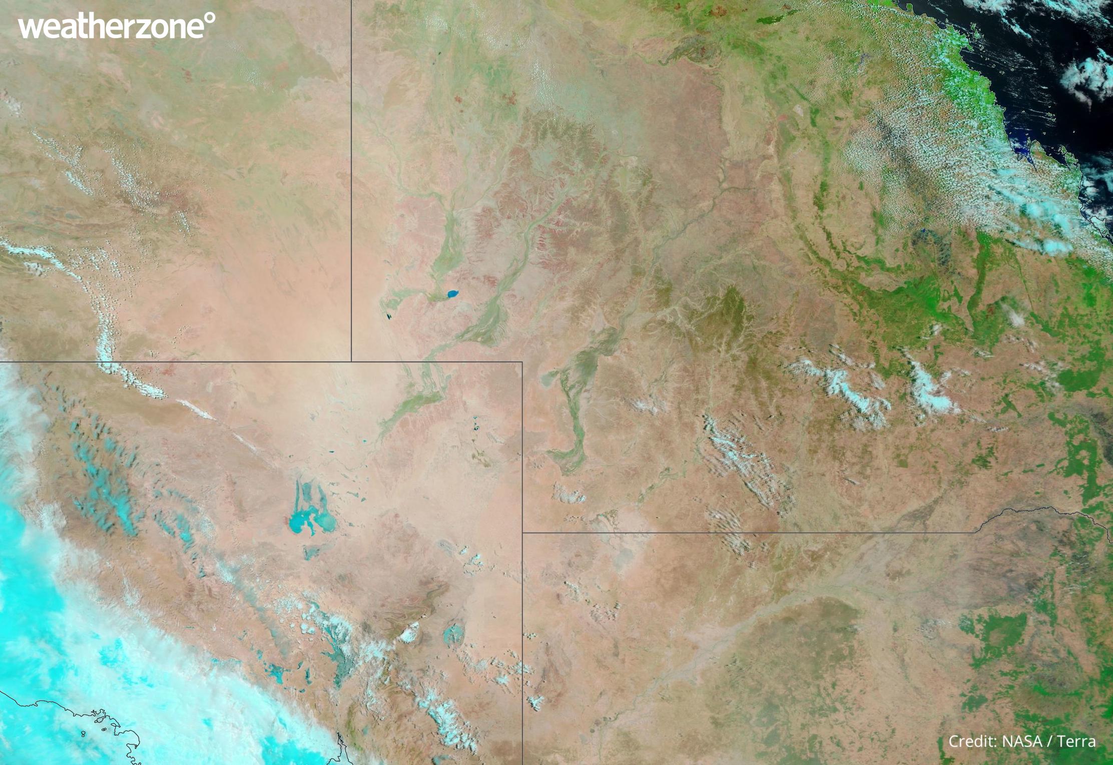
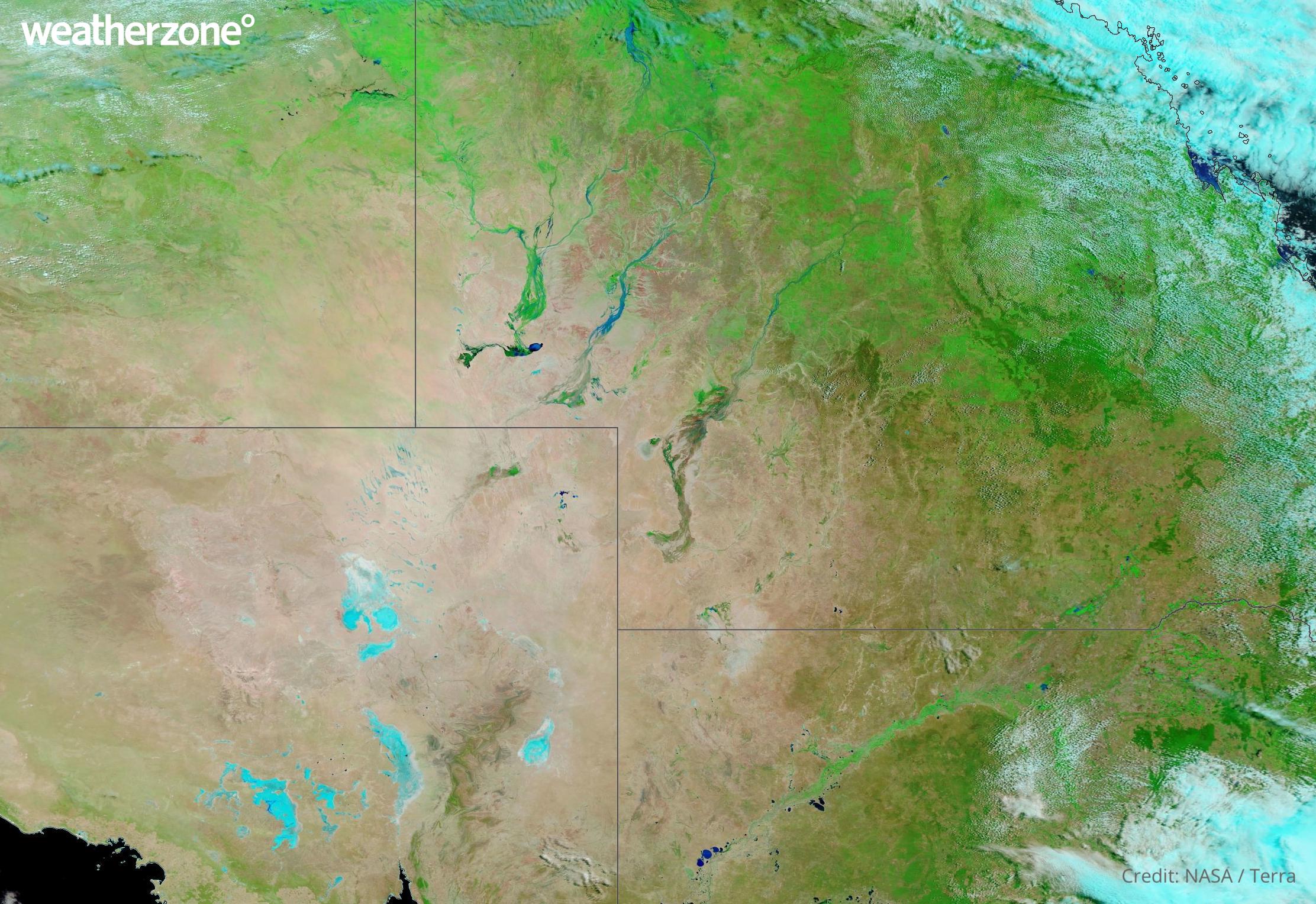
Images: False-colour satellite images captured on January 10, 2020 (top) and February 22, 2023 (bottom). The green areas on these images highlight vegetation, while bare soil has a pinkish tinge. Source: NASA Worldview
By this time next year, these satellite images will likely be showing some large burn scars across the landscape.
DTN APAC uses hotspots to alert you of nearby fires so you can take action to minimise the impact to you operations and personnel. To find out more, please visit out website or email us at apac.sales@dtn.com.


