Prosper in a dynamic world
Search

An active tropical cyclone season was promised, but has this been delivered?

Coming into the 2020/21 tropical cyclone seasons, all signs were pointing towards an above-average number of cyclones in the Australian region.

So far this season, this hasn’t eventuated. So what happened?

The tropics have actually been very active this season with 17 tropical lows generating widespread rainfall and strong winds across northern Australia. At times, the rainfall moved to the south of the country, with the whole country recording its third wettest December on record.

Despite the high number of tropical lows that have formed, only six have developed into tropical cyclones. This falls well below the average of nine to eleven a season.

This went against expectations because we were primed for an above normal tropical cyclone season owing to La Niña and warm oceans across northern Australia (figure 1). The warm oceans are one of the ingredients cyclones need to develop  – think of the oceans as their energy source or fuel.

Active tropical cyclone season promised but not delivered

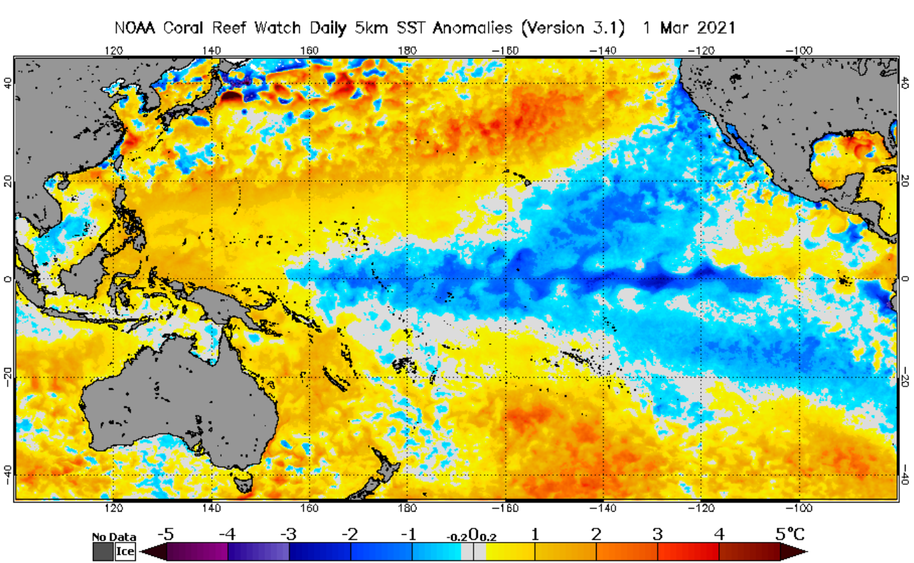
Figure 1: NOAA Sea Surface Temperature (SST) anomalies on the 1st of March 2021.

So why have there been so few cyclones this season?

Firstly, many of the low pressure systems have developed on or near the coastline, which has deprived them of their ‘fuel’ (warm ocean) that they need to develop.

Secondly, the wind setup has not been quite right, with opposing winds at different heights in the atmosphere, breaking the storm apart and working against each other.

Finally, the season is not over, we have a few months to go and March is usually the most active month. Never fear our meteorologists will be watching any tropical low development in the next few months. https://business.weatherzone.com.au

Latest news

Satisfy your weather obsession with these news headlines from around the nation, and the world.

DTN Dangerous Thunderstorm Alerts in action with severe thunderstorms disrupting Perth industries

Severe thunderstorms impacted southwest WA and the Perth region on Sunday, December 14, 2025, triggering Dangerous Thunderstorm Alerts (DTA) by DTN for industries and businesses in the region. DTN operates Dangerous Thunderstorm Alerts (DTA) which alert businesses and industries to thunderstorms based on intensity and movement. These alerts provide advanced notice of thunderstorms moving into […]

How Australian East Coast port and maritime operations could be disrupted by tropical cyclones over the next two weeks

Port and maritime operations across Australia’s East Coast could be disrupted by increased tropical cyclone activity in the Coral Sea and southwest Pacific Ocean over the next two weeks. Meteorologists reference a large selection of Numerical Weather Prediction (NWP) models to forecast weather. A number of these NWP models are forecasting the development of tropical […]

Extreme fire danger and severe heatwave conditions spreading across SA, Victoria and NSW

Hot, dry and windy weather causing elevated fire danger and severe heatwave conditions are sweeping across southeastern Australia over the next three days, driving high energy demand and disruption to operations. Clear skies associated a large and slow-moving high pressure system have allowed hot air to build up over parts of northern, western and central […]

Heightened bushfire risk during the 2025-26 summer for WA, Victoria and NSW in latest AFAC Outlook

The Australian and New Zealand Council for fire and emergency services (AFAC) identified western and southern WA, Victoria and inland NSW as key regions that are at risk of heightened bushfire risk this summer. Parts of Australia have experienced severe soil moisture and rainfall deficiencies over the past months and years, while high fuel loads […]