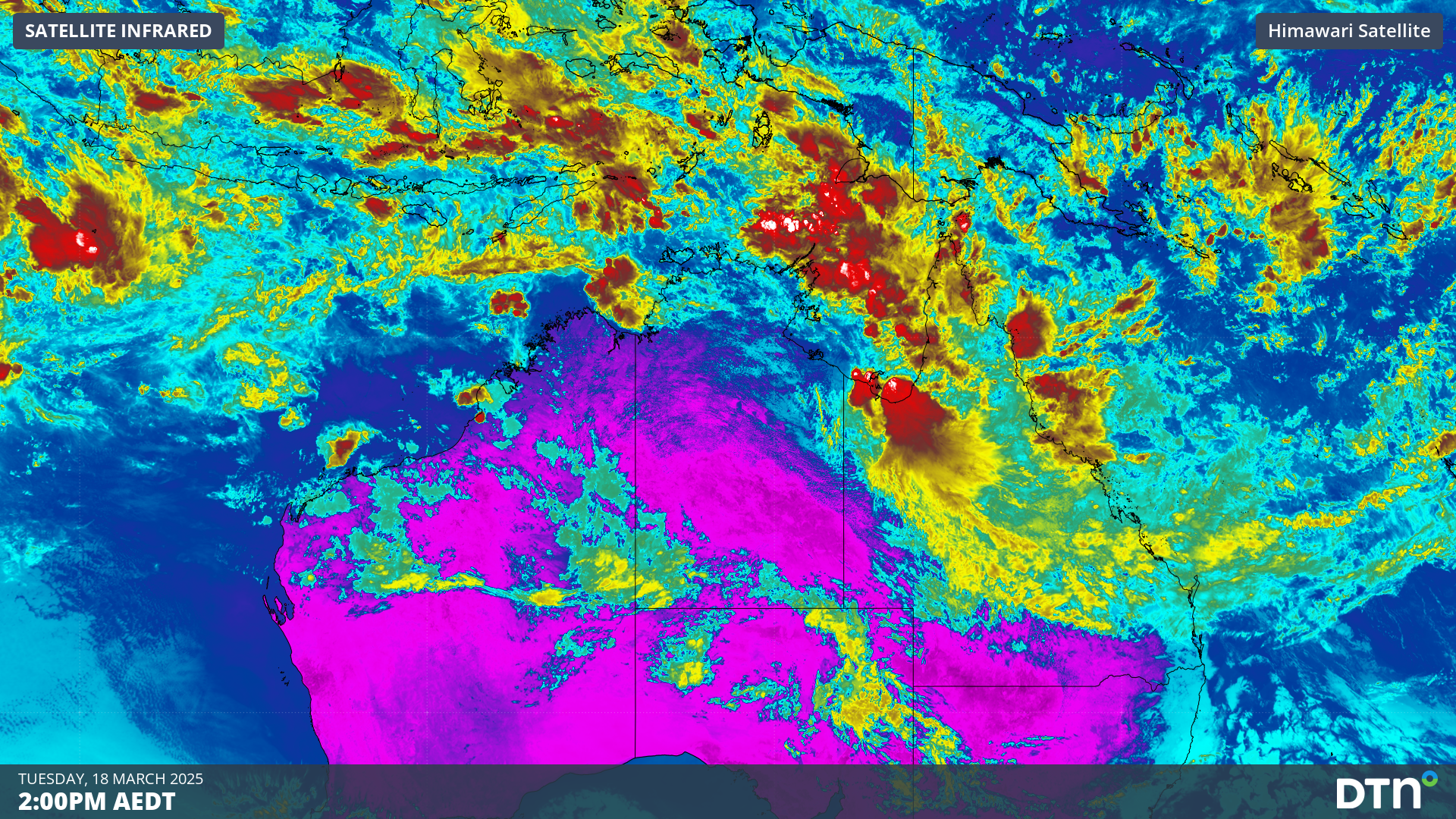
Australia’s tropics will be invigorated by a pulse of the Madden-Julian Oscillation (MJO) this week, increasing the risk of tropical cyclone activity near Australia.
A surge of monsoonal winds crossing the Maritime Continent will cause an injection of moisture-laden air into the tropics near Australia over the coming week. This monsoon burst will coincide with an active MJO passing to the north of Australia. The combination of monsoonal winds and an active MJO will increase rainfall around northern Australia and enhance the likelihood of tropical cyclone development.
The map below shows how much rain is forecast around northern Australia during the next seven days.
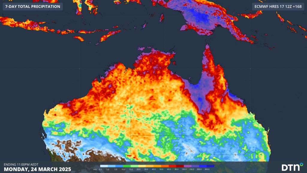
Image: Forecast accumulated rain during the seven days ending on Monday, March 24, 2025.
The focus of the heaviest rain on the Australian mainland will be on northern Queensland early this week. However, heavy tropical rain is also expected to spread to parts of the NT and northern WA in the second half of the week.
DTN APAC meteorologists are also keeping an eye on two areas of low pressure that have potential to become tropical cyclones to the northwest of Australia later this week.
One tropical low is currently developing near the Cocos (Keeling) Islands. According to the Bureau of Meteorology, this low has a moderate chance of becoming a tropical cyclone on Thursday. This system is expected to stay away from the Australian mainland over the coming week.
Forecast models also predict that another low pressure system will form to the northwest of WA’s Pilbara coast around Friday. At this stage, this system only has a low chance of becoming a tropical cyclone in the next seven days. There are indications that this system could cause some impacts in the north of WA towards the end of this week, although it’s too early to know with much certainty just yet.
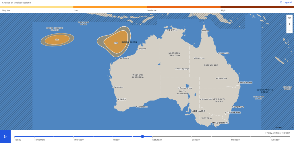
Image: Chance of tropical cyclone activity near Australia on Friday evening. Source: Bureau of Meteorology.
Anyone living in northern Australia should keep an eye on the latest weather and flood warnings over the coming week and people and businesses in northern WA should monitor the tropical cyclone outlooks and advisories in the coming days.
How DTN APAC can help
Tropical Cyclone Services
As the climate delivers increasingly severe weather events, their potential to impact your business operations grows.
DTN APAC, specialises in industry-leading forecast, alerting and threat analysis of tropical cyclones, offering you expert, customised solutions when the weather turns wild.
Providing rapid-update forecast information, we alert you to any low-pressure system gaining power within your region and, unlike other providers, can track its development out to 7 days. This gives you the time to prepare and safeguard your staff, sites and assets.
You will have the most precise weather intelligence charting rainfall, wind speeds and potential storm surges to help you make critical decisions quickly. Whether it’s adjusting key work schedules, protecting your staff or securing your site, we have the alerting capability to keep you steps ahead of the storm.
We will support you, 24/7, keeping you informed and making your critical decisions easier.
To find out more about large range of products and services contact us at sales.apac@dtn.com


