Prosper in a dynamic world
Search

Tropical Cyclone Jasper nearing Qld coast

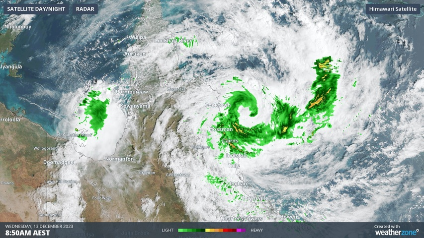
Wind and rain are increasing along Queensland’s North Tropical Coast as Tropical Cyclone Jasper moves closer to land, ahead of making landfall later today.

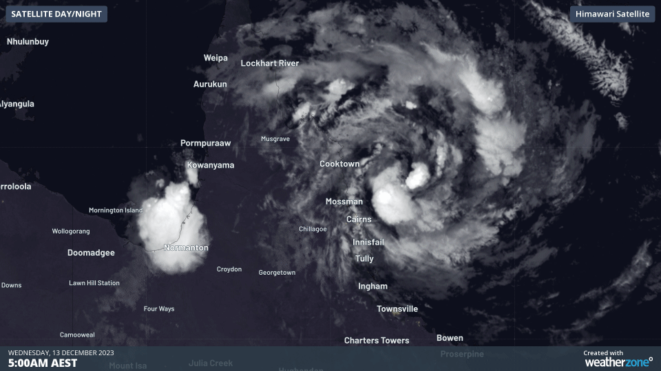
The animation below shows the sun rising over Jasper on Wednesday morning. At 9am AEST, it was a category one system located 130 km north northeast of Cairns.

Tropical Cyclone Jasper nearing Qld coast

Some of the heaviest rain so far has been well to the south of Jasper thanks to a stream of moisture-laden winds feeding into Qld’s central coast and ranges. A rain gauge at Clarke Range, to the west of Mackay, received 467 mm of rain during the 48 hours ending at 9am on Wednesday. Closer to Jasper, a few gauges between Cairns and Tully picked up 100 to 130 mm in the 24 hours ending at 9am Wednesday.

Jasper may intensify slightly as it approaches northeast Qld today, with the Bureau anticipating landfall as a category two system late on Wednesday afternoon or evening between Hopevale and Cairns.

Jasper’s coastal crossing will bring heavy rain, flooding, damaging to destructive winds and a storm tide along parts of the North Tropical Coast and Tablelands today. Numerous warnings are in place, including a cyclone warning, a severe weather warning and a flood watch.

While Jasper will waken quickly from this evening after moving over land this, its remnant low pressure system will carry heavy rain across Cape York Peninsula on Thursday and Friday. Looking further ahead, the low could move over the Gulf of Carpentaria on the weekend, where it may regain strength over the Gulf’s warm water.

For more information on our tropical cyclone forecasts, please contact us at apac.sales@dtn.com.

Latest news

Satisfy your weather obsession with these news headlines from around the nation, and the world.

South Pacific 2025-26 Tropical Cyclone Season Outlook

The Fiji Meteorological Service and New Zealand’s National Institute of Water and Atmosphere Research (NIWA) both released their 2025-26 tropical cyclone outlooks last week, with elevated risks focused on New Caledonia, Vanuatu and New Zealand’s North Island. The Fiji Meteorological Service is responsible for tropical cyclone services across the local Regional Specialized Meteorological Centre (RSMC) […]

Severe thunderstorms to hit NSW businesses and industries on Friday

Intense thunderstorms are likely to pummel parts of NSW on Friday, with damaging winds, large hail and heavy rain all a risk for mining, transport, insurance and aviation sectors. A cold front and associated low pressure trough will sweep across NSW on Friday, causing a relatively cool air mass travelling from the south to clash […]

Springtime temperature see-saw threatens NSW with low energy reserves

Two bursts of heat will impact Sydney and NSW in the coming week, driving high energy demand and a forecast Lack of Reserve Level 2 (LOR2) issued by AEMO. Bursts of springtime heat moving east The DTN forecast for Sydney below, generated by our professional team of weather risk analysts, shows two spikes in heat […]

US Climate Prediction Center declares La Niña – what this means for Australian industries?

A La Niña advisory has been issued by the US Climate Prediction Center (CPC), indicating that La Niña conditions have emerged in the tropical Pacific Ocean and are expected to continue for the coming months. What is La Niña? La Niña is one of three phases of the El Niño-Southern Oscillation (ENSO), a coupled ocean-atmosphere […]