Tropical Cyclone Errol, which formed on Tuesday night, is quickly gaining strength to the north of WA and could turn towards the Kimberley coast later this week.
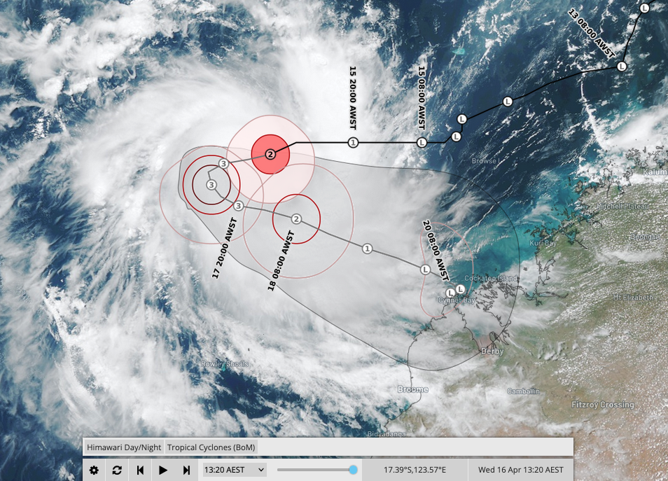
At 8am AWST on Wednesday, Errol was a category two tropical cyclone located roughly 515 km to the north northwest of Broome. The system is moving west and should maintain this track while strengthening during the rest of Wednesday into Thursday.
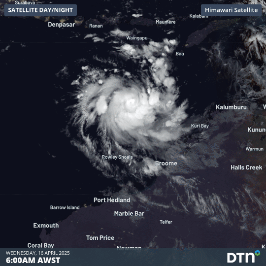
Image: Visible true-colour satellite images of Tropical Cyclone Errol on Wednesday morning.
Several factors should help Errol strengthen over the next 12-24 hours, including warm sea surface temperatures around 30°C and good outflow in its upper levels. The small size of Errol will also help it gain strength more rapidly than a larger tropical cyclone would.
Forecast models suggest that Errol should become a category 3 severe tropical cyclone on Thursday, although its small size and rapid rate of intensification may allow the system to reach category 4 strength.
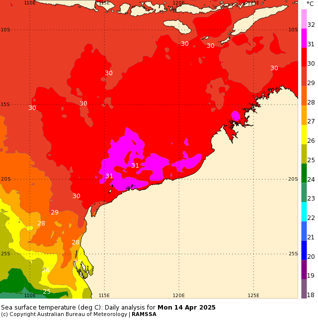
Image: Sea surface temperatures to the north of WA are currently hovering around 30 to 31°C, well above the 26.5°C threshold required for tropical cyclone development. Source: Bureau of Meteorology
After this period of rapid intensification, Errol is expected to make a left-hand turn on Thursday and start moving towards WA’s Kimberley coast. Fortunately, conditions will start to become less favourable for the cyclone to maintain its strength after it makes the turn towards the south, due to increasing vertical wind shear and dry air intrusion. This means Errol should weaken as it approaches the Kimberley coast, most likely making landfall as a tropical low, below tropical cyclone strength, this weekend.
Despite the expected weakening before landfall, the remnants of Tropical Cyclone Errol will still bring a burst of heavy rain to parts of the Kimberley region from Friday into the weekend, possibly spreading further inland towards the state’s North Interior early next week.
If Errol does get stronger than currently expected, this will also increase the risk of it approaching the coast as a tropical cyclone instead of a tropical low.
Anyone living in the north of WA should keep a close eye on the latest tropical cyclone advisors in the next few days.
Errol is the 11th tropical cyclone in the Australian region so far this season, making this Australia’s most active tropical cyclone season in six years.
How DTN APAC can help
As the climate delivers increasingly severe weather events, their potential to impact your business operations grows.
DTN APAC specialises in industry-leading forecast, alerting and threat analysis of tropical cyclones, offering you expert, customised solutions when the weather turns wild.
Providing rapid-update forecast information, we alert you to any low-pressure system gaining power within your region and, unlike other providers, can track its development out to 7 days. This gives you the time to prepare and safeguard your staff, sites and assets.
You will have the most precise weather intelligence charting rainfall, wind speeds and potential storm surges to help you make critical decisions quickly. Whether it’s adjusting key work schedules, protecting your staff or securing your site, we have the alerting capability to keep you steps ahead of the storm.
We will support you 24/7, keeping you informed and making your critical decisions easier.
To find out more about large range of products and services contact us at sales.apac@dtn.com


