A severe tropical cyclone could make landfall in northern WA, impacting mining, port and offshore oil and gas operations in the region.
At 8am AWST on Tuesday, a tropical low was spinning off the northern coast of WA, roughly 295 km to the northwest of Broome. This developing low pressure system is causing large pulses of convective cloud over the warm seas off the state’s northern coastline.
Image: Clouds swirling around a developing tropical low to the north of WA on Tuesday.
These warm waters will help the tropical low gain strength as it moves towards the south or southwest in the coming days, with the Bureau of Meteorology predicting that it will become a tropical cyclone on Wednesday. The latest track map issued by the Bureau anticipates that the tropical cyclone, which will be named Zelia, will then strengthen further on Thursday. Zelia is then expected to become a category three severe tropical cyclone by Friday as it gets closer to the WA coast.
As the tropical cyclone hasn’t even formed yet, there is still a lot of uncertainty regarding its future movement and strength. However, current computer model guidance suggests that Zelia may approach the East Pilbara or West Kimberley coasts as a significant tropical cyclone later this week.

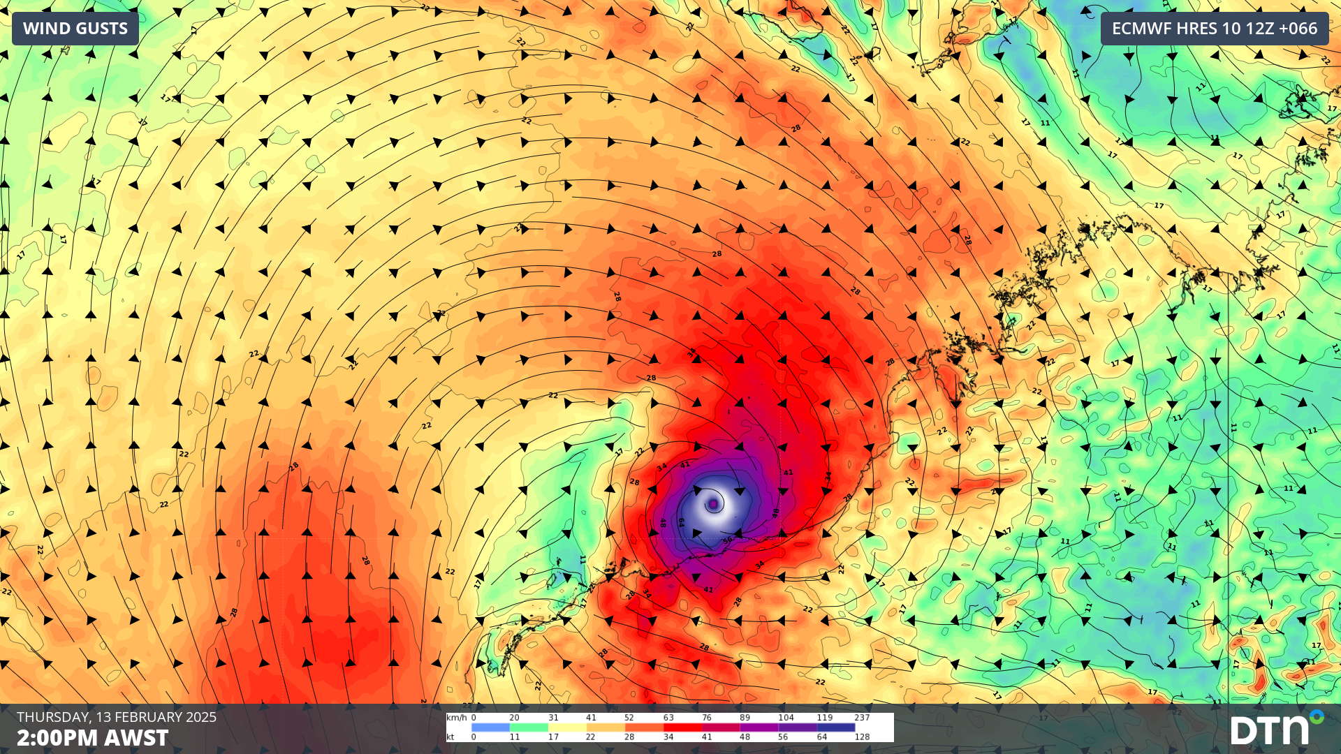
Image: ECMWF model forecast showing wind gusts near the north coast of WA on Thursday, February 13.
More reliable information will become available to meteorologists over the next few days, which will mean the tropical cyclone track maps and forecasts issued for this system should become more confident in the next 24 to 48 hours.
DTN APAC, specialises in industry-leading forecast, alerting and threat analysis of tropical cyclones, offering you expert, customised solutions when the weather turns wild.
Providing rapid-update forecast information, we alert you to any low-pressure system gaining power within your region and, unlike other providers, can track its development out to 7 days. This gives you the time to prepare and safeguard your staff, sites and assets.
You will have the most precise weather intelligence charting rainfall, wind speeds and potential storm surges to help you make critical decisions quickly. Whether it’s adjusting key work schedules, protecting your staff or securing your site, we have the alerting capability to keep you steps ahead of the storm.
We will support you, 24/7, keeping you informed and making your critical decisions easier. For more information contact us at sales.apac@dtn.com


