After dumping half a year’s worth of rainfall over Groote Eylandt in the past 48 hours, Tropical Cyclone Megan is building strength in the Gulf of Carpentaria and will make landfall over the NT coast on Monday night.
Tropical Cyclone Megan formed on Saturday afternoon in the Gulf of Carpentaria, making it the fifth tropical cyclone to impact the Australian region this season.
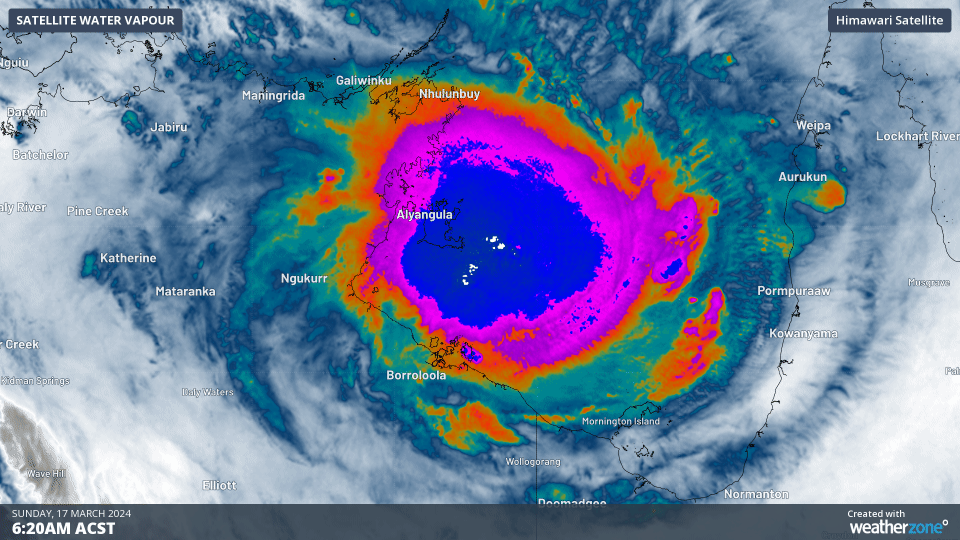
Tropical Cyclone Megan intensified overnight, dropping enormous amounts of rainfall over Groote Eylandt, Australia’s fourth largest island, which sits on the western side of the Gulf of Carpentaria.
The rain gauge at Groote Eylandt Airport recorded a mammoth 431mm in the gauge in the 24 hours to 9am on Sunday. This makes it their 2nd wettest day in 103 years of records, only behind the 513.3mm recorded on March 28, 1953. This also comes on the back of 249.4mm that fell in the 24 hours to 9am Saturday, meaning 680.4mm has fallen in just 48 hours. This is over half their average annual rainfall of 1275.2mm.
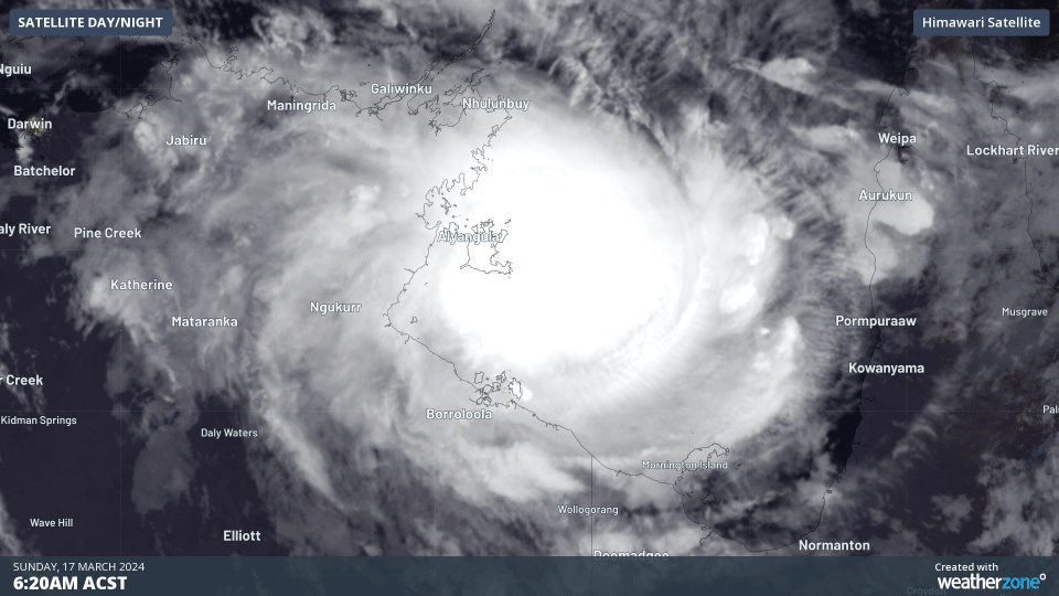
Video: Infrared satellite and BoM station observations showing the explosive-like convection spinning around Tropical Cyclone Megan. The black areas show the highest clouds, likely extending more than 16km into the atmosphere.
Tropical Cyclone Megan is continuing to develop with sustained winds of 110km/h, gusting up to 155km/h near its centre as of Sunday 10:30am CST. A tropical cyclone warning has been issued for Alyangula (Groote Eylandt) in the NT to Mornington Island in Qld, and extending inland to Borroloola, McArthur River Mine, and Robinson River.
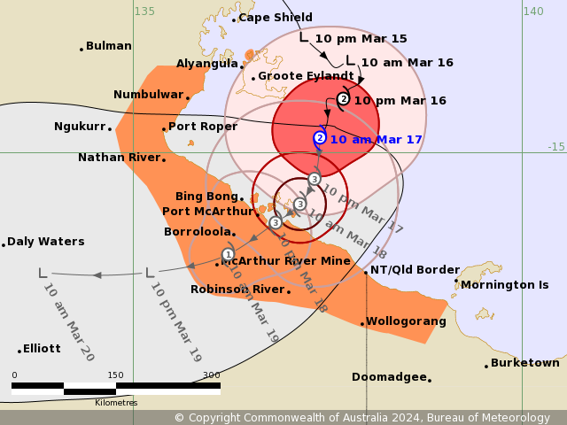
Image: Tropical Cyclone Megan advice 17 issued at 10:30 CST by the Bureau of Meteorology.
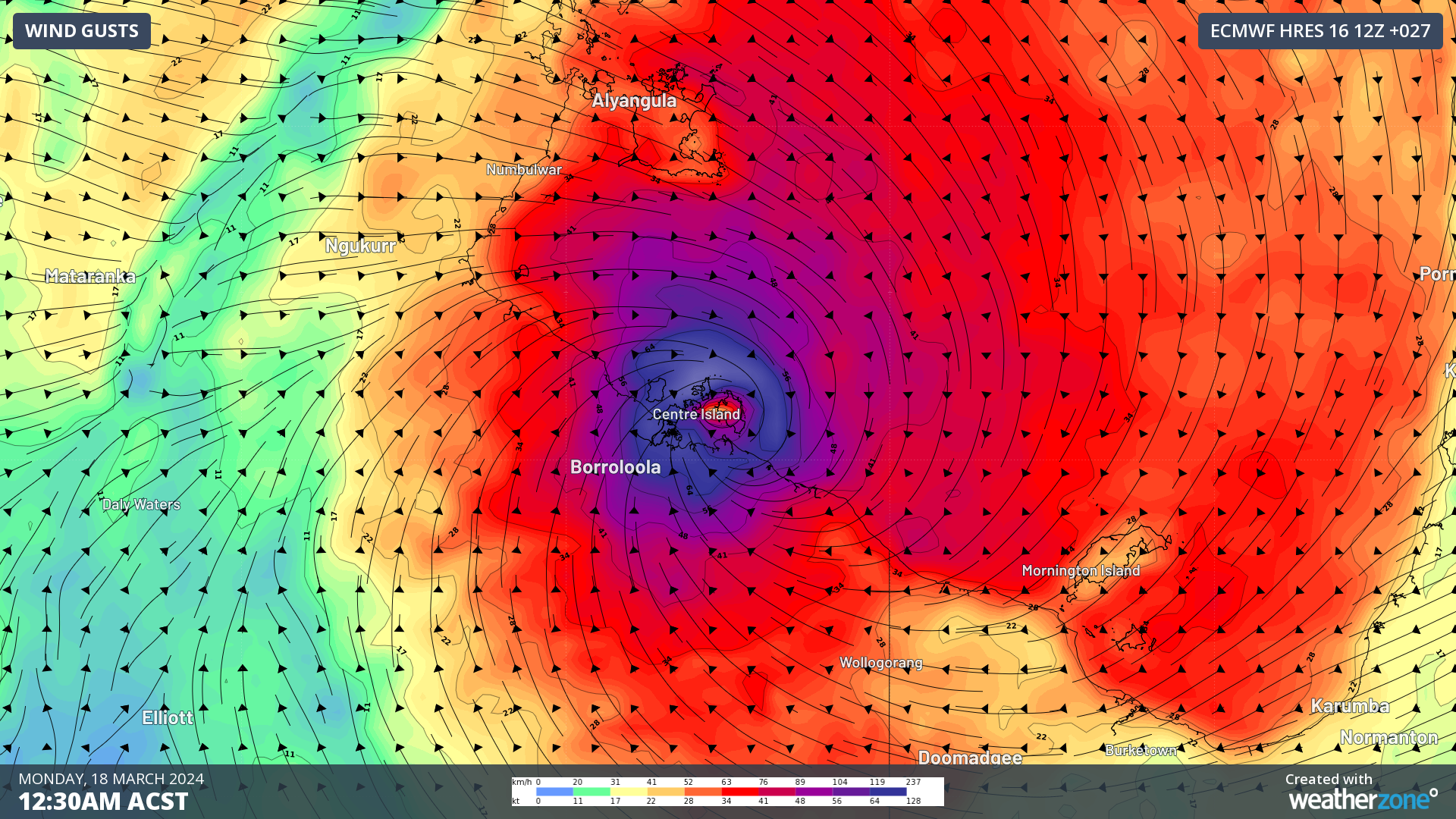
Tropical Cyclone Megan is slowly tracking to the south, where it is expected to make landfall on Monday evening and Tuesday morning, somewhere between Nathan River and the NT-Qld border. Most likely, it will pass near or through the Sir Edward Pellow Island Group, including the observation site at Centre Island, and track inland to Borroloola and McArthur River, before weakening.
Megan is forecast to make landfall as a category 3 severe tropical cyclone, with wind gusts of up to 210km/h expected in its very destructive core. Broad areas within about 140-170km of the centre are likely to see gale-to-storm force winds (already observed at Centre Island), with forecast gusts above 90km/h, potentially above 125km/h, during landfall.
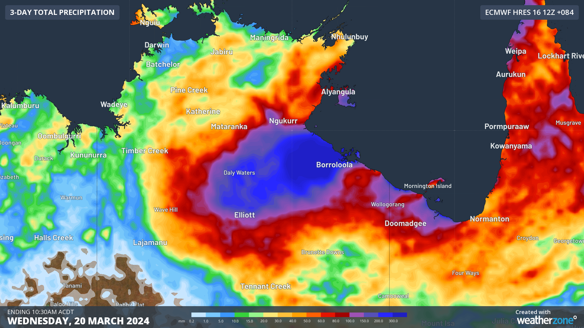
Rainfall looks to be heaviest in the Carpentaria region of the NT, with areas on Megan’s western and northern flanks the most likely to see the heaviest falls. Widespread falls of 100-200mm are expected, with isolated falls of 300-500mm expected over the mainland in addition to the rain already fallen.
Further ahead, Megan looks to be taking a similar initial track to Tropical Cyclone Lincoln from last month, heading west towards central parts of the NT. It is likely to bring heavy rainfall and flooding in its wake, although it is not expected to travel as far as Lincoln did before dissipating.
You can keep up to date with the latest warnings here, and monitor the progress of the tropical cyclone, including the latest advisories and weather observations, on the Weatherzone Radar.
DTN APAC has a suite of tropical cyclones services we provide to deliver our clients with as much forewarning of tropical cyclones as we can. We have 4 levels of forecasts timeframes:
- Tropical cyclone seasonal outlooks
- Weekly tropical update
- Daily 7-day tropical cyclone forecast
- Detailed tropical cyclone impacts (issued every 1-6 hours aligning with offical advisories)
Through these products you can have as much preparation as possible for tropical cyclones and their impacts. To find out more, please visit our website or email us at apac.sales@dtn.com.


