
Another northwest cloud band has brought significant rain to parts of the southwest during the last 24 hours, with more to come.
The largest totals southwest WA has seen in the 24 hours leading up to 9am on Wednesday, June 12 were;
- Maxon Farm recorded 31mm
- Lancelin (defence) saw 19.2mm fall
- 14.8mm fell at Bunbury
- Lynton observed 10mm
- Meanwhile Perth only saw 1.4mm
The satellite images below show the northwest cloud band continuing to bring rain to parts of southwest WA on Wednesday morning.
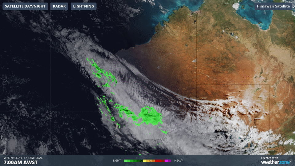
Image: Himawari-9 satellite image and radar showing the three hours leading up to 8am AWST on Wednesday, June 12.
The image below shows one model’s forecast rainfall on Wednesday and early Thursday, with widespread falls of 10 to 20 millimetres stretching from the Gascoyne down to the Eucla coast, including parts of the Central Wheat Belt. Isolated falls of 30 to 50mm could fall in parts of the Gascoyne and Goldfields districts on Wednesday.
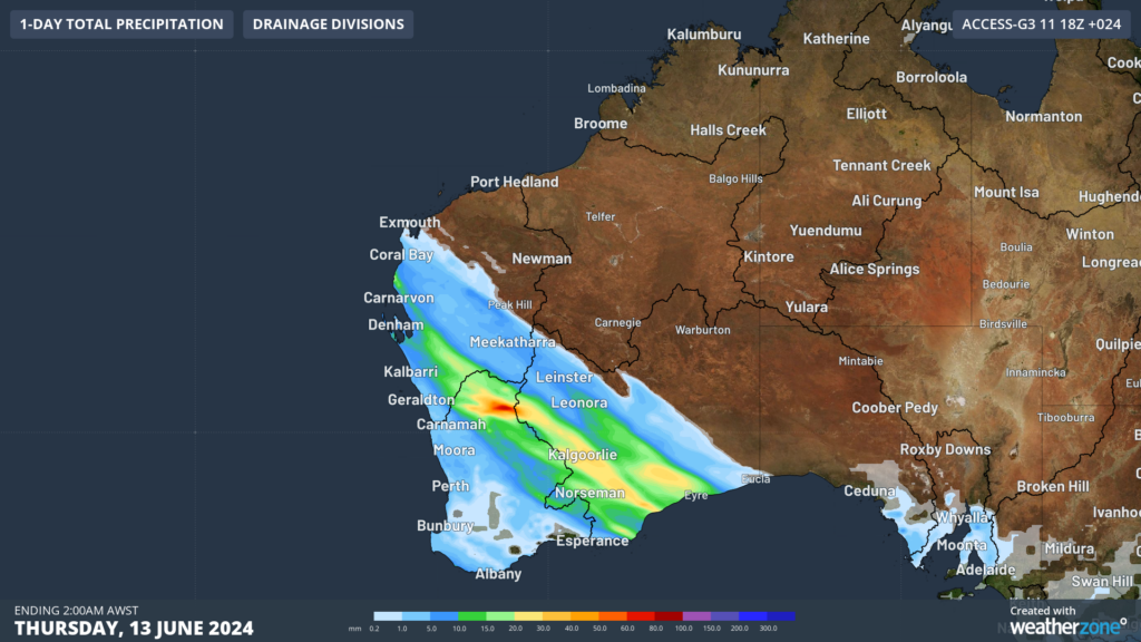
Image: 24 hour accumulated rainfall to 2am AWST on Thursday, June 13, according to Access-G
Rain should ease on Thursday as the northwest cloud band progresses east into SA. However, a cold front will sweep across southwest WA on Sunday, bringing another bout of rain and thunderstorms. Ahead of the cold front, temperatures will be relatively warm in Perth reaching around 21°C.
Miningzone is the proven and trusted turnkey solution –deployed at over 400 mines globally – offering you tailored forecasting and alerting systems to protect your valuable staff and assets.
Weatherzone’s integrated services are intuitive and user-friendly, providing you with the specific weather and blast data needed to gain a complete environmental picture.
You will have access to our lightning and severe weather tracking and alerts, EPA-approved blast dispersion modelling, thunderstorm tracking and high precision and site-specific forecasting, along with comprehensive reporting capacity.
Precise, market-leading data is delivered via multiple platforms including Weatherguard – our easy-to-use app – and can be fully integrated into your operational control or SCADA systems.
The tailored solution to drive your decisions.


