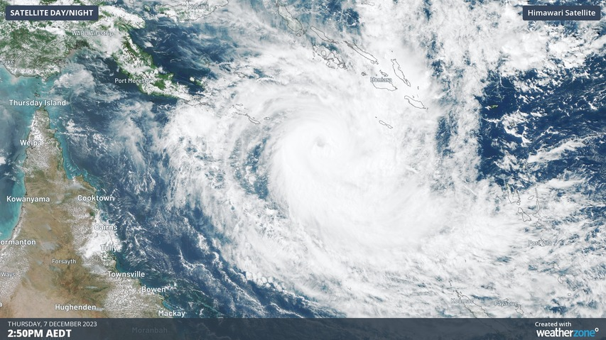
Severe Tropical Cyclone Jasper could become the earliest category four tropical cyclone in Australia’s area of responsibility since 2005.
Cyclone Jasper formed over the Solomon Sea late on Tuesday before moving towards the south and gaining strength. By Wednesday night, Jasper had intensified into a category 3 severe tropical cyclone and the system is expected to reach category 4 strength on Thursday night.
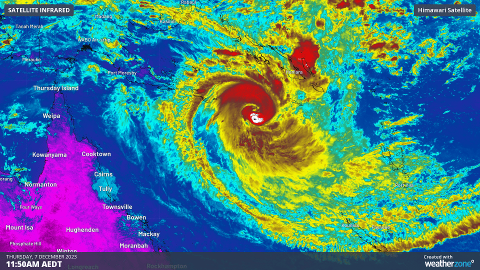
If Jasper does reach category 4 strength as expected, it will be the earliest category 4 tropical cyclone in the Australian region for 18 years. The last cyclone that was stronger and earlier was Severe Tropical Cyclone Bertie, which reached category 4 in late-November 2005.
Jasper’s life as a category 4 tropical cyclone will probably only last a day or so before increasing wind shear (change of wind speed/direction with height) and an injection of dry air causes it to weaken from late Friday into the weekend, while moving towards the west.
This anticipated weakening is good news for communities living in eastern Qld because Jasper is expected to continue on a path towards the state’s east coast early next week.
While there is still a lot of uncertainty regarding Jasper’s strength and location beyond the weekend, there is growing model consensus that it will make landfall somewhere over the central or northern coast of eastern Qld. At this stage, landfall will most likely be between Cooktown and Mackay between Tuesday and Thursday, if the system does end up reaching the coast.
It’s still too early to be certain that Tropical Cyclone Jasper will make landfall and how strong it will be if it does. If you live in eastern Qld, be sure to stay up to date with the latest tropical cyclone advisories over the coming days.
How can Weatherzone help this cyclone season?
Providing rapid-update forecast information, we alert you to any low-pressure system gaining power within your region and, unlike other providers, can track its development out to 7 days. This gives you the time to prepare and safeguard your staff, sites and assets.
You will have the most precise weather intelligence charting rainfall, wind speeds and potential storm surges to help you make critical decisions quickly. Whether it’s adjusting key work schedules, protecting your staff or securing your site, we have the alerting capability to keep you steps ahead of the storm.
We will support you, 24/7, keeping you informed and making your critical decisions easier.For more information, please contact us at apac.sales@dtn.com.


