A tropical low currently developing over the Timor Sea has a high chance of becoming a tropical cyclone later this week, with a possibility of landfall somewhere in the Northern Territory or Western Australia. Key industries could be impacted including Ports, Mining, Transport, and Agriculture.
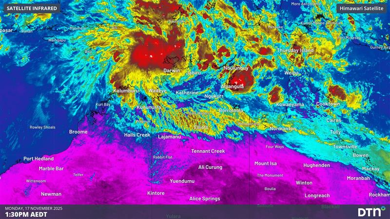
The satellite images below show cloud circulating around the developing tropical low on Monday morning.
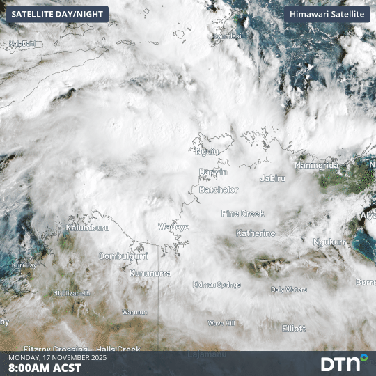
Image: Visible satellite images showing a developing tropical low over the Timor Sea on Monday morning, November 17, 2025.
This system has already caused heavy rain and thunderstorms over the western Top End in the last couple of days, including 228 mm in 24 hours at Charles Point near Darwin, which was its heaviest rain in a decade.
The low pressure system is in an environment that should help it gain strength over the next few days, with plenty of warm sea surface temperatures to provide energy and favourable atmospheric conditions to facilitate its intensification.
The Bureau of Meteorology currently gives the system a moderate risk of becoming a tropical cyclone from Wednesday and a high risk from Friday.
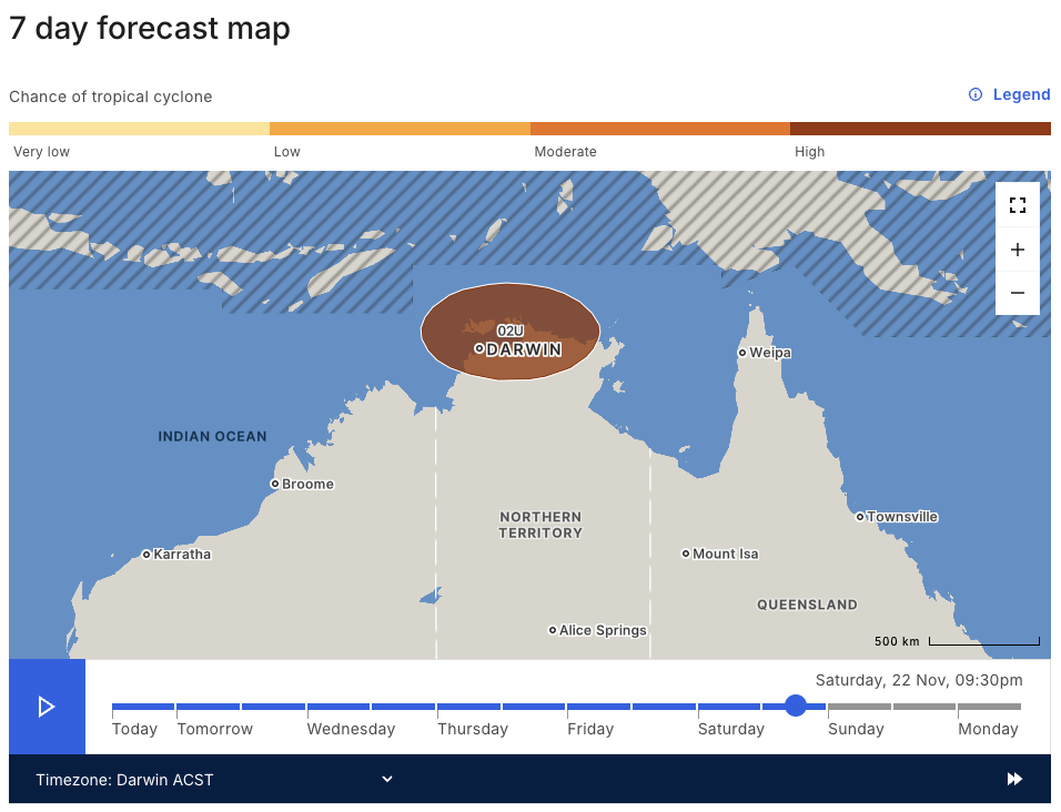
Image: Map showing a ‘high’ risk of a tropical cyclone near the NT’s Top End on Saturday, November 22, 2025. At this stage, the centre of the system is likely to be located somewhere inside the brow-shaded ellipsis at 9:30pm ACST on Saturday. Source: Bureau of Meteorology.
While there is some uncertainty regarding the prospective tropical cyclone’s future path, most forecast models suggest that it will move towards the northeast between Monday and Wednesday while gaining strength. Some models predict that it will then turn back towards the south or southwest from Thursday or Friday, potentially approaching the coast of the Top End, Tiwi Islands or Kimberley towards the end of the week or early next week.
At this early stage in the system’s development, it is difficult to predict exactly where it will move and how strong it will get. However, there is enough consensus between forecast models for residents and businesses in the Top End and Kimberley to pay close attention to the latest tropical cyclone forecasts and advisories for the most up-to-date information over the coming week. Prepare now and make sure you have an emergency plan in place.
Is this early in the season for a tropical cyclone?
Australia’s tropical cyclone season officially runs from November to April. However, we don’t usually see many tropical cyclones near the Australian coastline this early in the season.
Only four tropical cyclones have made landfall on the Australian mainland in November:
- Tropical Cyclone Alessia (2013)
- Severe Tropical Cyclone Quenton (1983)
- Severe Tropical Cyclone Ines (1973)
- Tropical Cyclone 01U, also called the ‘Broome Cyclone’ (1910)
If this week’s system does become a tropical cyclone, it will be named Tropical Cyclone Fina.
DTN APAC helps your business prepare for Tropical Cyclone Season
The 2025-26 Tropical Cyclone season has already kicked off, is your business equipped with the right weather data and support to protect your people and operations?
From 24/7 expert Risk Communicators to tailored Tropical Cyclone Outlooks, DTN APAC specialises in industry-leading forecast, alerting and threat analysis of tropical cyclones across Australia and Asia, offering you reliable solutions when the weather turns wild.
Whether it’s preparing for this season’s tropical storm potential, or rapid-response forecasting with a typhoon approaching, or simply ensuring your operations team is equipped to confidently make decisions ahead of severe weather, our weather Risk Communicators are here for you.
Our weather Risk Communicators deliver short- to long-term guidance from:
- Hourly-event weather monitoring (alerting you of impending destructive winds and heavy rain ahead of a tropical cyclone).
- Week to month operational planning based on likely timing of increased monsoonal rain or periods of reduced cyclone activity.
- Seasonal long term planning based on climate drivers and the likely trends across the coming months.

We deliver clear and comprehensive weather data, personalised risk assessments and briefings to you and your team, so that your critical decisions can be made with confidence.
We are available 365 days a year, so you always have the timely guidance you require, especially when severe conditions hit.
You have our insights to rely on to see you through complex situations, minimising potential loss of profit and maximising the safety of your staff and assets.
Learn more about our industry-leading weather solutions or email us at sales.apac@dtn.com


