The first tropical cyclone of the season is likely to form early next week near the Solomon Islands and could move into Australian waters.
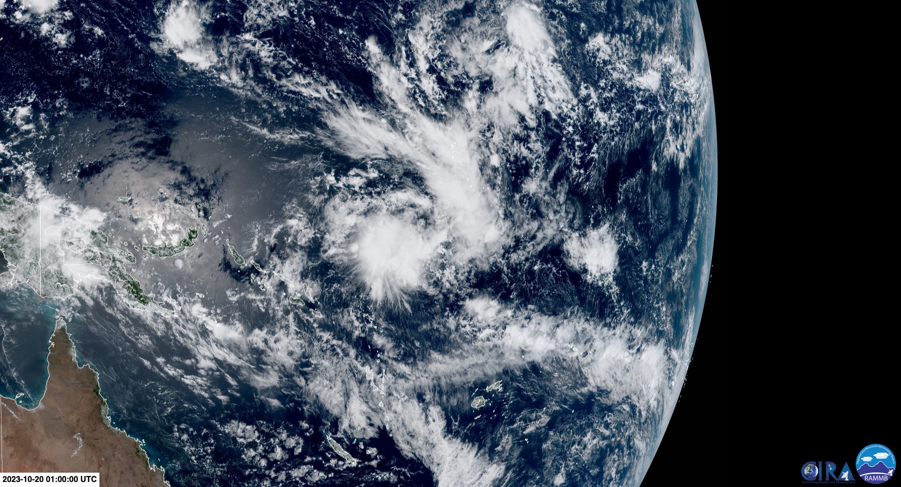
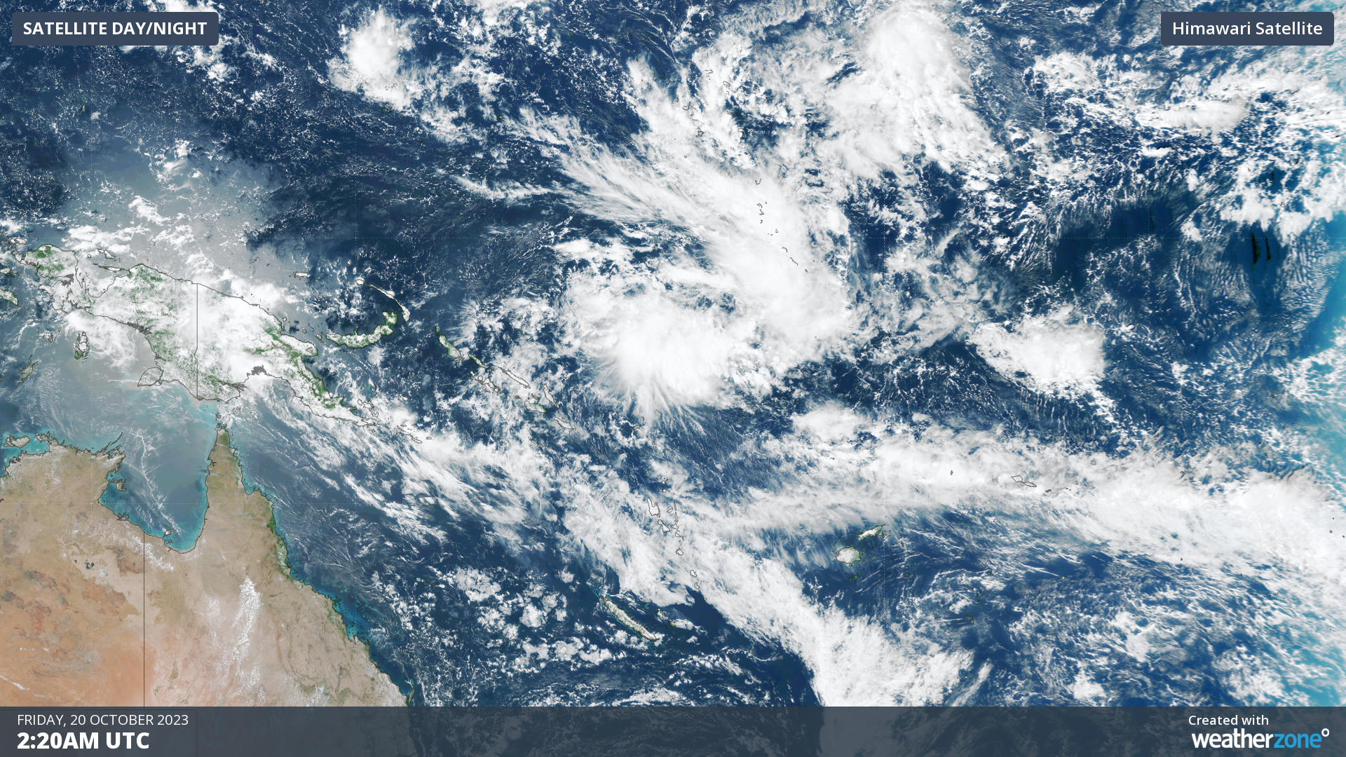
A tropical low-pressure system developed to the east of the Solomon Islands on Friday morning and has been named Tropical Low 01U by the Bureau of Meteorology.
The deepening low and its encircling cloud was captured by satellite imagery near the islands on Friday morning.
Tropical Low 01U is expected to move southwest over the weekend into favorably warm waters in the Pacific Ocean.
The low should deepen into a tropical cyclone on Monday in the Fijian Area of responsibility, which means it will be named by their meteorological organisation. If it does move into Australia’s area of responsibility, it will retain the name designated by the Fiji Meteorological Service.
This tropical cyclone is forming early in the season, with Australia’s tropical cyclone season typically running from November to April. While they can form at any time of the year, during this 6-month period we typically see 9-10 cyclones.
Several computer models are forecasting that the tropical cyclone could enter the northeastern corner of Australia’s tropical cyclone boundary mid next week.
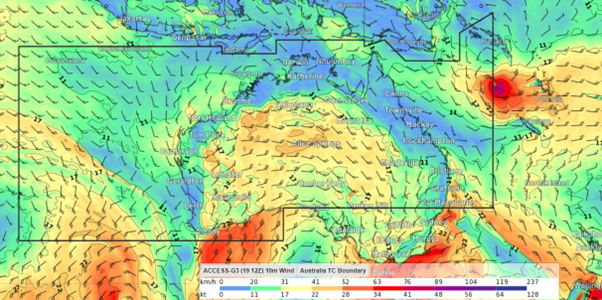
Image: Low pressure system or cyclone near Australia’s tropical cyclone border at 11am AEDT on Thursday, October 26
Others suggest the system will move southeast away from Australia next week.
While the movement of the system is uncertain, the tropical cyclone is expected to remain well away from the Queensland coast.
Later next week, southeasterly winds could become strong and gusty along the Qld coast as a high pressure ridge and the offshore low pressure system interact.
The image below shows the wind forecast for next Saturday afternoon.
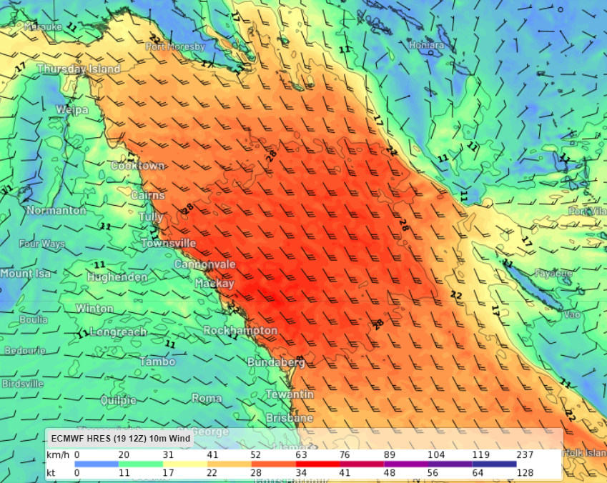
Image: ECMWF wind forecast at 5pm AEDT on Saturday, October 28.
As this situation unfolds, be sure to keep an eye out for the latest forecasts and warnings for the most up-to-date information.
As the climate delivers increasingly severe weather events, their potential to impact your business operations grows.
DTN APAC, specialises in industry-leading forecast, alerting and threat analysis of tropical cyclones, offering you expert, customised solutions when the weather turns wild.
Providing rapid-update forecast information, we alert you to any low-pressure system gaining power within your region and, unlike other providers, can track its development out to 7 days. This gives you the time to prepare and safeguard your staff, sites and assets.
You will have the most precise weather intelligence charting rainfall, wind speeds and potential storm surges to help you make critical decisions quickly. Whether it’s adjusting key work schedules, protecting your staff or securing your site, we have the alerting capability to keep you steps ahead of the storm.
We will support you, 24/7, keeping you informed and making your critical decisions easier. For more information, please contact us at apac.sales@dtn.com.


