A rare sight of fog graced Kalgoorlie in the early hours of Sunday morning, starting from around 5am, peaking just after 6am as the sun rose, and lifting by 7am as winds started to pick up.
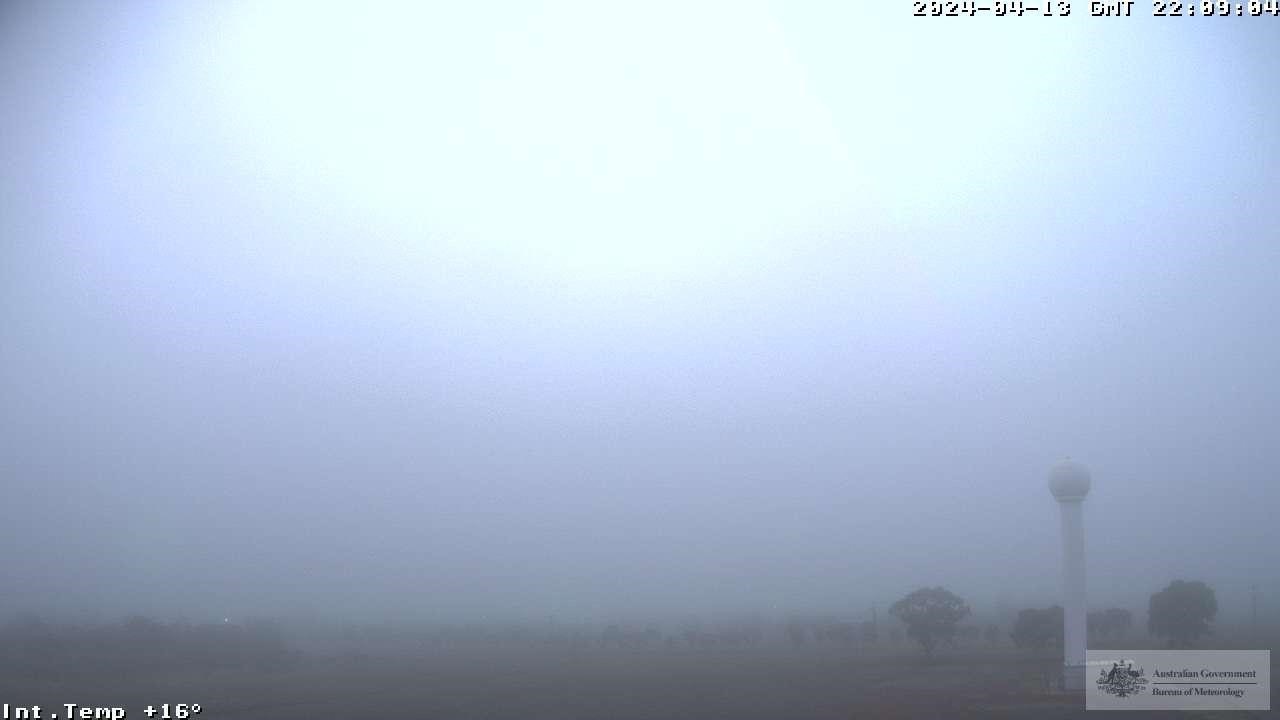
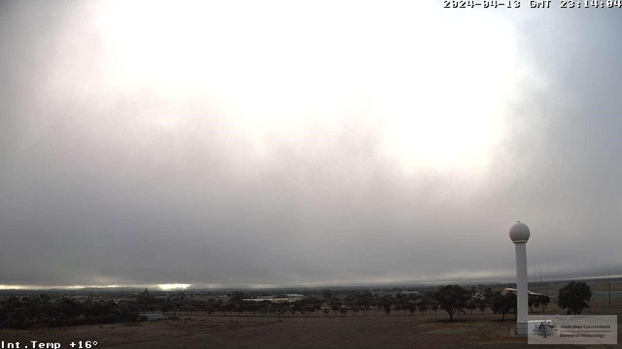
Images (west-facing) on Sunday, April 14 AWST: (Top)- Kalgoorlie at 6:09am, and (Bottom) – Kalgoorlie at 7:14am (Bureau of Meteorology).
How rare is such an event, you may ask? Under half of observed fog events at Kalgoorlie Airport occur after rainfall, and less than 10% occured outside the months of May-August.
Turns out, both occurred in the lead up to the morning shrouding.
The figures below show a snapshot of what was going on as the fog cleared.
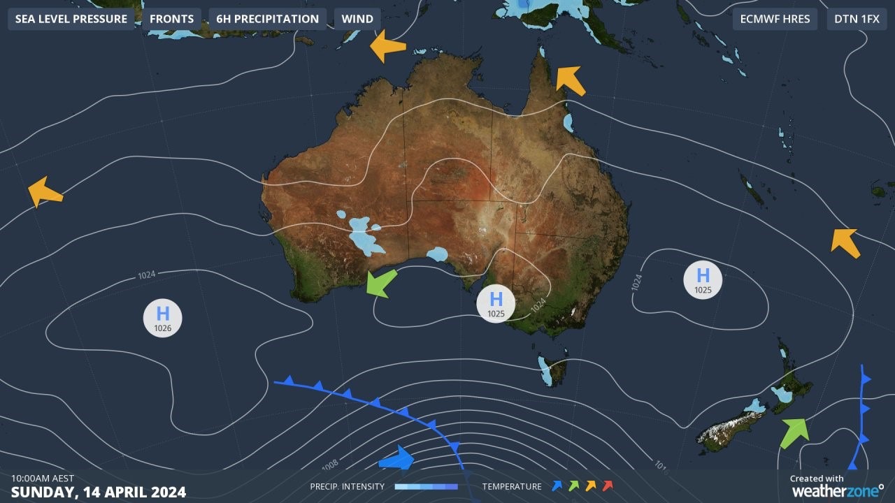
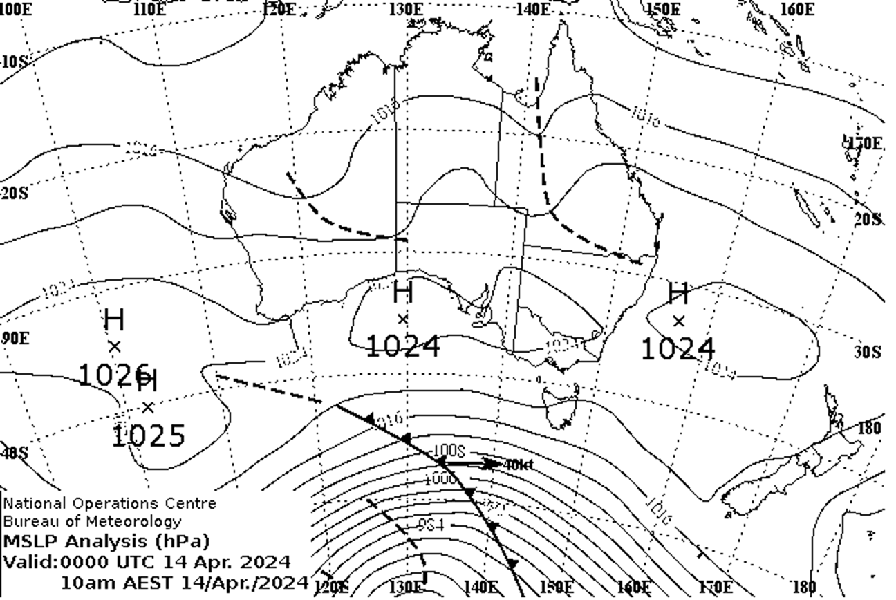
Figures: Sunday April 14th 8:00am AWST synoptic charts including (Top): rainfall & winds and (bottom): troughs (Bureau of Meteorology).
For the fog to form in such an isolated instance, specific meteorology was required at the right time.
A surface low pressure trough over WA’s interior cradling mid-level moisture directed from the remnants of Ex-tropical Cyclone Olga brought some showers & the odd storm between 3am and 3:30am. Combined with this moisture, temperatures cooled to the dewpoint temperature to achieve nearly 100% humidity, winds began to ease, and conditions stabilised as the trough’s moisture settled.
The temperature then continued to drop, and as it did, the ability to hold moisture followed suit. The result was suspended water particles suspended in the air near the ground; what we know as fog.
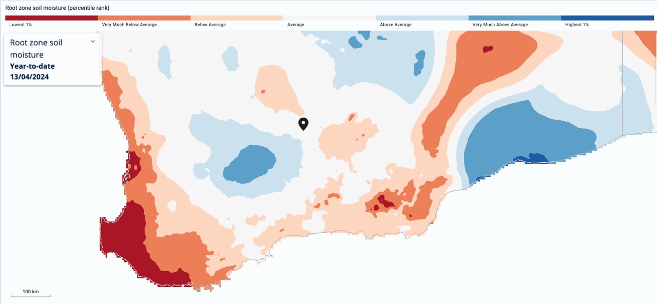
Figure: Soil moisture percentiles for April 13th, 2024 over southern Western Australia. Kalgoorlie is located at the black marker (Bureau of Meteorology).
What also helped the fog to form was the soil moisture at the time. Soil that is slightly moist makes it easier for the ground above it to condense into fog. Any drier soil would have likely not absorbed the showers, making it harder to produce fog.
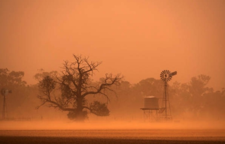
Fog is dangerous due to the dramatic drop in visibility, in thick fog there may be times when you cannot see a metre in front of you. So, you can see why this poses a major safety risk for mine sites, where personnel are driving or operating heavy machinery. This effectively halts operations at the mine sites for several hours, until the fog clears.
Clearance times and fog risk forecasting for individual mine sites is paramount in ensuring safety and the efficiency at mine sites. Weatherzone business enables mine sites to manage their time more effectively. This saves mine sites millions of dollars, with personnel transferred onto training or other activities, rather than sitting around and waiting for the fog to clear.
To detect fog at the bottom of the mine pit, we can install Automatic Weather Stations (AWS), which AWS stations on top of the ground may not detect (fog can be in the pit and not above the ground).
Weatherzone has developed forecast systems (Weatherzone’s model Opticast), which adapt based on Automatic Weather Stations (AWS) observational data which are deployed at the bottom or top of mine sites. The system works by taking forecasts from a range of computer models and comparing them with past observations to produce the most accurate possible forecast possible, tailored to a specific location where weather observations are taken. The accuracy of Opticast is world’s above other models fog forecasts, as they have no idea that there is a giant hole in the ground (mine pit). Opticast provides ultra-local forecasts, based on your mine sites observations.
Some mine sites have deployed up to 6 AWS, which observes wind gusts, inversions and humidity at different areas and levels within the mine. This has led to very accurate fog forecasting, with Opticast adapting its forecast regularly with the observational data.
Weatherzone forecast fog risk, density and onset and clearance times out to 7 days. It shows as a traffic light system, with green having no impact on operations, yellow a moderate impact and red having a high impact.
We can alert for fog down to the hour, what the density will be, and we fine tune our models dependent on the individual mine sites requirements and local topography. Generally, when fog density is around 99-100%, mine sites halt operations. If the fog density sits between 97-98% density trucks will need to slow down to 40km/h with more trucks needed for carting to ensure efficiency. Weatherzone’s traffic light system enables mine sites to make decisions and plan well in advance.
Fog density alerts can be set up, which go off up to 36 hours in advance. Of course, Opticast has many other weather solutions for mine sites, including forecast rainfall, which helps with blast planning and warns of rockfall. Opticast alerts for thunderstorms and high winds, which are a risk to crane operations and thunderstorm risks and alerting. All the thresholds can be adapted to your individual mine site. For more information, please contact us at apac.sales@dtn.com.


